In brief: Today’s update covers a lot of ground, from what a real fall front should feel like, to a chance of storms this evening, and just how cold it will get in the coming days. We also briefly discuss the catastrophic Hurricane Melissa.
What ‘real’ front should feel like
Houston has seen several cool fronts this fall, but we have always characterized them as weak. This is because they have mostly been ‘back door’ fronts in which a nose of drier air has pushed down into the region from the northeast, rather than the northwest. Typically these fronts have brought not abrupt change in winds or rapid drops in temperatures. This stands in contrast to the type of cold front that most of us think of, when a much cooler pool of air spills down from the north and northwest. If you happen to be standing outside when such a front passes you can feel it because there is an abrupt change in winds, and an almost immediate influx of cooler and drier air. Well, I am happy to report, that is the kind front we will experience today, along with a sustained stretch of cooler and drier weather in its wake.
Tuesday
Ahead of the front we are going to see a rather warm day, partly due to compressional heating as the front advances southward. Skies will be mostly sunny, with high temperatures reaching the upper 80s for much of the region. Winds will be generally light, from the south. The front itself will drop into the city this afternoon, and push off the coast this evening. I don’t think there will be too many showers or thunderstorms northwest of Houston, but as the front nears the coast it will find more moisture to work with, and this should result in a more robust line of storms in central Houston and for coastal areas.
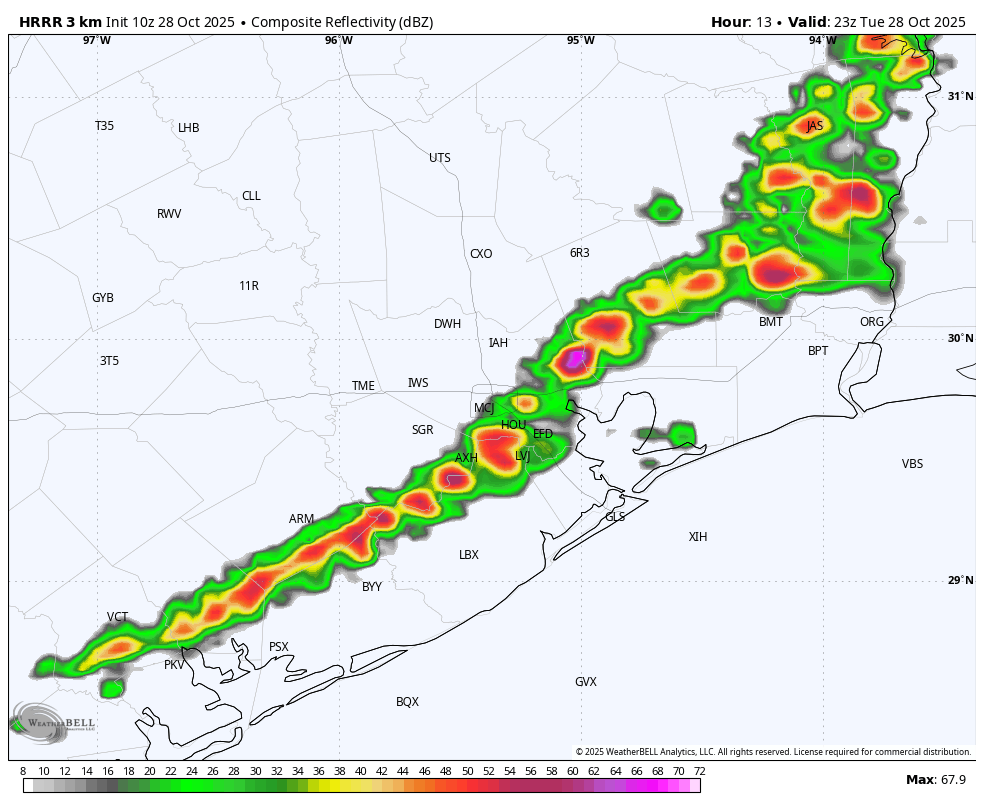
The front will be moving quickly so flooding is not a concern, but there will be a brief period when damaging winds and potentially hail are a threat as the front pushes through. In terms of timing, I’m thinking 3 to 5 pm for a line from Katy to the Woodlands, an hour later for central Houston, with the front likely off the coast between 6 and 8 pm.
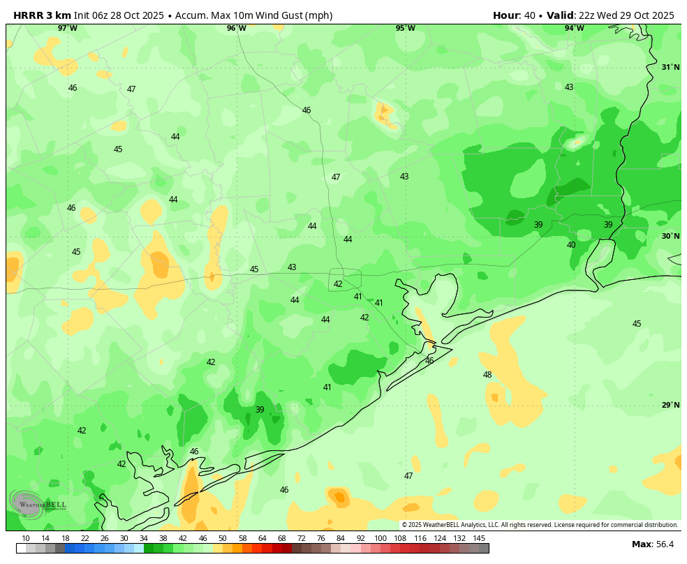
After this point we’ll see winds turn sharply from the northwest, with strong gusts tonight up to 35 mph. Lows will drop into the mid-50s by early Wednesday.
Wednesday
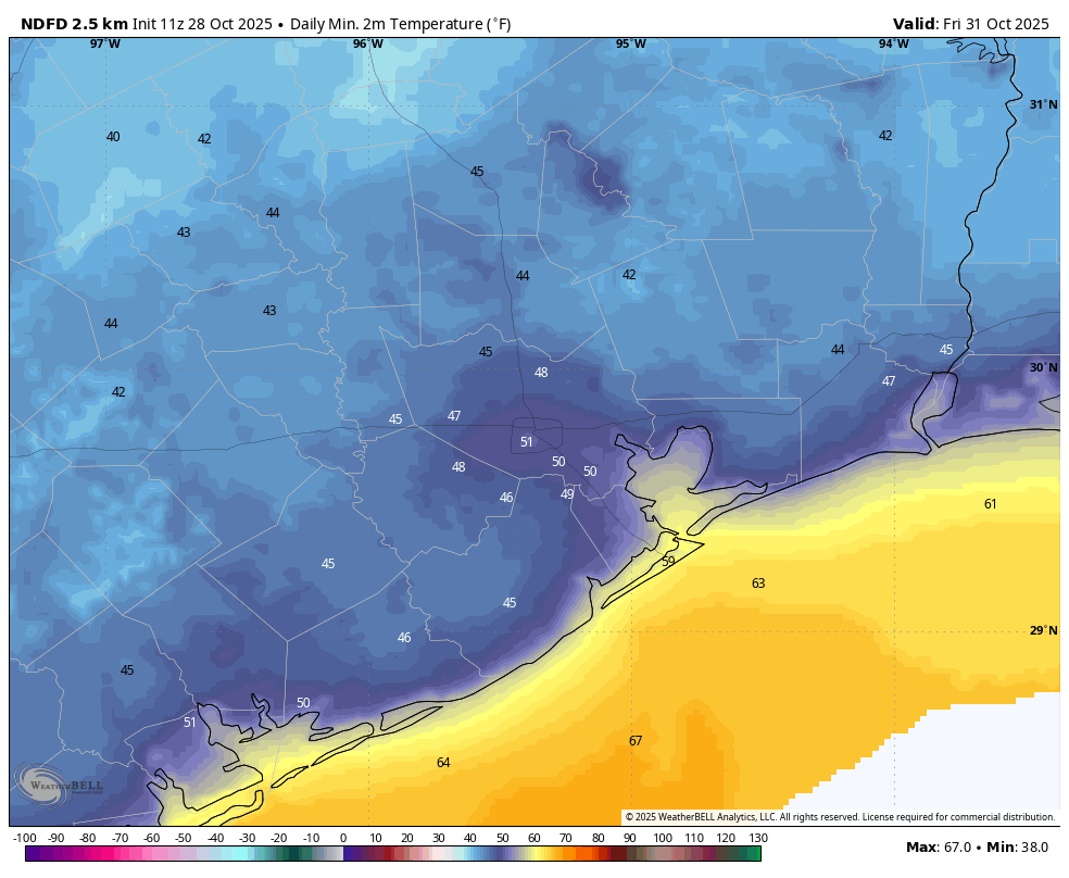
This will be a sunny and windy day. I expect winds to peak during the afternoon, when gusts could briefly reach about 40 mph, especially closer to the coast. Highs, otherwise, are likely to top out in the upper 60s. Lows on Wednesday night will drop to around 50 degrees in Houston, with cooler conditions for outlying areas. This will be our region’s coldest night in more than 200 days.
Thursday and Friday
These will be a pair of fine, fall days with lots of sunshine and high temperatures in the vicinity of 70 degrees. Friday morning should be the coldest of the week, with much of the area potentially dropping into the upper 40s. As for Halloween trick-or-treating we have precisely zero concerns, with clear skies expected along with moderate temperatures in the upper 60s, and light winds.
Saturday and Sunday
The weekend should see continued pleasant weather, with daily highs in the upper 70s, a touch more humidity, and nights in the 50s. There’s the potential for some rain on Saturday evening or Saturday night due to a passing disturbance, but I want to see more data before having confidence in such a forecast.
Next week
Most of next week will probably see something along the lines of high temperatures in the upper 70s to 80 degrees, with lows around 60, but I don’t have super high confidence in such a forecast yet.
Tropics
We haven’t said much here about the Atlantic tropics in the last month, when I wrote that the Texas hurricane season was probably over. (And indeed it was). However Hurricane Melissa bears a mention this morning, as this extremely powerful storm is poised to become the strongest tropical cyclone to ever hit Jamaica. We have ongoing, full coverage of Melissa at The Eyewall.
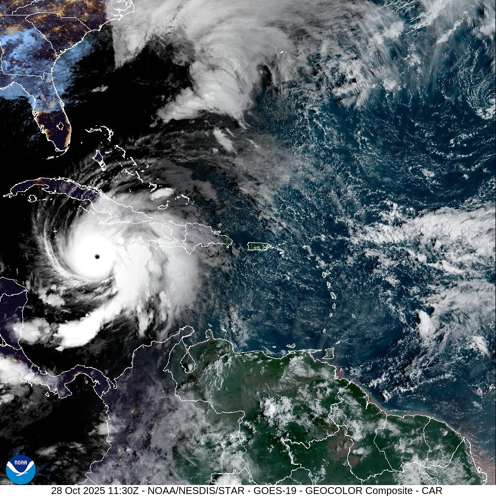
This storm is just about the worst imaginable hurricane: extremely strong and very slow moving. The only slightly positive note is that its core of strongest winds is relatively small. Nevertheless, Melissa is now bringing catastrophic damage to the Caribbean island of 3 million people, and compassion and help will be the order of the day in its wake.
