In brief: In today’s post we discuss this evening’s liftoff of four astronauts to the Moon, with fine weather conditions expected for the launch window. Closer to home we remain in a warm and muggy pattern, although Houston will start to see increasing rain chances today. Saturday still looks dynamic ahead of a cooler and gray Easter Sunday.
Update on Artemis II
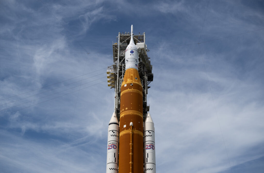
I’m in Florida this morning for the historic launch of Artemis II, during which four astronauts—who have been our neighbors here in Houston for at least the last decade—are scheduled to fly to the Moon. The two-hour launch window opens at 5:24 pm ET this evening, and local weather conditions are favorable for liftoff. There is always the chance of technical issues with the rocket or spacecraft, but if not, we’re sending humans back into deep space for the first time in more than 50 years. And these are really great people, Reid Wiseman, Victor Glover, Christina Koch, and Jeremy Hansen, whom we can all be proud of and cheer on. Following the launch window opening, there will be a full Moon at 8:11 pm ET. Seems fitting. My colleage and I at Ars Technica will be providing full coverage if you’re interested in knowing more.
Wednesday, Thursday, and Friday
Alright, back to local weather. There won’t be much change over the next three days so I am lumping them together. We are going to see continued warm weather, with daytime highs in the range of the mid-80s, plenty of humidity, and very warm nights with temperatures only falling into the lower 70s. Southerly winds will also be frisky, gusting up to 25 mph or higher during the afternoon hours. We are also going to see some bonafide rain chances, but these showers will be very hit or miss. A few areas may see some afternoon thunderstorms whereas the majority of us only sees gray skies. Overall I expect most of Houston to pick up a tenth of an inch of rain, or two, over the next couple of days. But a few areas will get more.
Saturday and Sunday
Our weather this weekend will turn a bit more dynamic. We’re still outside the range of high-resolution models, but generally the picture is fairly straightforward. Saturday morning looks warm and muggy, but I don’t anticipate much in the way of shower activity. So basically a continuation of previous days.
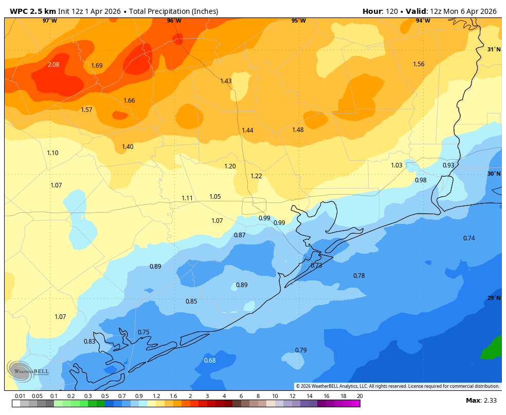
However, rain chances will increase during the afternoon hours, with the greatest likelihood of rain from mid-afternoon on Saturday to the early morning hours on Easter Sunday. For now overall conditions are not particularly supportive for severe weather, with the primary threat heavy rain. I don’t want to over-set expectations here. My hope is that most of the region receives a good soaking, with 0.5 to 1.5 inches of rain. Given the high atmospheric levels we cannot exclude the possibility of heavy rainfall briefly backing up streets, but I don’t think this will be too much of an issue.
By Sunday morning it will feel cooler outside, with temperatures in the upper 50s for most locations. If the front lingers near the coast for awhile, we may see some scattered showers on Sunday morning, especially for areas along and south of Interstate 10. Skies should remain mostly cloudy regardless, with daytime highs in the upper 60s. Lows on Sunday night will drop into the mid-50s in Houston, with cooler conditions for outlying areas.
Next week
Fine, spring-like weather will hang on through the middle of next week, with highs in the 70s and lows in the 50s. Daytime highs may rebound to around 80 degrees toward the end of next week, when some modest rain chances remain.