In brief: After yesterday’s smattering of decent rain in spots, Houston will continue to see at least spotty to scattered showers and storms the next several days. A cool front is expected to disrupt the warm and humid weather early next week, with some uncertainty on just how far through the area it gets. Also, don’t forget to turn back the clocks tomorrow night!
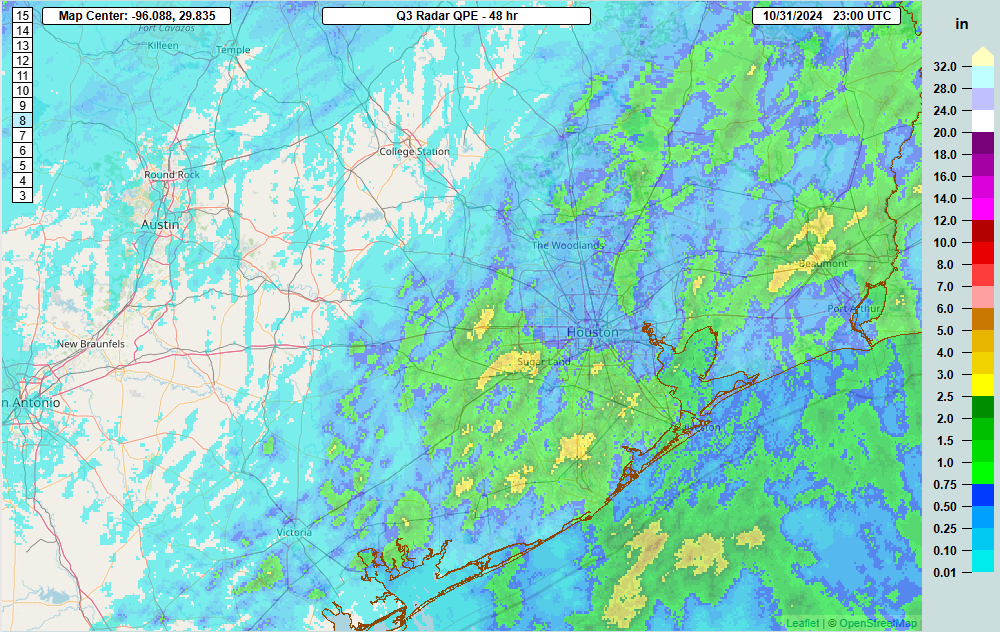
Houston saw a wide range of rainfall yesterday, with a couple of areas clearly cashing in, while others struggled. The big winners were in Richmond, Rosenberg, and just west of Sugar Land, where close to 4 inches fell. Galveston and Brazoria Counties did well also with a general 1 to 3 inches in most spots. Beaumont did well to our east, as did Brookshire to our west. All in all, I’d venture to guess that about 60 percent of you are pleased with what has fallen so far, while the other 40 percent are smarting a little.
The good news is that we are not quite done with the rain yet, but the bad news is that it will be very spotty over the next few days.
Today through Sunday
Look for sun, clouds, and a smattering of showers each day. Exactly where and when these occur is impossible to predict, but the environment is supportive of at least a 30 to 40 percent rain chance each day. No need to alter plans, but have a spot in mind to scoot to if it rains for a brief time. Highs will be generally in the low to mid-80s with lows in the 70s and muggy conditions.
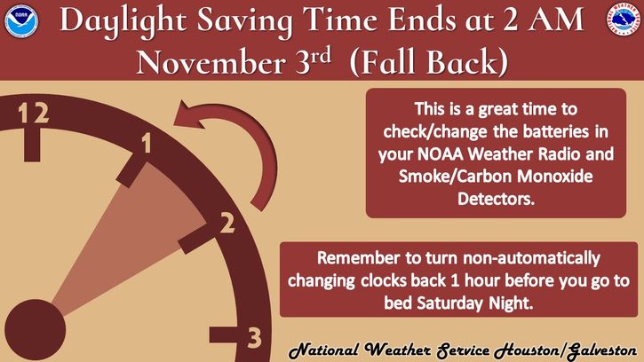
Oh, and don’t forget to set the clocks back an hour tomorrow night. I used to joke that I would have to adjust my temperature forecasts because of “one hour less daylight.” Meteorologist humor.

Anyway, have the umbrella handy but hopefully the rain won’t bother you too much.
Monday and beyond
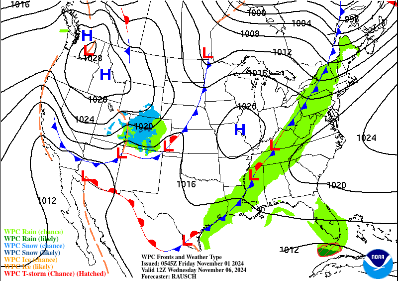
Next week will be a bit of a tricky forecast. Monday should start off much like the weekend with high humidity, warm, and humid conditions. We’ll continue a chance of a shower or storm. On Monday night, a cold front will approach Houston. It should push through the area, but there are hints in model guidance that the front will probably stall near the coast or just offshore. Assuming that happens, we will turn slightly cooler and less humid on Tuesday and Wednesday. I’d expect highs in the 70s and lows in the 60s.

Nothing too special there, but it’ll feel refreshing at least! That front may actually come through with a little oomph on Tuesday morning, and I wouldn’t be shocked to see a line of thunderstorms douse everyone with a half-inch to inch of rain and some thunder.
After Wednesday, the front will probably push back onshore Thursday, ushering back in warm and somewhat humid conditions before the next front. When will that arrive? Maybe next weekend? We’ll see. Model guidance has been a little wonky in the extended range lately in terms of timing and strength of fronts, so I don’t want to overpromise anything.
Tropics
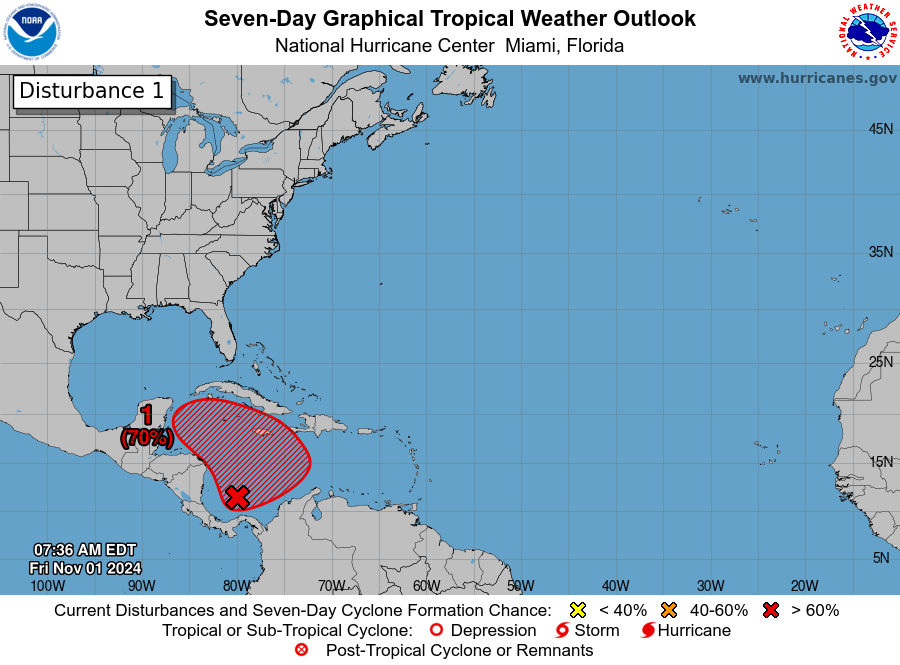
Yes, it’s November 1st, and yes Houston’s hurricane season is (historically) done. We don’t need to worry about the system in the Caribbean with a 70 percent chance of development.

However, it could be a player in the weather across the western Caribbean next week. We can’t get too specific on anyone’s forecast, but if you’ll be traveling to the western Caribbean or Central America next week, keep tabs on things at our companion site, The Eyewall.


I swear humidity was over 6000% during trick-or-treating last night, but none of the official sites confirm this.
It was disgustingly damp. Sweaty, sultry , steamy and sticky. 😫😰😰 I’m so sick of this humidity.
Just stopped at the halfway point for a brief break during the morning walk in Magnolia. Even though the Humidity and Dew Point are similar to yesterday, it’s a bit more tolerable because of a northwest wind blowing 3-5 MPH. Okay, off to finish the walk.
This fall is reminiscent of 1988, 1999, & 2010 where we have not had highs yet to drop below 70 degrees. We’re losing valuable time for window opening weather.
At least the San Andeas like cracks in our lawns are closing up with the recent rains.
The fall of 2016 was like that as well. At least where I live along the coast, we didn’t see highs in the 60s until November 19th. This Fall has been very similar to 2016.
Dude this humidity can go home. Absolutely disgusting. I certainly do not want to see anything having to do with winter holidays when it feels like this out. 🫠
I’m hoping since this fall is so warm that this winter will actually be steadily cool/chilly. Sometimes warm falls can lead to cold winters. I’m not talking about 2 or 3 brutally cold days and then the rest of the winter being warm like what we have seen the past few years. I’m talking about more days averaging cooler than normal than above.
Oftentimes when we have winter in October and November, the actual winter turns out mostly mild to warm. But I understand that we may see a warm winter regardless because of La Nina. Also, in today’s climate everything seems to favor warmer than normal conditions most of the time as well.
Scoot.
Well played.
I like your meteorologist humor! Once when it was Spring and we were going to get an extra hour of daylight – a coworker commented that she liked springing forward an hour because it gave the grass more time to grow!
It takes all kinds!
I got 5/8″ since Wednesday afternoon. Maybe enough to keep things from dying but clearly need more. Keep the rain coming, Matt!
Hobby Airport recorded its hottest October on record, 4.9 degrees above average. IAH came third behind only 2004 and 1963.
Yep it’s not surprising at all. Every year we break the warmest this or the warmest that on record. Eventually more people will see what’s happening.
Is there a place online to look for historical high and low temps? I swear to you there was a day back in 1998 – 2001 around late August to early October where the morning low was in the 50’s. I have (somewhat) vivid memories of being at the bus stop for this and wanted to look it up.
It depends on where in Houston you were at that time, IAH recorded 50s in late September 1999 and 2000, but it was 2000 where a strong cold front hit in late September, knocking temps into the 40s after the early September record heat wave.
I think you are correct, Sheltering, and using the link Joseph provided in another reply I believe you and him just helped settle a 25-year old debate. I can’t wait to show my friend in the morning, lol. I narrowed it down to 1999-2001 (excluding 1998 because I rode my bike to school that year) and it looks like Aug/Sept of 1999 was fairly normal with a few weak fronts toward the end of Sept.
August 2001 was also normal but the end of September had a much stronger and longer lasting front. Despite the highs creeping back up into the 80’s (I like and prefer Texas-style cold weather) I know I was enjoying the weather overall around this time. However, I’m sure this period isn’t the one I’m looking for because unfortunately many of us weren’t riding the bus at this time due to the Sept 11 attacks and parents being overly cautious. My mom and dad alternated taking me and my sister to school until Thanksgiving break.
This brings me back to what you pointed out – September 2000. Another strong front that hung around toward the end of the month. I know that me and my friends were riding the bus at this time and more importantly, the heatwave that happened earlier made the cold front so stark (causing it to be a long lasting memory). The low was 53 at Hobby (I lived in Pasadena at the time) on Monday, September 26th 2000. This would’ve been the day I remember getting halfway to the bus stop before turning around and running back house to grab my windbreaker. Then when I got to the bus stop everyone was talking about how weird it was that it was this cold already. My friend who was there remembered this as happening in August (I disagreed) and while I don’t deny there may have been a weirdly cool day in August before, I think he was mixing memories up because this had to happen around this time specifically because of other things we agreed on (the other kids that were there and the bus stop location during this year). The only disagreement was the month and for that particular time period, no August comes close to these September numbers.
Again, thank you to everyone that replied!!!!!
https://www.weather.gov/wrh/Climate?wfo=hgx
I’m not sure if that link will work but that is the best place to find historical data that I have found personally.
I tried posting a link but I don’t think this website will allow it. Try typing in past weather http://www.weather.gov. it should be the first link in the search list. Than click on past weather above the map that pops up. That is the best place for historical data that I have found so far.
Yes, I tried sending a link, but this website won’t allow that. It’s kind of hard to find. Try typing in NOAA past weather. One of the links that shows up is called finding past weather fast. Click on that and then click on the top of the screen where it says past weather. Then, a map of the U.S. will show up. Click on the Houston region of Texas, and then you can search historical data for multiple stations across the region. You can find the daily highs and lows in Houston all the way back to 1889. Galveston’s data goes all the way back to the 1870s.
Joseph wrote: “Yes, I tried sending a link, but this website won’t allow that.”
Your post with the link got posted. The “problem” is if you include a URL in a post, a “moderator” has to read it, test the link, then “approve” the posting. And a moderator may not show up for hours, so why the post will take a while to show up.
And actually, there is a message when you want to reply, that is written at the top of Comments:
“Leave a Reply. —-> URLs require moderation. <—-“
Yes I just learned that the hard way lol. The best link was on my first reply at 1:59pm.
I appreciate the link, Joseph! The info that Sheltering provided seems to line-up with what I remember so I’m going to check the site and see if it lines up. If I find what I’m looking for this is going to settle a nearly 25-year old debate, lol. Again, thank you!