Good morning. Our overall forecast remains more or less the same, with hot August weather on tap for days and days and days. Some relief may be found in scattered to isolated storms, but overall rain chances for most parts of the region remain about 20 percent each day. I’ll say more about the tropics below, but for now I wanted to mention the Perseid meteor shower. This celestial event, often the best of the year, peaks Wednesday night and Thursday morning.
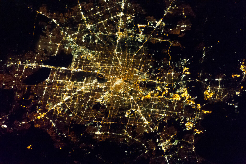
The best time to see the show will be during the pre-dawn hours of Thursday. The forecast is favorable, with clear skies likely. For those of us in Houston, the biggest problem is always finding a wide-open dark sky. Our metro area is simply bright with all of its development. I’ve included a map of the region, at night, taken about five years ago from space to help guide you toward some darker skies.

Wednesday
The National Weather Service has posted a heat advisory for today in Houston, but if you’ve lived in the region for any period of time, conditions will not surprise you. Highs will be in the mid- to upper-90s with lots of humidity and mostly sunny skies. The heat index will peak during the afternoon hours, so limit your exposure at that time. Winds will be light, out of the southeast. As with recent days there will be a few scattered showers this afternoon, but your overall chances of seeing rain are probably about 20 percent.
Thursday and Friday
Not much changes toward the end of the work week, with continuing highs in the mid-90s and lots of sunshine.
Saturday and Sunday
The weekend will bring more of the same, in terms of heat and humidity. A “cool” front will push into the region and reach the coast later on Saturday, but you won’t really notice its effect. Mainly, it could serve to increase rain chances later on Saturday and Sunday to perhaps about 30 percent. Skies should remain mostly sunny and I think any showers will be fleeting.
Next week
There’s a chance we may see some better rain chances over the region next week in the Tuesday or Wednesday period, but that’s predicated on an upper-level low sliding south into Texas. I’m not sure that will actually happen, so most likely we’re just going to continue to see hot and sunny weather.
Tropics
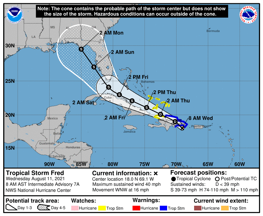
Tropical Storm Fred formed on Tuesday evening, and for the most part it’s behaving as expected. The storm will move across the Caribbean Islands this week before reaching the Florida Keys this weekend. After that time it should turn to the northwest and then north. The main impact from Fred, which most likely will remain a tropical storm, should be rainfall. Parts of Florida could see 2 to 10 inches of rain this weekend.

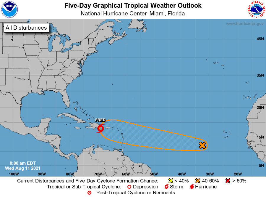
Behind Fred there’s another tropical disturbance we mentioned yesterday. The National Hurricane Center now gives this system a 40 percent chance of becoming a tropical depression or storm. Most likely it will follow a track similar to that of Fred, which would preclude it from having any effect on Texas or the Western Gulf of Mexico. But it’s too early to have any definitive comment on that.

Wasn’t Fred the name of the hurricane in The Abyss?
Hah, yes! I was just thinking that 😀
There is a great light pollution map here: https://darksitefinder.com/maps/world.html#8/29.695/-95.861
There really isn’t anywhere in the Houston area that is even close to being dark.
Reminds me of the old George Carlin “Hippy Dippy Weatherman” line:
Tonight’s forecast – dark, with scattered light appearing around morning.