In brief: We should see two more days of some of summer’s hottest weather to date before a tropical disturbance brings clouds and rain chances Friday and Saturday. We start to heat back up again next week with another round of 100° risk possibly beginning on Tuesday.
Yesterday bested Monday for Houston’s hottest day of summer. We officially hit 100 degrees for the first time since August 22nd of last year. Congratulations. This is our 4th summer in a row with at least one 100 degree day. 2021 had none. For real.
Today and Thursday
More heat. More humidity. More ouch. We will probably threaten yesterday’s hottest day of summer record on either or both days.
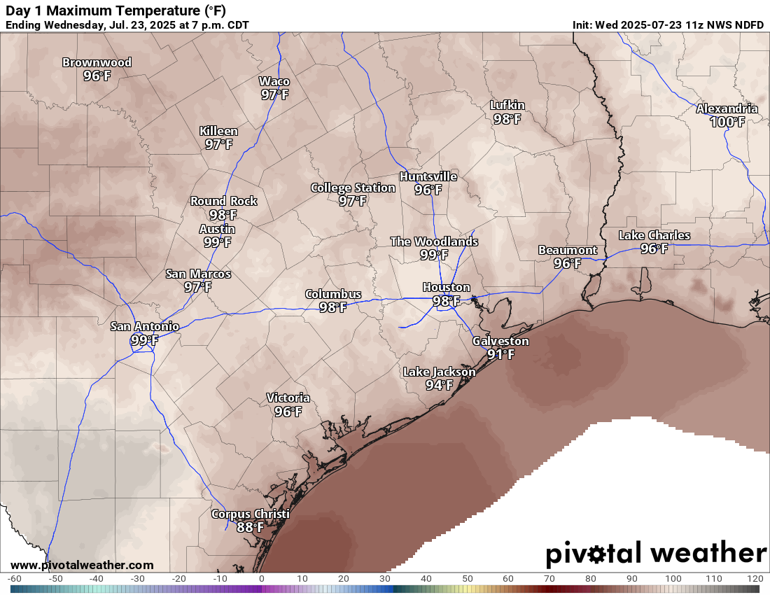
Rain chances will be at a minimum.
Friday & Saturday
We continue to see plenty of signs that the tropical wave moving across the Gulf will “make landfall” in Southeast Texas on Friday. No development is expected (though the NHC did tag it at 10% yesterday evening). However, it will nudge up our rain chances substantially on both Friday and Saturday, especially near the coast and east of Houston. Rain chances will also spread inland too. But the best chance of some locally heavy rainfall will be south and east.
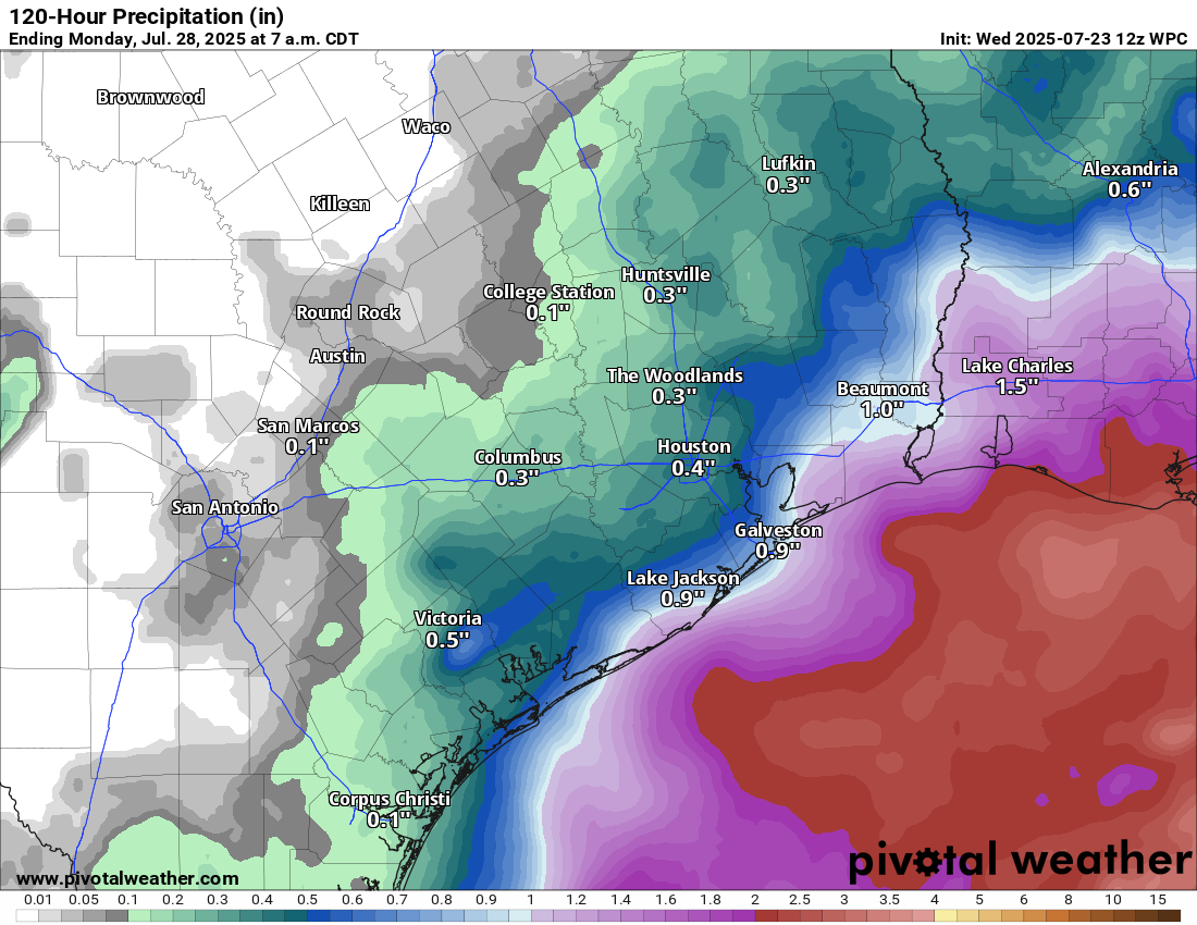
I’m not sure I would go cancelling outdoor plans just yet. You may still be able to squeak some windows in of drier weather on those days, particularly away from the coast. But stay tuned.
Temperatures will be held back due to clouds. Look for highs in the low-90s at best, possibly upper-80s in a couple spots, especially south and east.
Sunday & Monday
We should transition out of this pattern at the end of the weekend and on Monday. Look for highs to bounce back into the mid-90s or even a bit hotter by Monday.
Tuesday through Thursday
I would expect us to see another round of heat rivaling the hottest of summer beginning next Tuesday. Highs will approach 100 degrees in spots. Rain chances will again be minimal. Or so we think. If the ridge of high pressure over the Plains orients a little further north, it could crack the door to the Gulf open some more. If that happens, we could possibly see more cooling downpours each afternoon. We’ll see. More to come.
