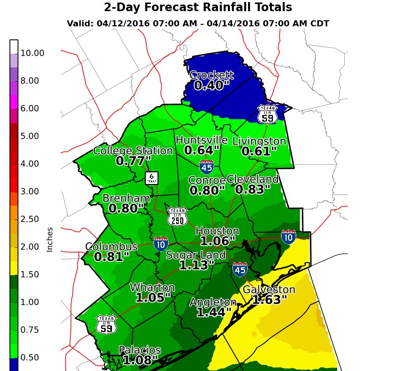
Thus far what was supposed to be a “wet” week has mostly been a dud in the rain department. However I still expect that to change on Wednesday, when there’s the potential for heavy rain.
TODAY
A weak front is moving through Houston this morning, however it’s going to stall off the coast, and not going to bring much cool air. Highs will be around 80 degrees today, and even with the frontal boundary we’re going to see moisture pooling over coastal areas. This will allow for a chance of light showers today, and the potential for heavy rain tonight and on Wednesday.
WEDNESDAY
Because of the front’s proximity to the coast, very high moisture levels, and favorable conditions in the upper atmosphere we’re going to see rain between late Tuesday night and noon on Wednesday. For Houston I’d guess the heaviest rain comes between about midnight and sunrise. Coastal areas could see widespread totals of 1 to 2 inches of rain, with lesser amounts inland. In addition we can’t rule out some isolated flooding where rain showers are heaviest. That’s always a concern when the atmosphere is this moist. Fortunately as high pressure moves in by Wednesday evening we’ll see an end to shower activity.

THURSDAY and FRIDAY
With high pressure overhead we’ll see a couple of pleasant, partly to mostly sunny days with high temperatures in the upper 70s, and lows in the lower 60s.
SATURDAY and SUNDAY
The predominant feature this weekend will be the return of an onshore flow from the Gulf of Mexico. This should lead to mostly cloudy days, highs near 80 degrees, and lows in the upper 60s. Light rain is possible too, with heavier rain possible Sunday night.
MS-150 RIDE
First, the good news. I’m still expecting strong southeasterly winds for both Saturday and Sunday for the ride from Houston to Austin. However, in addition to the possibility of light rain on Saturday, there’s the potential for heavy rain in Sunday. The European forecast model, in particular, is showing a strong storm system developing across west Texas and then moving into central Texas during the middle of the day on Sunday. This could bring heavy rain to the tail end of the bike ride rolling into Austin. This is by no means a certainty, but we’ll have to watch it.
Thank you for the update! Should be a fast ride on Saturday with the winds. Sunday is going to be rough though.
Are we still under a hail threat for tonight-tomorrow?
No, it’s a heavy rainfall threat primarily.
What do you see as the likely conditions for Saturday in the Boerne/Comfort area?
Chance of storms, cloudy, high in the upper 70s; but I’d bet against much rain.