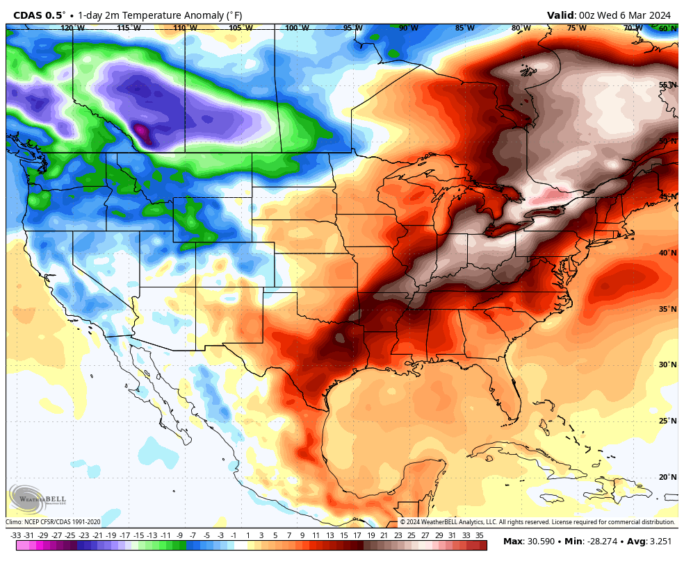
Summary: After record heat on Tuesday, Houston will cool off slightly today and Thursday. Rain chances return Friday, with the slight potential for some thunderstorms. The weekend looks rather pleasant, with a fair amount of sunshine and highs in the 60s.
Early season heat
Houston fell just short of 90 degrees on Tuesday, with a high temperature topping out at 89 degrees at Bush Intercontinental Airport. This smashed the previous record high for March 5, 84 degrees, which was reached in 1907, 1991, and 1998. The normal high for this time of year is 72 degrees.
If you’re wondering whether this would have been the earliest 90-degree day on record in Houston, had the mercury ticked a single degree higher, the answer is no. The city’s earliest 90-degree day in a calendar year came on February 20, 1986, with a high of 91 degrees.

What does all of this mean for the rest of spring and summer? As it’s a single data point, probably not a whole lot. But with a waning El Nino we already were expecting warmer than normal conditions through the middle of this year. So if nothing else, it’s a preview of what is to come. But fortunately, not just yet.
Wednesday
A few more clouds today should help to cool temperatures a bit, with highs likely in the low- to mid-80s. Winds from the southeast will be light, at 5 to 10 mph. With dewpoints around 60 degrees the air will be modestly humid, but nothing too crazy.

Rodeo forecast
Once again there should be no weather concerns about attending the Houston Livestock Show & Rodeo this evening. Temperatures going in to the show will be in the low 70s with partly cloudy skies. Afterward they’ll be in the upper 60s, so very mild. Rain chances are nil. Overnight lows will drop into the low 60s in Houston, with the possible development of fog near the coast.
Thursday
This will be a mostly cloudy day with a high of around 80 degrees. We’ll also see a more robust southerly wind at the surface, at times gusting to 20 or 25 mph. There is a slight chance of some very light showers later on Thursday afternoon, evening, and overnight, with lows likely only dropping into the upper 60s.
Friday
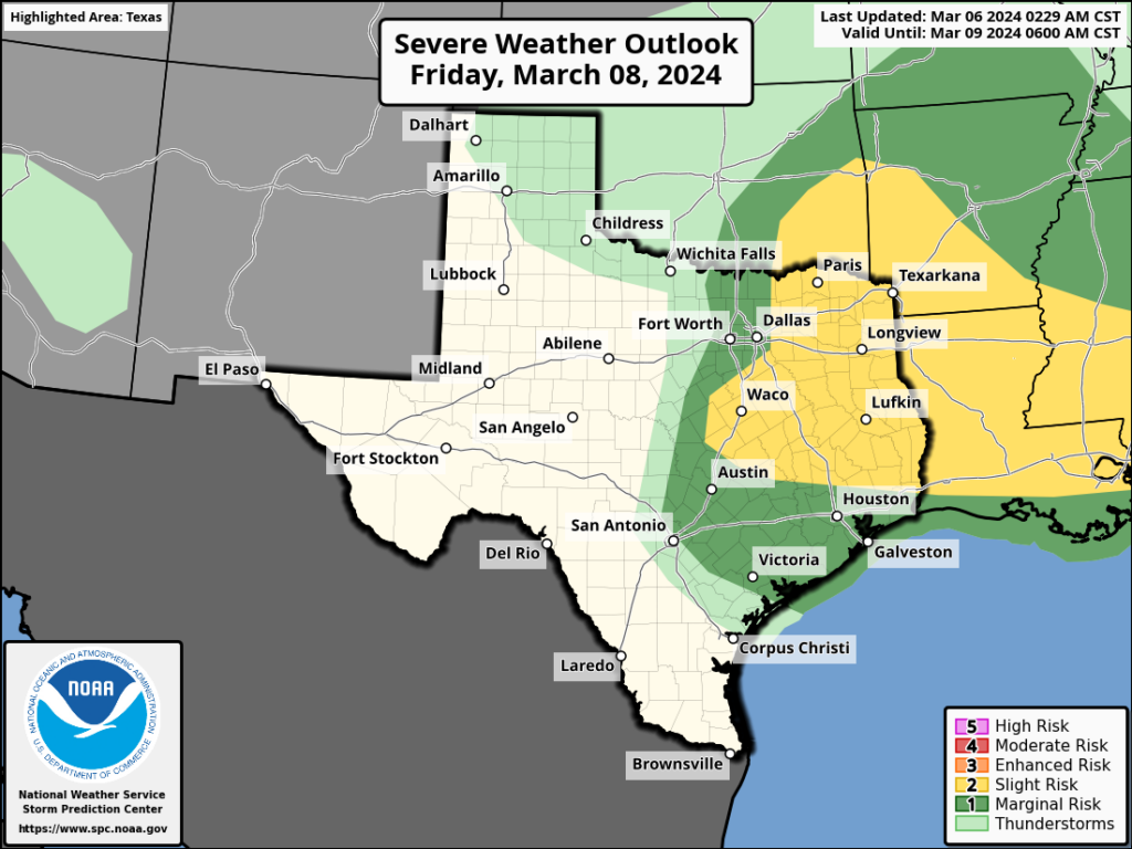
I have lots of questions about Friday, but only some general answers at this point. In the big picture, an upper-level low pressure system will shove a front toward our area, and this will help provide the impetus for some rain showers. What I think will happen is that beginning early Friday morning and running through the early afternoon, we’ll see some mostly light showers progressing from west to east across the area. I don’t think accumulations will be too great, likely on the order of a few tenths of an inch of rain. With that said, there is a chance that we see some stronger thunderstorms embedded within these showers. Again, I think the likelihood of this happening is low, but it’s non-negligible. Chances are better for thunderstorms to the north of the Houston metro area.

In terms of temperatures we’ll see highs, probably, in the upper 70s. Drier air will arrive with the front during the afternoon or evening hours, pushing overnight lows into the 50s.
Saturday and Sunday
The weekend will see the return of mostly sunny skies, for the most part. Saturday will be breezy, as drier and cooler air blows in. Look for highs in the upper 60s, with lows dropping on Saturday night to around 50 degrees in the city, with cooler conditions further inland.
Sunday should be a fine, partly sunny day with highs in the mid- to upper-60s and lighter winds. Lows Sunday night again drop to around 50 degrees.
Next week
Most of next week should bring highs in the 70s, with a mix of clouds and sunshine. It continues to look like we’ll see a decent shot of rainfall during the Thursday and Friday time period ahead of another front, but the contours of all that remain pretty hazy.

Rooting for the cold front. That is all.
Me too 😉
Back to the usual refrain, the same as the last 4 years. When will it rain. Not a little sprinkle. Rain. It’s spring time. Drought should start in July. That’s what I remember.
Spring rainfall can be quite fickle in our region. The low pressure systems or mid-latitude cyclones that swing through the country usually stay further to the north above Texas during the spring, which puts us at a higher risk for that infamous capping inversion to intercept the cold fronts that move through our region. Some of our worst droughts happened because of lack of spring rain. Even during an El Nino spring can still be pretty dry. 1996, 1998, 2003, 2008, and 2011, 2022 were some of the driest springs I can think of off the top of my head atleast in my area. 1996 and 2011 were the 2 driest on that list. And it can go the opposite way as well. Some of our worst floods have happened during the spring. Basically the weather is very bipolar and Texas has never taken it’s medication and probably never will.
89 in March is beyond brutal. There has been zero chance to pre-soak any cold at all this year. Not ready for another 8 months of this after last year.
Serious question: keep hearing amount a waning El Niño making for a hot summer, but we had a roaring El Niño last summer, and it was so hot and dry that many trees (especially the pines) dropped dead. What gives?
It doesn’t help that the sauna sitting off our coast, the GoM, and a decent chunk of the tropical Atlantic are anomalously warm: https://www.ospo.noaa.gov/data/cb/ssta/ssta.daily.current.png
“ Again, I think the likelihood of this happening is low, but it’s non-negligible.” Can non-negligible be changed to negotiable?
I suspect ‘non-negligible’ is intended to imply – in this case – the chance of rain – is not negligible but not positive. It would have been better and less obscure to have written, ‘slim chance’.
One could easily google what the word non-negligible means if they don’t know. just like one may have an issue of you using the term obscure