In brief: After a week straight of 100s, we’re now on the downtrend, albeit slowly. Look for increasing rain chances heading toward next week and less hot (but not quite cool) weather. Each day will provide us at least a non-zero chance for a cooling downpour or thunderstorm.
Yesterday was Houston’s seventh consecutive 100 degree day. And while we may make light of this summer’s heat after last summer, did you know that this was only the 14th time since the 1890s that Houston has strung together a week straight of 100 degree weather? It’s true. Of the 14 instances of a week of 100s, eight have occurred since the year 2000. Only one occurred prior to 1962. The average temperature over the last week has been 90.2°, which only ranks tied for 94th hottest seven-day stretch all-time. So there you go. The good news is that the worst is over, and we can introduce the word “rain” again a little more frequently.
Today
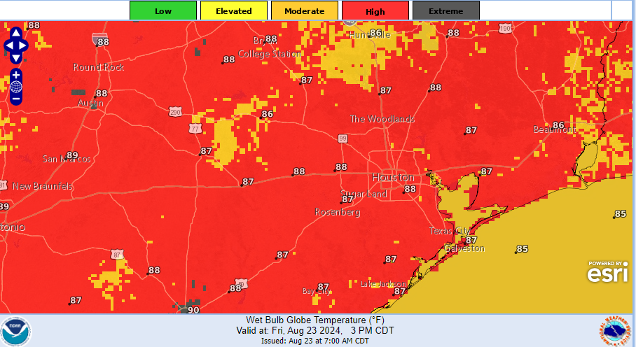
We have some storms this morning drifting south and west out of Fort Bend County and into Matagorda County. So be on the lookout for that. Otherwise, we may get through today without a heat advisory.

We’ve got a slightly cooler air mass, slightly more humidity, and slightly higher rain chances today than we had yesterday. Some people did see rain and hear thunder on Thursday, including Sugar Land and Missouri City, as well as southeastern Brazoria County. Today, a few more of us should see raindrops besides those seeing them this morning. Expect scattered activity to pop up later, but rain chances are only around 20 percent. Where it rains later, look for temps in the 90s falling into the 70s or 80s for a time, then heating back up after it stops. Where it doesn’t rain, look for mid to upper-90s.
Weekend
The forecast for this weekend is straightforward but also tricky. In general, it will be sun, clouds, 90s, and a chance of a shower or storm with the sea breeze each afternoon. However, based on the model guidance I’m seeing this morning, I would lean toward Saturday being a quieter day overall and Sunday being more active, with a greater coverage of showers and storms. The European model and its AI model seem to support this idea, but I would have the umbrella and a plan to scoot inside on either weekend day.
Next week
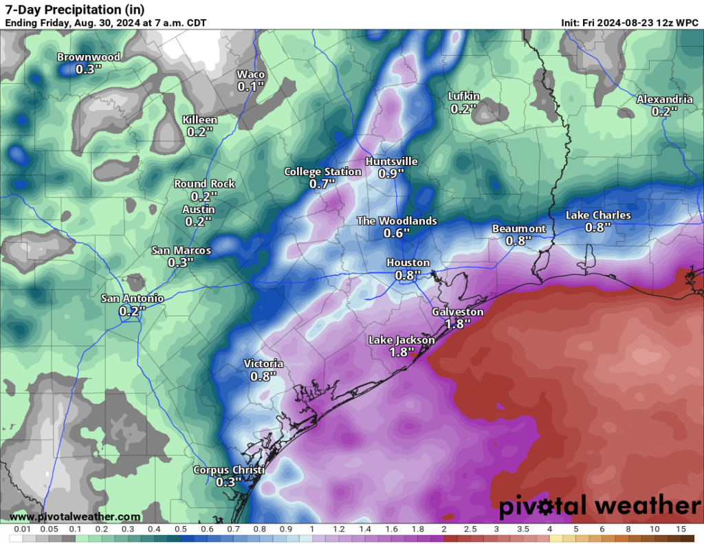
We get to watch two things next week. The first will be this disturbance in the Gulf that pivots onshore on Sunday night and Monday. It will not develop into a tropical system, but it will continue rain chances into Monday, Tuesday, and Wednesday for us. The second item may be a piece of another tropical wave over Hispaniola today that moves into the Gulf next week and adds another little bump in moisture levels toward next weekend. No development is expected. That said, it may peel off to our east into Louisiana before arriving.

We are looking at some modest rainfall overall, especially south of I-10. Locally heavier rain is likely in a few spots that are TBD right now. Basically, there will be a chance of rain every day next week, with some day to day variation in coverage and specific locations of highest rain chances. This should not be a major rain setup for Houston, but it will certainly be a change from this week. Highs will be in the low or mid-90s, so not exactly cool but with periodic rains and more clouds, it will be more tolerable overall.
The tropics remain quiet. More on that at The Eyewall later this morning.

Some of the weather peeps are saying rain today with 60 mph winds. Is that possible? #ptsd
No.
Who is saying 60 mph winds?!
So, for a thunderstorm to be classified as “severe,” it needs to have at least 58 mph winds or hail of a certain size or a tornado. So the garden variety severe storms we get virtually anytime of the year can indeed have 60 mph winds! I wouldn’t worry a ton today, but we’ll be keeping an eye on things in case it gets busier than we’d like.
That’s fascinating. “Severe thunderstorm” is one of those terms I’ve heard all my life and never paused to wonder what it actually means. Thanks!
Your weather peeps were very wrong today so far
which weather station has shown 7 straight days of ambient 100F temperatures? thanks….
Hi @bruce …
Read yesterday’s SCW weather post – there is a graph showing consecutive 100 degree days at KIAH.
You can also web-search for “nws kiah temperature graph” and select the NWS link for the graph for KIAH that is listed.
IAH. Hobby did 6 straight and a 99 yesterday, so they just missed.
Very happy to see actual cloud cover and increasing chances for rain. Even if it just sprinkles, it means that the highs will be in the low 90s, rather than the high 90s.
No one is in danger of freezing. If you’re cold in the low 90s, put a hat on. And, you may want to seek medical attention since something is probably wrong with your metabolism.
It’s hard to believe we had 20 inches of rain in July. You would never be able to tell now the rainy pattern we were stuck in last month. There is already 1 and 2 inch wide cracks all over my backyard and the grass is starting to turn brown and yellow in spots. There is no such thing as a happy medium in this climate.
there was a long period without rain this summer, that makes a difference. Rain is needed here at least once a couple weeks
My main issue with it being rainy constantly is it brings out the cockroaches. I need them to remember they need stay outside, not inside. 🙁
Next week is more of a typical summer pattern for us. I wish these High pressures would move as fast away from us as they do in the Winter.
That is what my dad used to always say. Unfortunately the jet stream winds are weak and far north of Texas during the summer months so any high or low pressure area that sets up tends to stay in the same place for a while.
No rain in First Colony in early morning hours, but close enough lightning to make our Shitzu go “off the rails” bonkers for a good while. Ugh..
Rain will help the yards and also the air quality. The later has been bad all week as my nose and throat can testify today.