In brief: In today’s post we talk about the region’s flirtations with fall, and we are going to have a couple of very fine days with cooler nights. But after this a warmer and somewhat more humid pattern returns, although we are beyond the worst of summer. Dwight also checks in with an update on our app!
Fall’s first front
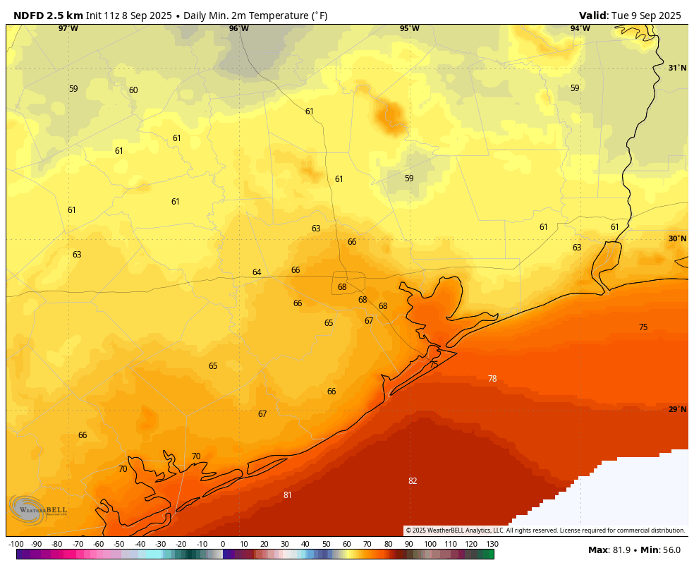
A decent front has pushed offshore, and we are seeing rather dry air move into the region. As as result humidity will feel decently low today and Tuesday. The big question for me is, will we hit 65 degrees tonight? It’s going to be close. That is our arbitrary definition of the first fall-like weather in the city. Since the city’s official station moved to Bush Intercontinental Airport in 1969, the average date of the first 65-degree (or cooler) night has been September 12, so we’re close to that time of year. Regardless, it will feel notably cooler tonight than we have experienced since May 12.
Final app update🤞🏻for 2025
(The following update comes from Dwight). As summer fades, so does our annual development push for the Space City Weather app. Over the past couple of months, developer Hussain Abbasi has been cranking away on updates for the Apple and Android versions, smashing bugs and tuning the apps for performance. We think both are in a good place right now, and pending any undiscovered issues, we’re happy. We hope you are, too!
And you appear to be, because over the past few weeks, the number of bug reports we’ve received have dwindled to near-nil. Thanks to everyone who used the Send Feedback button in the app to make those reports. They help!
And as part of our new Discourse platform, which handles blog comments in a forum setup, we have added a new category: App Feedback. Got comments, questions, concerns or feature requests? App Feedback is the place to leave them. In addition, we’ve got an initial post which serves as a mini FAQ about the SCW app, with a few Good Things to Know™ as well as instructions for filing a bug report. Please give it a read before posting in this new forum category, because there’s a good chance your question is already answered there.
As always, thanks for downloading and using the app!
Monday
Today will be sunny and warm, with a high temperature in the upper 80s to 90 degrees for the metro area, with a northeast wind of about 10 mph. I highly recommend planning to spend this evening outdoors because it is going to be lovely, with mild temperatures and drier air. Seriously, this is porch weather. I don’t have a great handle on how low temperatures will go tonight, but I think Houston will fall into the upper 60s, with inland areas dropping into the lower 60s to upper 50s.
Tuesday
This will be another day with reasonably dry air. Expect sunny skies and highs around 90 degrees. As winds shift to come from the east humdity will start to come up a little. Still, I expect Houston to see lows around 70 degrees with inland areas dropping into the 60s on Tuesday night.
Wednesday, Thursday, and Friday
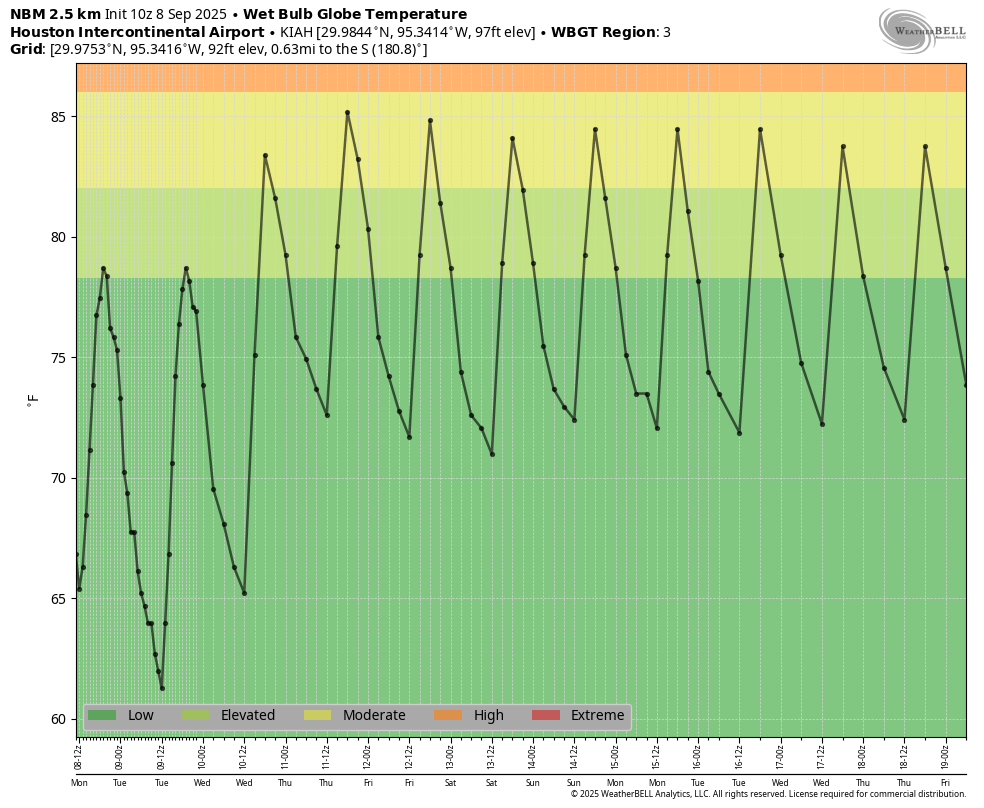
We return to a more summer-like pattern for the rest of the week as high pressure starts to build. However since we’re now approaching mid-September, this means highs generally in the low- to mid-90s, with nights in the mid-70s. Dewpoints will be high, but not opppressively so. So hot, yes. But super hot, no (see, for example, the wet bulb globe temperatures in the graphic above). Expect sunny skies and no rain.
Saturday and Sunday
The weekend looks the same: Sunny skies, highs in the low- to mid-90s, with a fair but not exessive amount of humidity. Rain chances appear to be close to zero through the weekend.
Next week
This pattern of highs in the low- to mid-90s should persist into next week as late summer holds on. Some rain chances may finally return to the forecast about 10 days from now.
The Atlantic tropics
Things are surprisingly quiet right now for September, with zero threats in the Atlantic. We only have a few weeks left of “prime time” for storms in Texas. Tomorrow I’ll take a look at what may happen during that time.
