In brief: Did you like Sunday’s weather? Because that pattern will persist into Wednesday. After that point we’ll add daily rain chances into the forecast through the weekend. However, one thing that won’t change is the relatively high temperatures and humidity we’ve been experiencing.
A quick word on the Sun
By the calendar it may still say spring, but in terms of sunshine, we are rapidly approaching the peak of the year. Nowadays, shortly after 1 pm, the Sun reaches an angle of 75 degrees (out of a maximum of 90 degrees) in the sky. Of course the Sun reaches a maximum height on the summer solstice (June 21 this year, 84 degrees), but the Sun is already climbing to the same height as it does in early August.
What’s your point, Eric? Well I think a lot of Houston residents associate August with a month when you can pretty quickly get a sunburn outside. My point is that similar conditions exist in April, so if you’re planning to be outside during the middle of the day, please take some precautions to protect your skin. It will burn quickly.
Monday
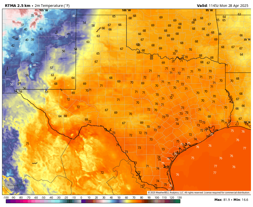
High pressure will prevail to start the week, so we are likely to see ongoing warm and humid weather for a few days. For Monday, this means partly cloudy skies, with high temperatures in the mid-80s. Like on Sunday, we will see fairly stiff southerly winds at about 15 mph, with gusts up to 25 mph. Rain chances will be low to non-existent. Skies will remain mostly cloudy overnight, with low temperatures dropping to around 70 degrees.
Tuesday
This should more or less be a carbon copy of Monday, albeit with high and low temperatures perhaps a degree or two higher. Again, with high pressure in place, rain chances should remain near zero.
Wednesday
The forecast turns slightly more dynamic on Wednesday as a cool front approaches the region but, more likely than not, stalls out well to the northwest of the metro area. Although we will be watching for the possibility that the front pushes into Houston, right now the most probable weather is scattered showers (greater chances north of I-10) on Wednesday afternoon, evening, and overnight. Expect highs generally in the mid-80s with mostly cloudy skies. Those pesky, strong southerly winds will remain in place. I don’t think we’ll see enough oomph from the front to make a meaningful impact on nighttime temperatures.
Thursday and Friday
With clearer skies these days should see highs in the upper 80s to 90 degrees for most of the area, with nighttime lows around 70 degrees. However, each day may see some scattered shower activity during the afternoon and evening hours with daytime heating. I’m confident in the heat, but less so in the rain chances.
Saturday, Sunday, and beyond
With a fair amount of moisture lingering in the atmosphere, we should continue to see daily rain chances in the vicinity of 30 to 50 percent this weekend. With a few more clouds, high temperatures may back off into the mid-80s, with continued nighttime lows around 70 degrees. With dewpoints in the 60s it will definitely feel humid outside, but not oppressively so like it will in a month or two.
Most of our modeling is showing another system that could bring elevated rain chances by the middle of next week. However, as this feature is about 10 days away, it is difficult to place too much confidence in any one outcome at this time.

This April has been much nicer than last April. Here’s to May being the same 🌻
I disagree, yes last April was much above average as well, but at least cold fronts had consistency until early May. This April we’ve had ONE which was an arctic blast, otherwise we would be having an April as if it was Miami.
I hear you.
We had bad roof damage twice last April with the storms. Didn’t happen this April.
So I’m glad about that.
Unfortunately it looks like the cold front on May 2-3 is out of the picture as it looks to die and stall, here’s hoping the one around May 10 will go all the way, we are scarce on fronts so far.
Last April 2024 definitely had more cold dips. The timing of the more than two weeks of drought in April 2025 was particularly disturbing for flowers and tomatoes also. It is hard to pin down a description of early spring here…always something new it seems.
Definitely fondly remembers days like these where there would be a 10-20 minute spring shower per day; good for the grass, with the clouds bringing nice shade.
“Climate is what we expect, weather is what we get.” – Mark Twain
I am going to go out on a limb here and venture a forecast for May. This forecast is based on a complex algorithm of personal observations, weather lore, history, analog years, the Madden Julian Oscillation (MJO) and the Quasi Biennial Oscillation. My methodology is not peer reviewed, based on a hunch and much more likely to be wrong than it is to be accurate but here goes…
May is going to be much wetter and likely below average temperatures at IAH.
We will see how this pans out on June 1st…
You could be right about the wetter-than-normal weather, but I wouldn’t hold my breath on below-average temperatures with the current trend. Cooler-than-average days due to cloudy and rainy weather won’t make much of a difference if the nights continue to be well above average due to a warmer Gulf and persistent southerly winds. We would have to get several strong cool fronts with the rain for us to see below normal temperatures for May, given the new climate system we live in.
Seems like the average temperatures of Hi 80/Low 60 in April needs to be adjusted.
Global warming is successfully doing that.
Bless you, get help…
The Harris Center for Mental Health and IDD
24 Hour Crisis Line
713-970-7000
Here’s a number for you Betty:
1-800-222-DBAA
Maryland National Bank?
Lol that’s good
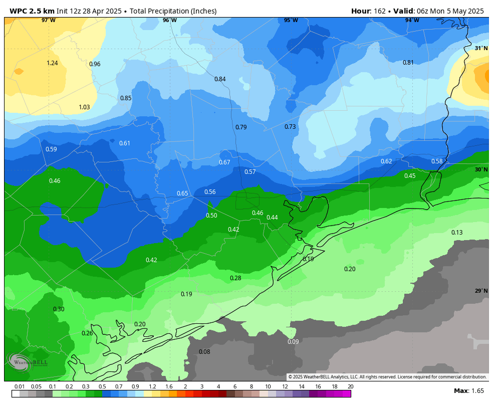
We get our best rain chances when there’s a surface low over the Mexico highlands. Seems to negate the warm air inversion cap – just my observation. WPC still shows a mid-CONUS frontal boundary pushing to the coast Thursday May 1 with rain around then. We’ll see.
The weather pattern has not yet set up the clockwise dome over Mexico to the four corners. This June – Sept feature brings on the regular AZ, NM monsoon season and conversely steam cooks Houston. Can’t wait! Got to love it when you know it’s coming.
Does that mean a heat dome this summer?
Every summer. The variability you feel is if it jogs west at times. That lets all sort of mayhem to get in. But a tropical depression is just fine! no higher.
I’ve observed our best chance for summer time pop up storms comes when the Bermuda High camps over the SE U.S. and the natural flow around this high brings us moisture from the Gulf. This is our typical 93-95 degrees days with an active sea breeze front keeping daily rain chances in the 20-30 percent range.
Like 2 gears aloft! But if the Mexico dome encroaches too much you can’t even get a sea breeze except on Tiki Island, lol.
So, watch the placement of the Bermuda High, and that can determine if we get another heat dome summer like 2023?
Sort of but not entirely because the Bermuda high can shift drastically just like any other pressure system. Upper level winds play a huge role in the weather we experience during the summer just like the tropics. A sharp trough or dip in the polar jet stream often sends late season cool fronts through the southern United States during the middle of summer which can push the Bermuda High also known as the subtropical high to the south and east. These stalled troughs and cool fronts in the Gulf can trigger tropical lows which can turn into depressions or hurricanes.
Many times they just turn into rain making lows that bring repeated rounds of cloudy and rainy days much like last July and the summer of 2021. The Bermuda high can only dominate as long as the upper level high pressure ridge at the 500 milibar level maintains its grip over the southern US.
More like a wait and see approach since all the info being presented to you are predictions at this time
Very true
The Very True comment was a reply to Glenn
Ugh. Summer and it isn’t even May yet.
Summer will continue to start earlier and end later in the coming years thanks to climate change.
Not necessarily. There are still poorly understood feedbacks and oscillations that may not mean “warmer earlier and longer”. For example the tropical pacific is experiencing a long term cooling trend trend that is going against what the climate models have forecast.
That is true, but the Gulf has continued to get warmer, which has and is currently leading to much warmer than usual weather over Southeast Texas through most of the year. The cooling trend in the southern Pacific has not had any cooling effect on us yet, so I don’t expect it to have much of an impact in the future. In fact, La Nina is part of the cooling trend in the tropical Pacific, which is another thing that can bring us warmer weather here in Texas. So, until the Gulf itself starts cooling down, I expect to see warmer weather in our part of the globe continue unscathed until further notice.
The Atlantic Multidecadal Oscillation (AMO) has been in its warm phase for the better part of the last thirty years. Whatever causes it to flip will probably continue to do so and at some point it will flip back to a colder cycle. When it does we can probably expect a string of colder years. I don’t think anyone knows why or how but it is well documented.