In brief: This morning’s post discusses the potential for rain showers this week, which is high on Wednesday and Thursday. However, that will be offset by what looks to be fantastic, spring-like weekend. Also, we’re starting to get questions about another Arctic air blast during the first week of February. Is there any validity to this?

Monday
After Sunday’s widespread rains, a cold front has moved offshore during the overnight hours. It won’t go far into the Gulf of Mexico, but it will go far enough to bring somewhat cooler and cloudy conditions today. Expect high temperatures of about 60 degrees, with light northerly winds. Low temperatures tonight will fall into the lower 50s for most of the metro area, so the watch word for today is mild.
Tuesday
This will be another gray, slightly warmer day, as winds shift to come from the east at the surface. Expect highs in the lower 60s. There are mixed signals from the atmosphere in terms of rainfall potential, but I think the most likely outcome is the low-end potential for some light showers. Skies, otherwise, will be cloudy. Lows on Tuesday night will only fall into the mid- to upper-50s in Houston.
Wednesday and Thursday
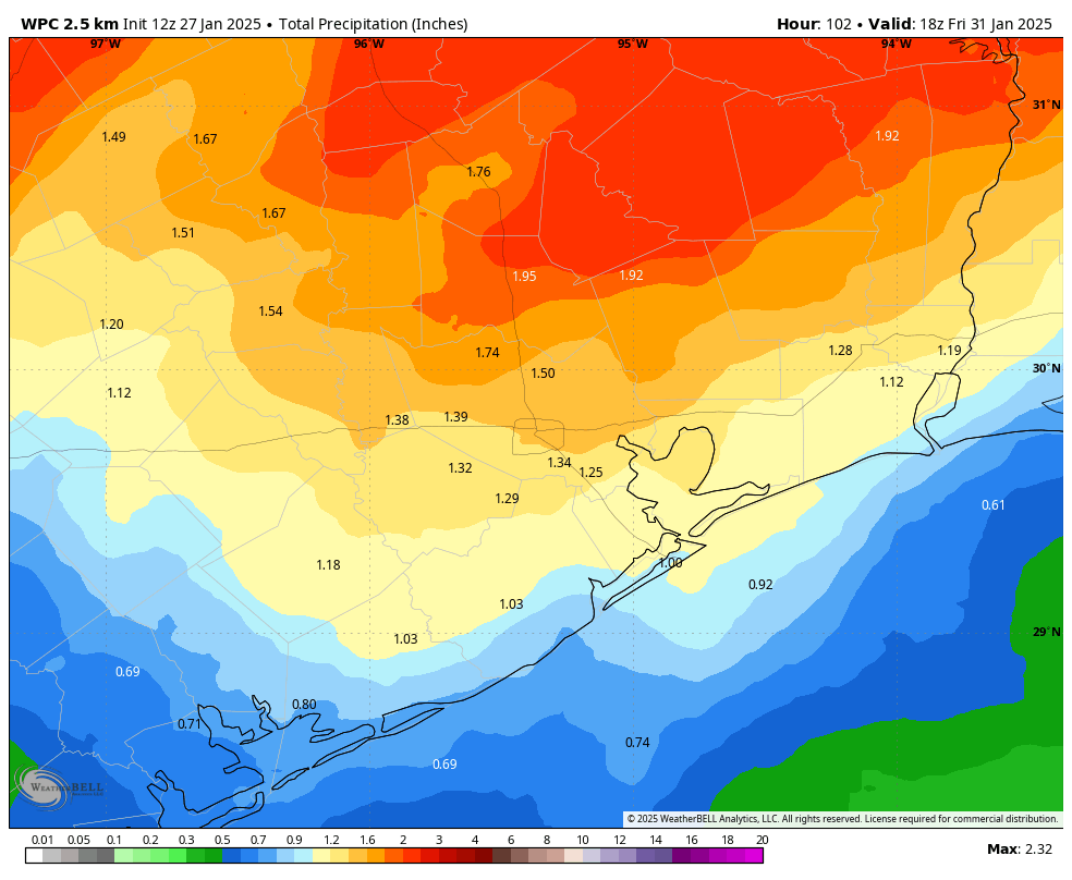
These will be warmer and wetter days. Expect high temperatures in the low- to mid-70s, with fairly humid air. (Not summer-like air, to be clear, but definitely a fair bit of humidity for January). Showers and possibly some thunderstorms will be possible from mid-morning Wednesday through Thursday night. Most locations will probably pick up 1 to 2 inches of rain, but we certainly cannot rule out some higher isolated totals. The threat of heavier rainfall will probably lie north of Houston, and areas such as Lufkin may face the potential for some flooding. It’s possible that a final line of showers and thunderstorms may accompany the passage of a cool front on Thursday night or Friday.

Friday
Rain chances will end some time on Friday morning, after which we’ll see clearing skies. Expect a pleasant day with high temperatures around 70 degrees, and a cooler night with lows in the upper 40s for much of Houston.
Saturday and Sunday
This weekend’s weather looks exceptional. We’re talking sunny skies and low humidity. Highs around 70 degrees. Modestly chilly nights. Like seriously, try to plan something outdoors this weekend.
Next week and an Arctic blast?
Most of next week should be mild, with high temperatures in the lower 70s, and overnight temperatures in the upper 50s or lower 60s. However we’ve started to get a bunch of questions about the potential for another Arctic blast around the weekend of February 8. This is pretty far into the future, but so far there appears to be far more buzz about this on social media than there is evidence to substantiate a seriously cold blast. I’m not ready to rule anything out for a forecast that is more than 10 days into the future. The models are hinting at a frontal passage around that time, but at this point I’d say lows are more likely to be in the 40s rather than the 30s or even 20s. So we’ll keep an eye on things, but I wouldn’t go wrapping your pipes again just yet.

Tiktok meteorologists need day jobs.
Goodbye winter I guess we will meet again next January.
3″ of rain over the weekend near Westchase.
Watching a national “24 Hour Weather” TV station (also, a well known News channel with locations thru the US) – they are, at this moment, showing graphics of the projected “Next Winter Storm” that will move from the west to the north and east.
And they are describing the storm path, day by day, and “what” to expect (snow, or rain, etc).
I took a photo of their Summary description box, and literally copied the text from the image – here it is (with two comments from me):
[ TRACKING NEXT WINTER STORM ]
SAME SYSTEM BRINGING RAIN TO
CALIFORNIA WILL MOVE TOWARD FOUR CORNERS MIDWEEK
SLOW-MOVING SYSTEM WILL BRING HEAVY SNOW TO SOUTHWEST & ROCKIES
(no snow shown for Texas).
FLOODING & SEVERE STORMS LIKELY FOR
TEXAS, OKLAHOMA, ARKANSAS & LOUISIANA.
(storms, in this context, is heavy rains).
So, for TX and ARK and LA , their prediction is heavy rains and potential flooding – they don’t discuss anything about snow.
Did they say anything else? NMI.
Well winter was nice while it lasted. We almost had a full month of it. Now for 2 months of spring/summer and then 7 straight months of full on summer.
Exactly. Still gone are the days of having 3 month winters. My guess is that this February will probably be like last the last two with most days in the 70s and multiple 80-degree days.
I cant wait, those are perfect temps!
I’m thinking/feeling there’ll be another cold blast -> it’s not quite over yet
My mother said it always freezes one more time before Easter.
Everyone knows spring and fall have the nicest weather.
In my opinion all weather is good weather, with two exceptions: 1) cold, dreary, cloudy, with sprinkles but no good soaking rain and no snow, and 2) scorching hot, sunny, with no rain in sight.
As an open water swimmer that has to monitor Beach Watch fecal count, I calling The Gulf of Infection. Swimming 7 weeks after Harvey was not in my best interest despite the clear reports!
🤣😂🤣
I’m so psyched for this weekend’s weather!