In brief: Rain chances will dial back, and temperatures will go up this week. But really, for this time of year, the heat could be significantly worse in Houston during the daytime. By the weekend much of the area could drop back into the lower 90s. Also, we discuss the likelihood of increased tropical noise.
Tuesday
There are some scattered showers along the coast this morning, and they should continue to push inland over the next couple of hours before dying out around Interstate 10. Later today mostly sunny skies should prevail across the Houston region, allowing high temperatures to push into the low- to mid-90s. Winds will come from the east at 5 to 10 mph. Low temperatures tonight will be in the upper-70s for most locations.
Wednesday, Thursday, and Friday
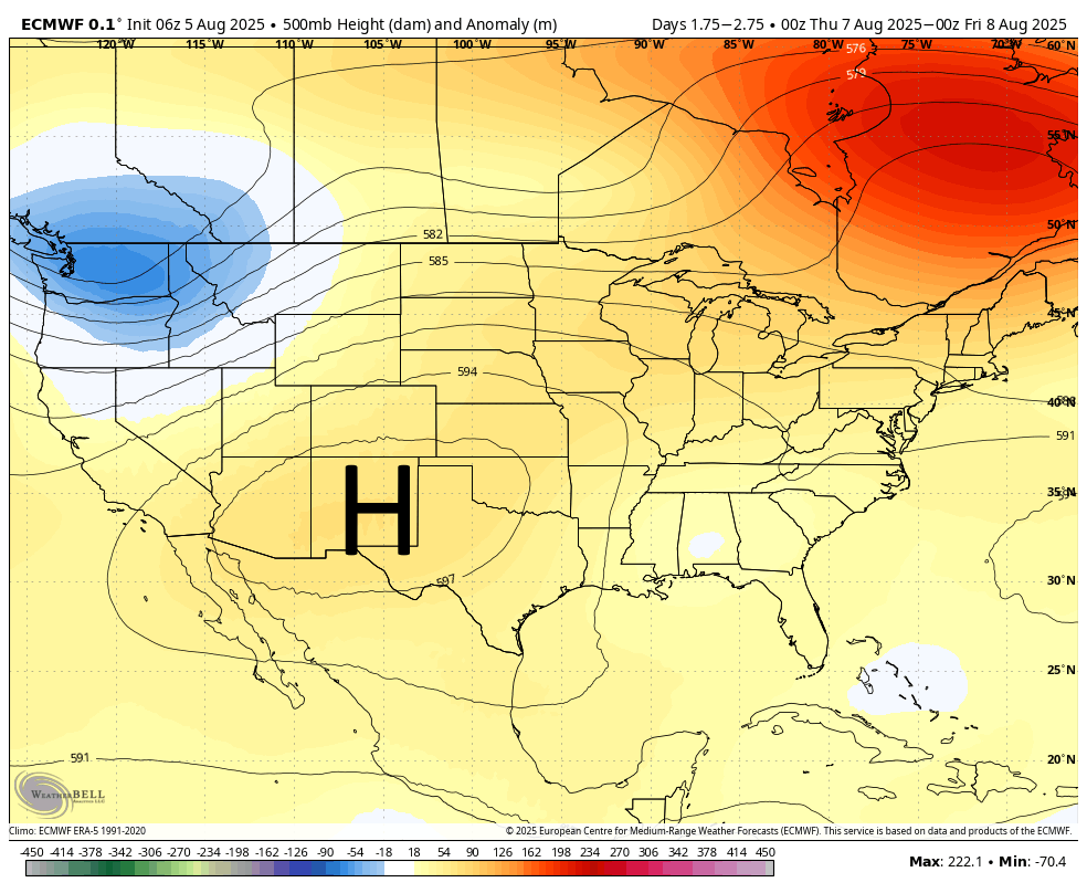
There will not be much variability across Houston for the remainder of the week. A stout ridge of high pressure has established itself over the southwestern United States, but our area remains on the edge so we won’t experience the full force of its impact. Essentially, then, for the remainder of the week we are going to see mostly sunny days with high temperatures in the mid-90s, with inland areas possibly at risk of seeing the upper 90s. Humidity will, of course, be rather high. Each day will bring a slight chance of showers along the sea breeze, with higher chances of rain (maybe 30 percent) closer to the coast whereas inland areas see perhaps a 10 percent chance. These are the dog days of summer, and by golly they are going to feel like it. Please note it could be worse, however. Record highs for this time of year in Houston are generally in the 104 to 106-degree range.
Saturday, Sunday, and beyond
High pressure retreats a bit this weekend, and this will have a very subtle effect on our weather. Daily high temperatures will probably go a bit lower, so something like low- to mid-90s for much of Houston. And rain chances may go up slightly this weekend. Skies should still be mostly sunny, but there will be a chance for brief, passing showers on the daily. This overall pattern looks to hold at least into the middle of next week.
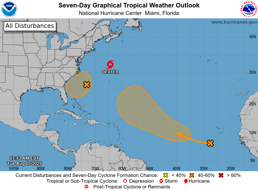
Here comes the hurricane hype
As we noted yesterday, the Atlantic tropics are starting to heat up. And the seven-day outlook from the National Hurricane Center (shown above) indicates that. At present there are no threats to the Gulf, but looking at the longer range models there appears to be the potential for another tropical wave (which is still well over Africa, and not reflected in the map above) to move off into the Atlantic and follow a more westerly course over the next two weeks. This might eventually track toward the Gulf, but it’s a long ways off and there are a lot of ifs and maybes.
Nevertheless, you can probably expect to see a lot of noise from social media-rologists about this and other potential threats to the United States over the next two months. But right now, here’s all we can really say for sure: The Atlantic is heating up, and if Texas is going to be threatened by a hurricane, it will almost certainly happen in the next eight weeks. When there are more specific threats to discuss, you can rest assured that we will discuss them.
