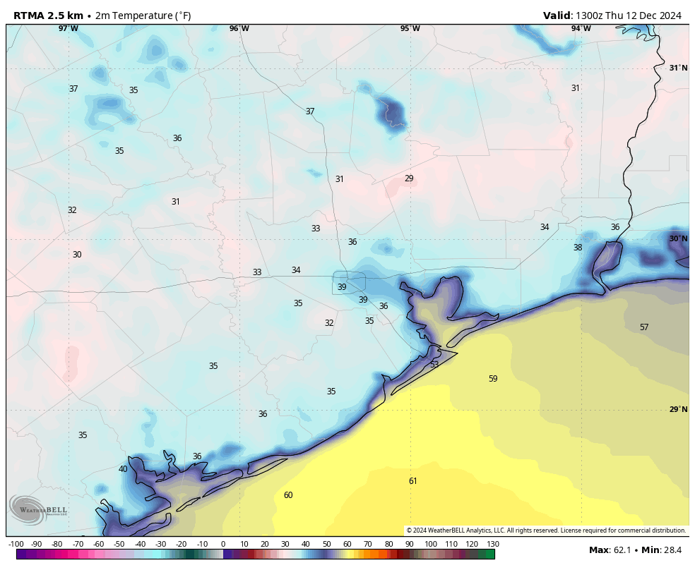
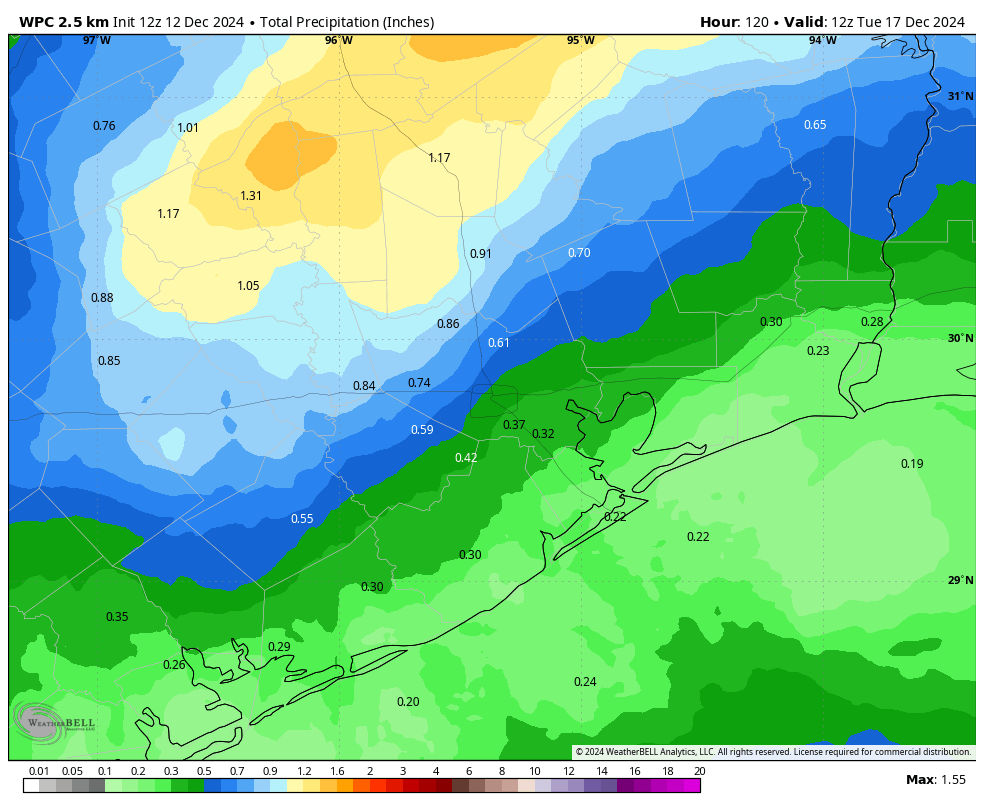
In brief: It’s a very cold morning out there across Houston, but temperatures will now be on the upswing, with balmy weather expected this weekend and into early next week. We’ll also see a smattering of rain chances throughout the forecast period, but nothing too crazy. We cool down later next week.
Thursday
It’s a rather chilly morning, with most of the Houston area in the 30s. A few inland areas, including Conroe and Cleveland, have dropped to 30 degrees or below. However, this is the bottom of the temperature valley for Houston, and we’re now going to ride the rails upward to a plateau of moderate days and mild nights through at least next Monday or Tuesday.

For today, specifically, skies will be mostly sunny with high temperatures in the mid-60s. With southeasterly winds in place, we’ll start to see a more moderate flow, and lows tonight will only drop into the low- to mid-50s for much of the area. By this evening we should see at least some partly cloudy skies as moisture levels increase in the atmosphere overhead.
Friday
Expect mostly cloudy skies on Friday, with high temperatures of around 70 degrees. I can’t entirely rule out a few light showers, but for the most part I don’t expect any rain. Friday night will be warm, with lows only in the lower 60s, and a slight chance of rain.
Saturday
A cold front will drop down into Texas this weekend, but most likely it will stall north of the metro area. This will lead to partly to mostly cloudy skies on Saturday, with perhaps a 50-50 chance of rain. Any showers that do develop will probably be light, so these will be a nuisance rather than seriously disruptive. Expect highs in the mid-70s. Saturday night looks warm and muggy, with lows only in the mid-60s.
Sunday
This will be a partly sunny and warmer day, with highs in the upper-70s. I’m hopeful that we’ll see some partly sunny skies, with only lower-end rain chances. In short, this is probably the better day for outdoor activities.

Next week
Monday looks warm and partly sunny, with a decent chance of rain, before a weak front arrives Monday night-ish. Tuesday and Wednesday will probably be a bit cooler before a second, and stronger push of colder air arrives later on Wednesday or early Thursday to bring seasonal weather back into Houston for December, which is to say highs in the 60s and lows near 40 degrees. It may be a little warmer or even colder than this through next weekend. We’ll see. Alas, it’s still too early to have much confidence in a Christmas Day forecast. It’s just too early and the models are bouncing all around.

Actually had frost on the roofs today as the temperature dropped to 38 vs. 41 yesterday. Absolutely delightful yesterday afternoon and on the morning walk today. Boo-hiss to upper 70s in December. Guys, please try to correct that before, say, the 22nd. Thanks.
That’s why models shouldn’t be allowed to the public. Only the experts at NWS and NOAA are trained to understand these things. And this is why the general population will never accept climate change because they see all these numbers and model failure on a routine basis.
Exactly. The gen pop is totally stupid. They don’t need to know what’s going on, they can’t do that cognating anyway. Let them just follow that black magick marker.
As long as the internet exists, people will still find ways to find models even if you try to block them
A climate change nut advocating for information censorship? These stories write themselves.
I actually got a frost warning in my car this morning – weird. And again, my sinuses are asking for some sort of stability UGH. 🙁
The forecasts seem to do well with cold advection temperatures but average out small areas of radiative cooling like we had this morning. That is, the trough had swung by yesterday and headed east with only the clear, cold air mass left behind and no wind. This is where you risk the killing frost when prediction is in the 30s. PS has someone picked “cold weather hater”?
From the post below at 9:01 a.m., yes. Yes someone has.
In Alief, the home weather station bottomed out at 34.
That should facilitate the trees to start jettisoning the leaves for the final lawn mow of the year.
I actually looked on the NWS website for frost warnings two days ago because I have plants that are sensitive to frost. Had I known we would have frost in the Santa Fe area this morning, I would have covered them. I’ll find out whether or not they survive.
Either the NWS doesn’t issue frost advisories or my search methods are flawed. I couldn’t find anything. Nonetheless, if SCW has access to this information from NWS or from some other source, it would be nice if they passed on this information to their users/supporters.
We had a light frost 3 weeks ago on Thursday November 21st in league city. I took pics. You had to really look to see it. Maybe that’s why no frost advisory was out this time?
This is just ridiculous. Too cold and can’t do anything when it’s like this. Bring the normal heat back please
Ran 7-1/2 miles at 5 a.m. this morning. Felt great. Plenty of things you can do in this weather. In fact, you can do pretty much anything in this weather.
It is good to be out running or walking in these conditions, not so nice cycling though – wind chill factor.
Yeah, different perspective I guess. I used to cycle and run through the Pacific NW winter. Just need the right clothing, lights, and fenders on your bike. Pearl Izumi gear was my best friend.
Don’t worry we will get heat again for 10 months soon. I think we’ve earned a little break from the heat for now.
Damn right we have.
Chill y’all. Of course there was frost if there was no wind. Frost happens all the time when the temp is in the upper thirties. (I forget why though)
Because the background of outer space conducts the heat away from solid objects faster than the air. If it is cloudy or windy than the cosmic background of space can’t effectively cool things like car windshields, rooftops, grass, etc. Trees also can prevent frost below the canopy leaves. I’ve noticed on frosty mornings that the grass in a field will be caked with frost but directly under a tree there will be no frost because the leaves provide protection from the radiative cooling of outer space
It’s heat transfer by black-body radiation. Roofs are black, so they loose heat by radiation to space much easier than say your white car.
my white fence had frost on it too.
It’s actually the opposite. Black objects absorb heat and white objects reflect heat more.
Agree with @Joey …
Black absorbs significantly more heat than white; while black absorbs almost all wavelengths of light, white reflects most light, meaning it absorbs much less heat
Well goodbye old man winter. We shall meet again in January. Maybe