In brief: In this morning’s post we discuss the end game for the tropical disturbance in the northern Gulf, look ahead to elevated rain chances on Friday, and then see what high pressure will bring us next week.
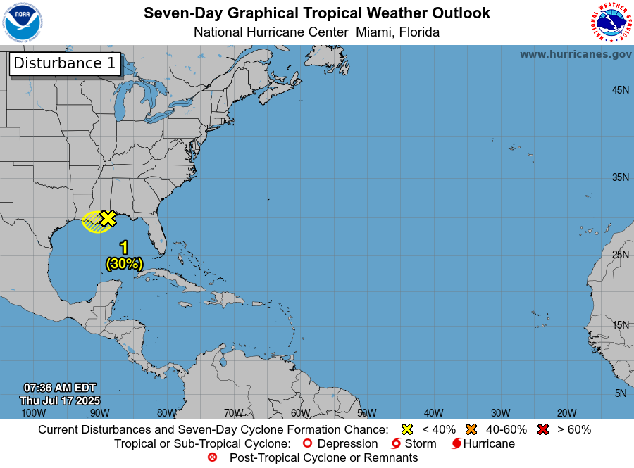
Invest 93L
As expected, the tropical disturbance in the northern Gulf of Mexico (aka Hurricane TikTok) is moving steadily westward and nearing the far eastern end of Southeastern Louisiana. The center of the storm continues to hug the coast, which has limited intensification, and thus this system remains poorly organized. The odds of it becoming a tropical depression or storm have been lowered to 30 percent this morning, and even this seems a little generous to me. It should move into Louisiana later today or tonight, bringing a chance of heavy rain to that state. Impacts to Texas will be minimal, although parts of our area will see increased rain chances on Friday as a result of atmospheric moisture related to this system.
Thursday
If you liked the weather on Wednesday you are in luck, because today will be pretty much the same. We may see a few more clouds this afternoon, but high temperatures should still reach the mid-90s for most locations with plenty of humidity. Winds will be light, generally from the south. Low temperatures tonight will drop into the upper 70s.
Friday
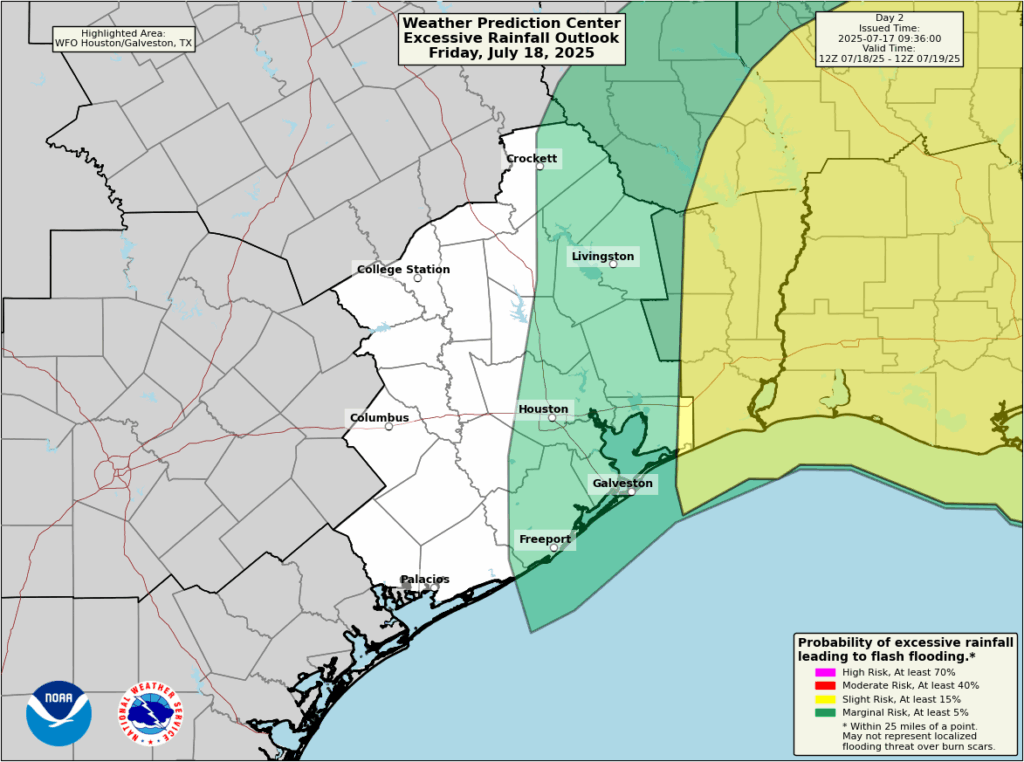
As atmospheric moisture levels rise due to the influence of the tropical disturbance, we will see an increase in rain chances on Friday, but how much will depend on how far east you live. If you are east of Interstate 45 I would put the odds of rainfall at about 50 percent or higher, and to the west I’d say considerably less than 50 percent. Overall accumulations likely will be in the 0.5 inch for areas that receive rain, but with the tropical moisture there could be higher bullseyes. It’s notable that the Weather Prediction Center (see below) has lowered the likelihood that any part of the Houston metro area will see excessive rainfall. Highs will reach the upper 80s to lower 90s due to increased cloud cover.
Saturday
Skies will be partly sunny on Saturday, with highs generally in the lower 90s, as atmospheric moisture lingers in the region. Rain chances will be about 30 percent, higher again to the east of our region. Accumulations look slight. Overall if you have outdoor plans I would be cautiously optimistic.
Sunday and next week
High pressure begins to build in by Sunday, and this should set the stage for sunny and hot weather for awhile. Most of next week should bring high temperatures in the mid- to upper-90s, with perhaps a 10 percent chance of afternoon showers driven by the sea breeze. It’s late July. It’s Houston. You have been warned.
