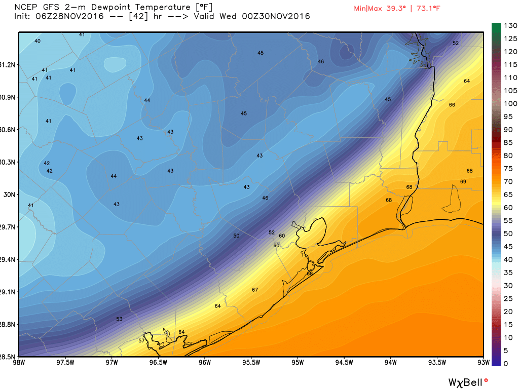
Good morning. I hope everyone had a great weekend—although a tad warm for this time of year, the weather was mostly pleasant for both Saturday and Sunday. More winter-like weather is coming, however.
Today
Storm conditions are only marginally favorable for Houston today, and as expected most of the development has been well to the north-northeast of the region in areas such as Lufkin. It appears as though a capping inversion remains in place over the city, and this should limit storm activity this morning. Some areas should see scattered rain showers, however.
By early this afternoon some drier air will move in along with a weak cool front, which should clear our skies and allow temperatures to rise into the low 80s for much of the area. Although warm, this drier air will also allow the region to cool off fairly quickly this evening, with temperatures falling into the upper 50s north of Houston tonight, and lower 60s closer to the coast.
Tuesday
After a cool start we’ll see another fairly warm day Tuesday as the weak front washes out, with highs in the upper 70s to 80 degrees. By Tuesday afternoon we should see a modest increase in rain chances as a stronger cool front approaches, and moves through the area sometime on Tuesday evening or night. I’m not looking for much more than a broken line of showers and storms with this stronger front. The front’s passage should be noticeable with drier air moving in behind.

Wednesday through Friday
We’ll see significantly cooler weather for the second half of the work week. Look for high temperatures in the mid- to upper-60s in the wake of the front, with partly to mostly sunny skies, and lows in the 40s expect for areas immediately along the coast. These are pretty typical conditions for winter in Houston—which at least in meteorological terms, begins Thursday, Dec. 1.
The weekend
Unfortunately the great weather appears unlikely to continue into next weekend, when a number of outdoor parades, performances and other activities for the holiday season really being to ramp up. (Our family has three Christmas activities on Saturday, alone, that may be affected). Right now it looks like we’re going to see a lot of atmospheric moisture flowing into the area beginning later on Friday, which should make for gray days on Saturday and probably Sunday too, with highs of around 60 degrees, and intermittent light-to-heavy rainfall. This forecast isn’t locked into stone, but is worth noting.
Note: If you’re interested in helping support Space City Weather, our T-shirt sale will continue for one more week. Click here to order!
Definitely looking forward to “Meteorological Winter”. The problem with Houston is our “Meteorological Summer”.
Which begins in meteorological spring and ends deep into meteorological fall!
SHSU playoff game in Huntsville Saturday at 2. You think tailgating will be a washout?
That’s a definite possibility, although the rain may come on later on Saturday.
Eric,
What is the purpose of the “Read More” button on each post? Is it to save space?
I love the website and consider this very minor, but why not just show the most recent post in its entirety? If it is space related maybe the answer is to shorten or just show links of past posts?
Again, just a minor observation. Thanks for doing what you do.
The point is to not bog down load times of the home page.
There is no setting to show the first post in its entirety and then just snippets of, say, the next five.