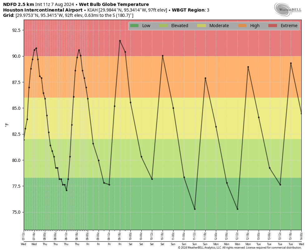
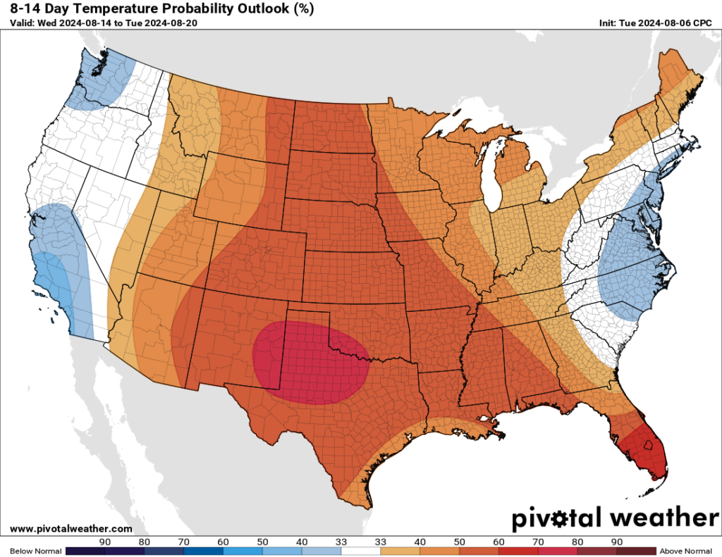
In brief: High pressure has hold of our weather, and that only means one thing for Houston in the summer: Heat. We are going to be hot and sunny for the next few days, before slightly cooler weather arrives next week with a smattering of rain chances.
A word about short forecasts
We don’t believe in wasting your time. So when there’s a lot to write about the weather, we’ll go into detail. And when there’s not, there’s no reason to. Such is the case in August when we’re under the influence of high pressure. And so the forecast today—and probably for the rest of this week!—is likely to be short and sweet. Well, maybe not so sweet.

Wednesday
Houston’s official high temperature, measured at Bush Intercontinental Airport on Tuesday, was 98 degrees. We’ll probably reach that mark or go a bit higher today as inland parts of the Houston area touch triple digits. Areas right along the coast will be a few degrees cooler. We’ll continue to see sunny skies, with calm winds in the morning and southerly winds of 5 to 10 mph in the evening. Lows tonight will be in the vicinity of 80 degrees.
Thursday through Saturday
Our present heat wave is likely to peak during this period, with high temperatures of 100 degrees likely for much of the Houston area. Winds will continue to be light, with lows only falling to 80 degrees. Skies will be sunny.
Sunday and next week
As high pressure starts to retreat slightly, we’ll see temperatures come down just a bit. On Sunday we’re still going to see sunny skies, but highs likely will only rise into the upper 90s. Later next week, perhaps starting on Monday, we’ll see some slightly better rain chances. Skies are still going to be mostly sunny, but the sea breeze may help to promote some afternoon showers. In terms of chances we’re probably looking at something on the order of a 10 to 30 percent chance into the middle of next week. So it’s not much, but it’s not nothing in mid-August, either.

Tropics
As anticipated, Tropical Storm Debby has moved off the the South Carolina coast into the Atlantic Ocean where it may strengthen some during the next 24 hours. However, the primary threat from this system remains very heavy rainfall, initially in the Carolinas and eventually on into Virginia and Pennsylvania.
Beyond Debby, things look to remain quiet for the next week or so, which is a fine place to be heading toward the middle of August.

Thank you high pressure for keeping us clear of tropical systems!
I’m taking great comfort in your statement earlier that this tends to be the hottest week of the year. Hope for cooler weather is coming! (No hope so far for fewer mosquitoes.)
You better say this is absolutely beautiful crisp weather or else you are going to get harrassed about how you complain about the weather to much. And then you’ll get the good ole classic “Its alway hot in Houston during the summer duh!!” 🙄
“And so the forecast today—and probably for the rest of this week!—is likely to be short and sweet.”
If you change that last “e” to an “a”, I think you’ve got it covered.
We don’t believe in wasting your time. So … when there’s not, there’s no reason to.
Well said, one primary reason along with NoHype SCW is pref
We had a teeny pop up shower last night around 9 pm here on the west side—woo hoo!
Do the WBGT forecasts shown, in estimating globe temperatures, assume full solar intensity or reduce for cloudiness forecast? Do they use the Liljegren algorithm?
There was no mention of tropical system that others were talking about yesterday. Does that mean it’s not something to be concerned about?
The NHC has downgraded it to 10% chance of formation in 7 days, so I’m guessing for now, nothing to see here. For now. I’ll take it, esp with HISD starting school next week and other districts the week after.
Tell that to the people a few days ago who were predicting a hurricane heading our way based on earlier models
No one was predicting anything – they were worried because the modeling looked like Beryl. Geez.
Ah, “the dog breath days of summer”. One of your best statements ever about August. Just have to endure it, knowing it will start to get better in September.