In brief: Saharan dust will give the Houston area a hazy sky this weekend, but it will also heat up too. Look for mid to upper-90s and very uncomfortable conditions. Next week sees a cooldown as rain chances return Monday and especially Tuesday, which could be a rather stormy day.
Today and Saturday
First off, welcome back to the Saharan dust that periodically impacts our region in June and July. You’ll notice it via some haze or kind of a milky appearance to the sky when clear. It will probably impact air quality to an extent as well, though most of the dust is suspended aloft. Couple that with building high pressure and you have a truly acrid pair of summer days here. As bad as August is here, some of these June days with high heat and haze can top the charts for most miserable of summer. Expect highs in the mid-90s, with a couple spots in the upper-90s perhaps on Saturday.
Rain chances look minor but not quite zero. Yesterday saw a couple small areas pick up 1 inch or more (Friendswood and between Rosharon and Angleton as examples), and that’s entirely possible today or tomorrow. But most likely, you’ll just stay hot and dry.
Sunday
We’ll close the weekend with close to the hottest weather so far this year, as highs will try to push into the mid to upper-90s. I think that the Saharan dust this weekend may be just enough to keep us more mid-90s than upper-90s. Whatever the case, it’s going to feel close to 105 degrees at times when you factor in the humidity.
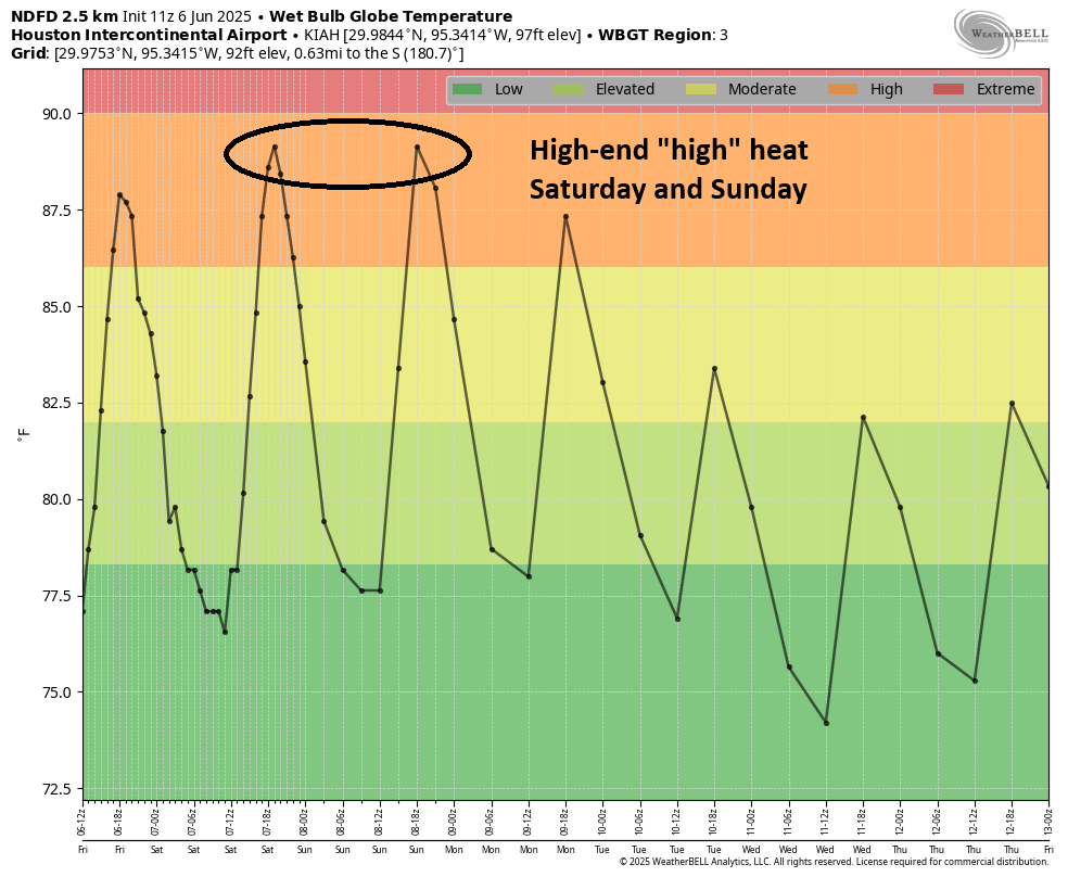
So, yes, for the early season this is some excessive heat. Take it easy, as we’re not yet fully adapted to these sorts of temperatures. Normally we’re just above 90 degrees in early June, not above 95 degrees. So it’s hotter than it usually is for this time of summer. Again, a stray shower is possible.
Another note, morning lows are also going to be quite uncomfortable this weekend with upper 70s to around 80 or better near the coast. We’ve been routinely seeing morning lows this week in the 80s on parts of Galveston Island through San Luis Pass down to Surfside. Some parts of inner loop Houston may also struggle to get below 80 degrees at times this weekend.
Monday
We’ll start next week in a transition. The ridge over Texas will reorient into the West, while a deep trough carves itself out in the Great Lakes. This means a return to showers and thunderstorms in Texas. On Monday, we may still be a bit sparse in coverage with the rain, but chances definitely step up from Sunday. This will knock us back into the low or mid-90s for highs.
Tuesday and beyond
Tuesday may be a very unsettled day with strong thunderstorms and heavy rainfall. It’s still a bit too early to get too into the weeds on timing or how the storms will evolve, but this day has been flagged since early in the week as a potentially stormy one. Plan accordingly.
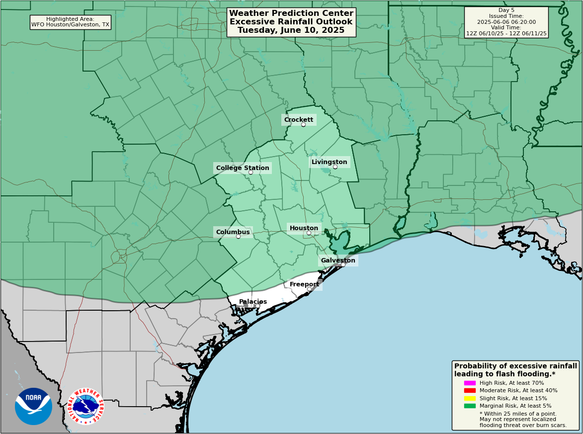
Rain totals may reach 1 to 3 inches in much of the area depending on exactly how things evolve. But there will be some risk for higher totals as well in localized spots. We’ll track how this evolves over the weekend and report back Monday. High temps may struggle to hit 90 on Tuesday.
The coverage of rain may back down after Tuesday but rain chances will remain fairly elevated through Wednesday and Thursday.

June sucks for many reasons (personal and public). 🙁
SCW team: Thank you for your dedication and for attempting the nearly impossible of predicting what is by its very nature ever in a fluid state of change.
Unbelievable… just checked the NHC website … for the Eastern Pacific, there’s now three Disturbances – two in red and one in yellow. And all all very closely knit to each other.