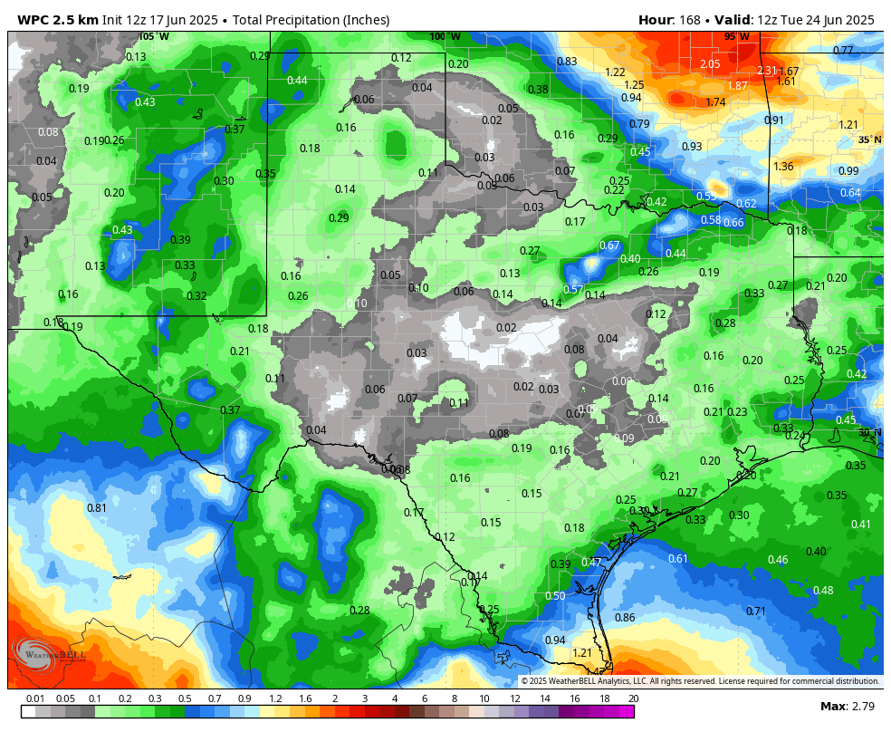
In brief: Overall our forecast is consistent for the rest of the week. We are going to see fairly normal weather for June, which is to say warm temperatures but not excessively hot. The humidity, of course, will be constant. And in a change from the last week our rain chances will go down significantly.
A stalemate in the atmosphere
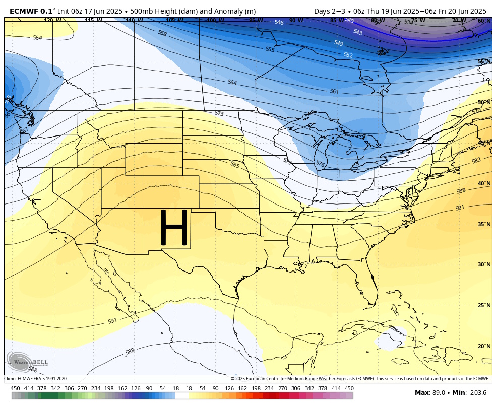
Over the next several days we are going to see two competing impulses in the atmospheres overhead. To our southwest, a ridge of high pressure will be attempting to expand into Texas. At the same time, a few upper level disturbances will be attempting to slide down from the northwest. So what will happen? Mostly, I expect fairly tranquil weather through the weekend, with mostly sunny skies and warm—but not too hot—temperatures as we go through the longest days of the year. Although we will have some shower chances, increasingly it looks like the high pressure system will keep most (but not all) at bay.
Tuesday
Today should be sunny and warm, with a high temperature in the vicinity of the low 90s. Winds, generally, will be light in the range of 5 to 10 mph with some higher gusts. To the extent we see rainfall, the majority of it is likely to remain offshore. But we definitely could see a few showers and thunderstorms pop up this afternoon. For the most of us, however, no. Lows tonight will trop into the upper 70s.
Wednesday, Thursday, and Friday
The rest of the week looks similar. If you squint, it’s possible to see some slightly higher rain chances on Thursday, maybe 30 or 40 percent. But these three days should all bring highs in the low 90s, mostly sunny skies, and warm nights. In terms of winds, Wednesday afternoon could get a little breezy, but overall things look pretty mild.
Saturday and Sunday
This pattern should persist into the weekend. Expect highs in the low 90s, a fair amount of sunshine, and perhaps a 20 to 30 percent chance of afternoon showers or maybe a thunderstorm.
Next week
There is some evidence that the aforementioned high should retreat a bit next week, opening us up to a bit better rain chances by Tuesday or Wednesday. That’s a week off so I don’t have much confidence. However the good news is that it does not appear as though we’re going to see a temperature spike into the mid- or upper-90s any time soon. (Note: This is not a taunt.)

However the good news is that it does not appear as though we’re going to see a temperature spike into the mid- or upper-90s any time soon.
August: Hold my beer
I think we all sacrifice August to the weather gods though. Nothing good happens here in August; only lesser degrees of bad.
Listen to Eric, Mother Nature!😁
No mention of the storm that hit Katy area last night? It was a humdinger. Got 2.6” rain in 1.5 hours!
Cinco got DUMPED on, lots of street flooding and a small section of northbound 99 just north of La Centerra with a low spot had no lie 3 feet of standing water in the left lane, deep enough to kill a car for sure. And immediately after just north of 10 it was almost bone dry, its crazy how localized some of our rain events are.