In brief: Today’s post takes a look at rising humidity for the next couple of days, and returning rain chances on Friday and Saturday. We also look at the likelihood of a weak front on Sunday, and the muddled possibilities for more next week.
A few notes on Fall Day
We have had a couple of questions roll in about Fall Day, our celebration of the end of summer planned for Saturday, October 25th, at Midtown Park. (You can find more information here). Several people have asked about parking, which has been a bit of a challenge during our last two events. This year I’m happy to report there is plenty of parking nearby, including an underground garage that is going to be free on the Saturday morning of our event. Secondly, we are indeed going to have some fun giveaways (including exclusive anniversary tote bags, which probably will go fast), and we will share more information on all of that soon. We are putting a lot of effort into this with our partner, Reliant, so we hope to see you there!
Thursday
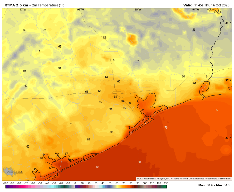
Our drier air is holding on for inland areas this morning, with temperatures ranging from the upper 50s inland to the 70s along the coast. From this point our dewpoints are going to steadily climb over the next couple of days, so less-than-dry air is going to be the norm through Saturday. This does mean we are going to see more clouds today, and this should help to limit high temperatures to the mid- to upper-80s. Winds will be light, from the southeast at 5 to 10 mph. Lows tonight will drop to around 70 degrees for most locations, depending on your proximity to the coast and central Houston.
Friday and Saturday
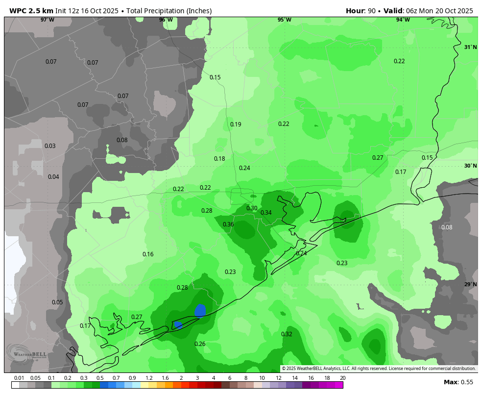
The onshore flow and rising atmospheric moisture levels will bring a decent chance of rain into the forecast on Friday and Saturday. Let’s be clear: both days are likely to have partly to mostly sunny skies. But there will be the possibility of a passing shower, with overall chances of 40 to 50 percent daily. Accumulations for the most part will be on the order of a tenth of an inch, but I could see a few areas that see stronger showers that put down half an inch. This is all probably going to be very hit or miss. Temperatures will generally range from the mid-80s to about 90 degrees further inland, with plenty of humidity. Nights will be warm, in the lower 70s.
Sunday
This is the day when a cool front will approach and (probably!) move through Houston and down to the coast. The European (and other) models remain fairly bullish on a nose of drier air dropping down into Houston on Sunday, but there is some uncertainty. Basically, I think if you live along and north of Interstate 10, you’re going to see a good shot of less humid air for a day or so, and but the closer one lives to the coast, the lower the chances and the less dry air. In short this is not going to be a strong front that barrels off the coast and leaves us all saying, “Ahhh.” With that said, most of Houston will probably see highs in the upper 80s on Sunday with lower humidity and sunny skies. Temperatures on Sunday night will vary widely, with some inland areas probably dropping into the 50s, but the coast remaining stubbornly in the 70s.
Next week
Who knows. I think the front on Sunday will wash out pretty quickly. But then we might see another one on Tuesday or Tuesday night. And then maybe a stronger something or other by Thursday or so. The models are flopping around a lot. There also appear to be some rain chances sprinkled in. The upper-level pattern next week does support the sending of a front all the way through Houston later next week, so let’s see what happens. I’ll guarantee you this: If we get a strong cold front, we will comp everyone’s admission to Fall Day. (That’s a joke, just to be clear. Fall Day, like this website, is free and open to everyone).
