In brief: Houston will see more humid weather this weekend with rain chances re-entering the forecast slightly today and tomorrow and more so on Sunday as a weak front approaches. Though locally heavy rain is possible, we don’t expect widespread heavy rainfall. Temperatures will be warm by day and cooler again by night early next week before a late summer hurrah arrives again after Tuesday or Wednesday.
Programming note
If you live or work in the City of Houston, you are going to receive a test emergency alert this morning at 11 AM. It will look like an Amber Alert, except it will read “TEST Wireless Emergency Alert from the City of Houston Office of Emergency Management: No Action Required. TEST ALERT. For more information visit HoustonOEM.org.” The test is meant to only go out to anyone in Houston at that time, though because it’s targeted to specific cell towers, you may be in an adjacent location and still receive it as well.
Tests like this are necessary periodically to ensure the system works properly. WEA cell alerts have been a source of, shall we say, consternation in recent years for a number of reasons. They’re well-intentioned but in some cases not always relevant. Ignoring the broader conversation around those sorts of public safety alerts, we will note that weather alerts are quite relevant. Only higher end flash flood warnings will get pushed to your phone. I think this topic takes on some renewed relevance in the wake of the July 4th Hill Country tragedy, something we can discuss more another day. If you’ve turned them off in the past and want to turn them back on:
iPhone:
Go to Settings > Notifications, scroll to the bottom under Government Alerts, and you can turn on Emergency Alerts there.
Android:
Go to Settings > Safety & Emergency > Wireless Emergency Alerts, and you can enable Allow Alerts.
Anyway, we just wanted to make sure you knew that was coming today.
Today
I’m not sure if anyone else felt this way, but yesterday seemed really nice. We had very few clouds and generally tolerable humidity, although it was fairly hot by late afternoon. It sort of “looked” like a change of seasons was slowly beginning.
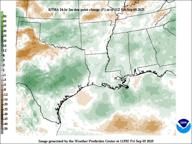
Of course, humidity is notably higher already this morning, so that autumn thinking may be short-lived. Expect a similar day overall: Sun, a few clouds, and highs in the mid-90s, possibly upper-90s — but with more humidity than yesterday. An isolated shower or storm could pop up this afternoon as the sea breeze moves inland, but most folks should stay dry.
Weekend
There has been some discussion around Lorena in the Pacific and how it may fling some higher moisture in our direction later this weekend. Well, Lorena’s forecast has changed significantly in the last couple days. It’s now post-tropical, and it’s expected to make a U-turn back out into the Pacific. While overall atmospheric moisture increases this weekend, the threat for any significant heavy rainfall has come off some.
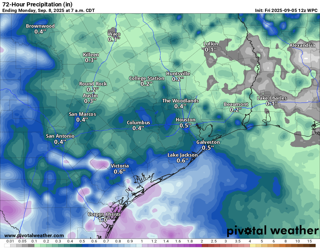
Expect at least isolated thunderstorms Saturday and more scattered to perhaps even numerous storms on Sunday as another (!) front approaches. Locally heavy rainfall could occur, but widespread, significant rain is unlikely. Still, if you’ve got outdoor plans this weekend, just consider a backup in case a downpour passes by. Highs will be in the upper-80s to low-90s due to clouds, with high humidity.
Next week
With drier air filtering in behind the front next week, we will probably see low temperatures drop back into the low-70s or even upper-60s in spots. High temps will likely remain rather hot in the low to mid-90s. Our autumn fling will probably end after early next week, as high pressure tries to build and expand over the Southern Plains. Better now than in July or August, I suppose.
Whatever the case, look for a late summer hurrah beginning after midweek next week.
