In brief: Houston’s record warmth may relax some as showers today and a cool front tomorrow disrupt things. Another, slightly stronger cool front may be in the cards by Wednesday. This should introduce some temperature variability to the picture at least!
A couple quick housekeeping notes. I (Matt) will be at Fluff Bake Bar tomorrow for their Saturday bake sale! Come get some yummy (weather themed) goodies before they sell out! Also, our annual fundraiser will begin next week, so please check back Monday for more!
Houston hit a record high of 89° yesterday, tying the mark last set way back in 2018. This was our sixth tied or set record high since October 1st. We also set a new record warm minimum temperature of 74 degrees, besting the 1989 record of 72 degrees. This was the third record warm minimum this month. We have some variability in the forecast at least, with a cold front that flirts with us this weekend, followed by perhaps a more substantial front next week.
Today
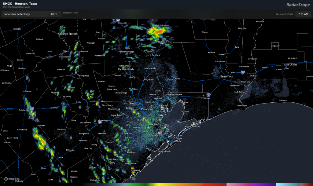
In the meantime, more of the same. It will be warm and quite humid again today. We’ve already got scattered showers peppered on the radar, mainly in the western half of the area.

Look for this to continue with perhaps more of a gradual north and northwest focus to things today. Whatever the case, keep an umbrella handy in case one passes through. Highs in the 80s but a bit less warm than yesterday.
Excessive rainfall risk is around a level 2 of 4, or a slight risk for areas north and west of Houston today and a 1 of 4, marginal risk in Houston and south. It’s possible that one or two storms become strong to severe in the Brazos Valley in particular with gusty winds or hail possible.
Weekend cold front
The cold front will reach the Brazos Valley by about Midnight tonight, Houston by sunrise or so, and the coast by 8 or 9 AM on Saturday. Additional showers, downpours, or rumbles of thunder could accompany the front overnight. You will notice a difference behind the front, with humidity falling off a bit and temperatures noticeably cooler. Once the cool front hits the Beaumont area, it will likely stall. So expect showers or storms around tomorrow east of Houston.
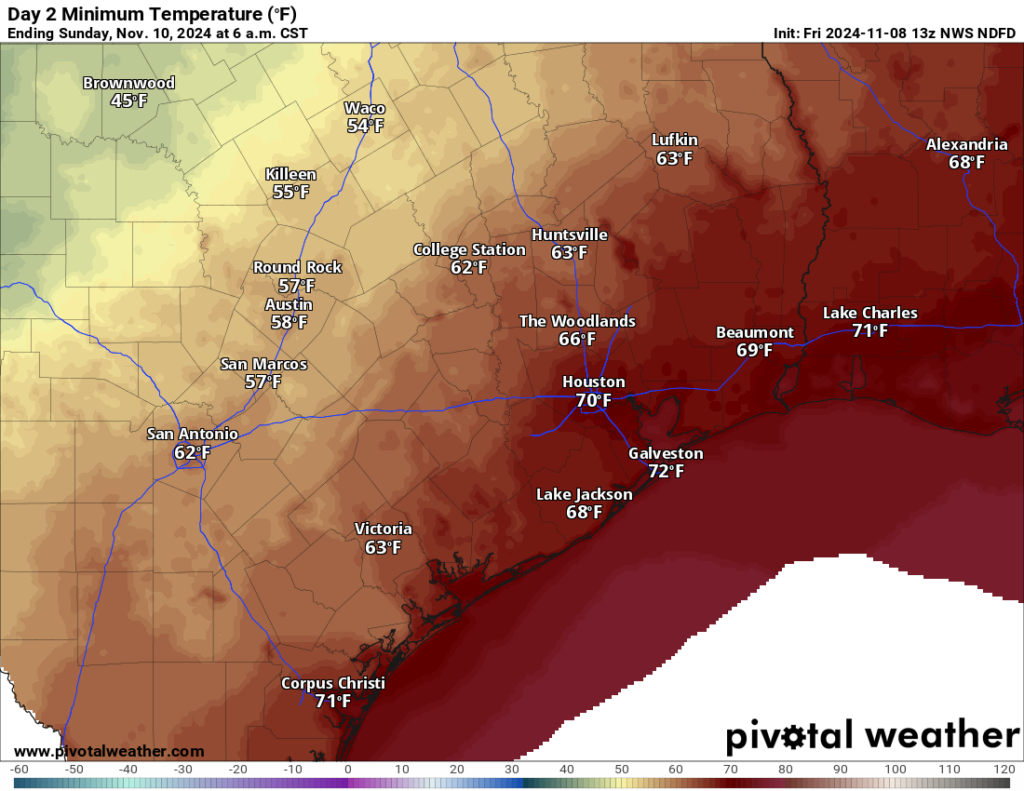
On Sunday, there opens up a little bit of uncertainty, as the front should stall out or wash out to our east, leaving us with a slight chance of showers or a thunderstorm. Some of the latest trends seem to keep us mostly dry though. I suspect Sunday will probably be a fine day, but Eric and I will watch things in case something changes. Highs both days will be in the 70s to perhaps near 80 degrees with morning lows in the 60s to near 70 degrees.
Next week
We may get a slight assist from Rafael on Monday with generally offshore winds helping to keep humidity low. The humidity may inch back up on Tuesday. Expect sun and just a few clouds. Highs will be in the 80s with morning lows in the 60s. A shower chance re-enters the forecast Tuesday afternoon. Lows Tuesday night will be in the 60s to perhaps near 70 ahead of the next cold front. That looks to plow through Wednesday around midday, knocking our temperatures back a bit.

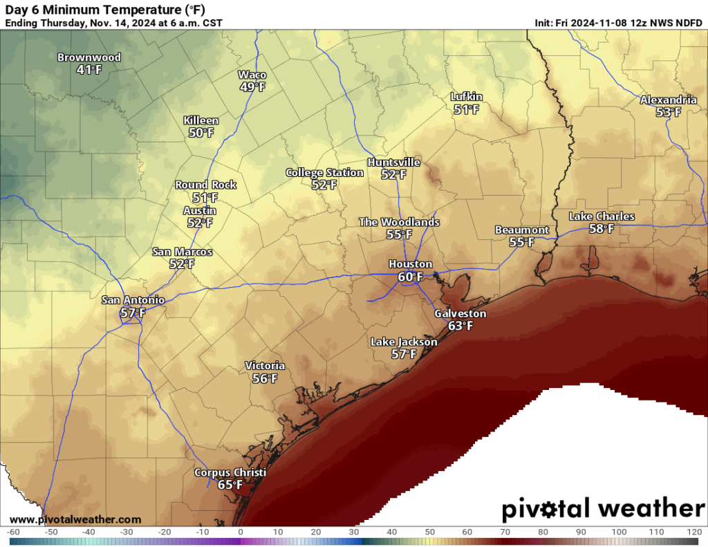
We should see a couple days of cooler temperatures in the wake of that front before things warm back up again next weekend. Another front may be in the cards after next weekend. We’ll see. Eric explained yesterday why our fronts have lacked teeth so far this year. No sign of that changing in the foreseeable future.
Tropics
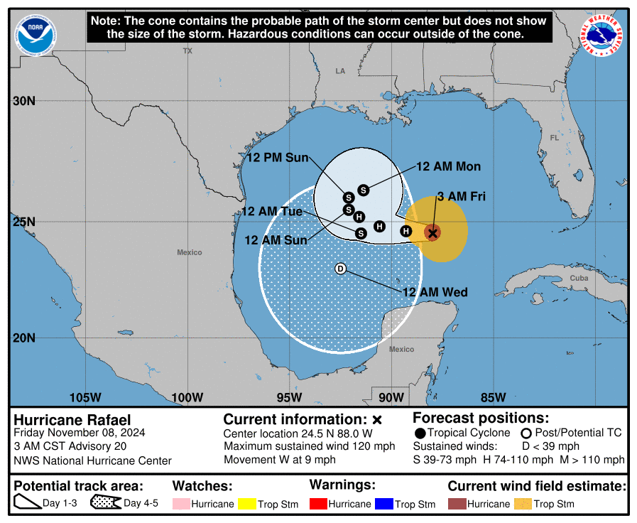
If you want to ask about Rafael and what the heck it’s doing, don’t even bother.

In all seriousness, Rafael is being steered by high pressure over the Southeast, but as it encounters dry air, wind shear, and approaching cold fronts, it will likely do some funky maneuvers over the open water before eventually ending up as a depression or remnant low in the Bay of Campeche next week. Check our companion site, The Eyewall for more.


After getting caught in the rain on my morning walk (that the Weather Channel radar said was not there), I am wondering if you have a radar app recommendation that might be more accurate? Figure if anyone would know…love your site/app!
We use two sites for radar (and beyond). Our primary is Wunderground. Mostly because we can choose one of many nearby PWS sites (really like that feature). So you get a “home page”, with a focused radar map. But you can open the dedicated radar page, which has many weather options beyond just radar.
.
The second site we use is “radar dot weather dot gov”. The default shows radar at a glance, of the entire US. Of course, you can zoom in on specific area for more details and alerts, etc.
I use the NWS too. You can search by zip code to get forecasts for your area. I love reading the Forecast Discussion section. There is Forecaster name Batiste who is always pretty funny.
RadarScope. Experts use it.
On my phone I use MyRadar. It’s available for both Android and Apple. Very accurate, and it’s saved me a few times when planning trip routes or out on the water. The base configuration is very useful, and there are some add-ons available. You can get good alerting and hurricane tracking, or Aviation information.
I read once about the year without a summer way back in the 1800s, this is the year without a winter, in the south anyway.
I remember back in 1997 that the temperature was in the 70s in August. Also, it was warm in Winter in 2020 and 2021. (I looked back at the data.) We got blessed in ’22 and ’23 with cold Winters.
Yea, we got “blessed” with burst pipes here in our Magnolia home both years.
Come on Aggie, BR didn’t mean it like that😉. I do understand your sentiment. Ask your insurance company if you were blessed in 21. Brisk weather most of us crave right now, yes. Failed power grids and burst pipes turning your ceiling into Niagra Falls, heck no.
Clarifying my last Reply, and correcting your (@BR) memory …
2021 was The Great Texas Freeze.
2022 also had freezing temps.
Never had freezing temps for 2023.
Did anyone happen to see the top story when you pull up Google? It’s talking about snow in Waco?? The date is Nov. 7, 2024. Where is that coming from?
I did! I have no idea why they’re pulling that for Waco. It’s not going to snow in Waco. But there is winter weather in the extremely NW Panhandle. In general that article seemed a little sketchy.
Anything found on Google needs to be viewed with cautious scepticism – or a pinch of salt.
I saw the article. It’s not going to snow in Waco. Very poorly written IMO. But there is some winter weather in the Panhandle.
The deniers can’t say its just summer right now.
Historic event ongoing in the gulf, with what was, a cat 3 120mph cane in central gulf overnight. And moving west on November 8th. No threat to anyone, but something to marvel at.
Meanwhile let’s ramble on about meaningless fronts that aren’t gonna do a damn thing for us. 😂
Well it’s not exactly historic. Since 1842 125 hurricanes have developed inside the Atlantic Basin. Several of them were major hurricanes including a cat 5 in 1932 that killed 3500 people in Cuba. This is a list of some other November hurricanes:
Nicole: A Category 1 hurricane that made landfall in Florida on November 10, 2022
Kate: A Category 2 hurricane that made landfall in the Florida Panhandle on November 21, 1985
A South Florida Category 2: Made landfall on November 4, 1935
The “Expedition Hurricane”: A Category 1 hurricane that made landfall in eastern North Carolina on November 2, 1861
The last known landfalling November hurricane in Texas was on November 5th 1839 near Galveston Island. Hopefully it stays that way for a while.
If you want to hear more about Raphael, go to their site The Eyewall. That site is about activity in the tropics. This site is a weather forecast blog. Where they forecast the weather, including upcoming fronts. It’s not “rambling.”
It is something to marvel at to have a major hurricane only a few hundred miles offshore in mid-november. Even better that it’s not going to bother anybody for a change. Will probably see cloud bands move in starting tomorrow.
Interesting fall this year, huh?
If this was September 8, it could’ve been Starship Enterprise red alert time.
Ol Rafa might have been doing some landscape modifications to our homes.
Lived along the Texas Coast for all my 66 years. This is the weirdest, warmest Autumn that I can remember. Average lows each night 15 to 20 to close to 25 degrees above normal day after day with a few paltry cold fronts along the way! We should be around 75-55F each day or even 70-50F very soon! Just for fun I tried to find a climate graph to march our 83-73F Mid-November days. You know what matches up? No, not Corpus Christi. Not even Brownsville. Nope, we are even warmer than Miami. In fact, the best match would be Key West, Florida! That’s the very warmest year round spot in all of the Continental United States. Of course, before you go planting avocado or mango trees, just remember one deep freeze in February will kill the crop. Hope it gets back to cooler temps soon.
What are your thoughts on the coastal flood advisory for east of galveston through Saturday evening? Is there going to be a problem for visiting that area?
It’s been my experience that when we have these indian summers the bottom will drop out probably in December. On another note Joe Bastardi has Rafael hitting the middle gulf coast as a tropical storm.
Only in Texas can it be snowing on one part of the state and be in the 80s and 90s on the other side.
Well, probably in CA too, but they have mountains.
Texas better