In brief: After a warmer spell Houston will now see some of its coldest weather of the season as temperatures fall into the 30s for much of the region. But don’t get too accustomed to sweaters, as warmer weather returns for the weekend and the first half of next week. Rain chances also return later on Friday, but showers definitely look to be hit or miss this weekend.
Hot, then cold, rinse and repeat
Houston’s roller coaster weather continues, as is often the case this time of year. High temperatures kicked up to 76 degrees on Monday, our warmest day so far this month. But then a fairly strong cold front has moved in over night to bring in much drier and chillier air for the next couple of days. But by Friday temperatures will be back on the upswing again with a warmer weekend after that.
Tuesday
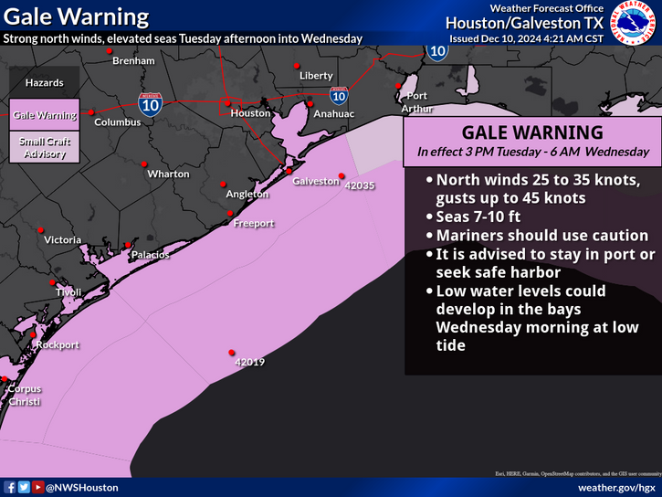
Depending on how far you live from the coast, temperatures this morning are either in the 50s or lower 60s. Winds are from the north-northwest. As the day goes on we’ll see some gusts up to 25 mph, and that should continue this evening. The effect will be especially pronounced for coastal areas, with the National Weather Service posting a “gale warning” for this afternoon and tonight, with seas of 7 to 10 feet and stronger winds offshore. Maybe not the best evening for a boating excursion.

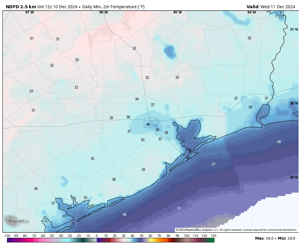
As for temperatures, we’ll likely see highs today in the lower 60s. If skies aren’t clear when you’re reading this, they should soon be. A secondary push of colder air later today will help drive temperatures tonight into the 30s (for inland areas) and 40s (closer to the coast). Combined with the wind, it will be rather chilly outside. Bundle the kids up for school tomorrow morning.
Wednesday
A fine and sunny winter-like day, with highs perhaps around 60 degrees. Expect another chilly night, with temperatures likely within a degree or two of what the region saw on Tuesday night. However, winds will be decidedly less.

Thursday
Thursday should be partly to mostly sunny, but the onshore flow will be back. Look for southeasterly winds, with gusts up to perhaps 20 mph or higher. This warmer and more humid air should lead to the influx of some clouds on Thursday afternoon, and highs in the mid-60s. Lows on Thursday night will be warmer, likely in the upper 50s for most locations.
Friday, Saturday, and Sunday
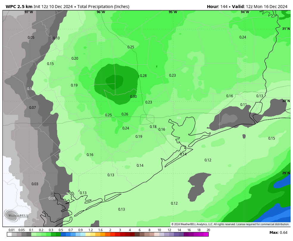
With the departure of high pressure, the forecast for the weekend is a little more uncertain. Some weaker fronts are likely to approach the area, but it’s not clear whether they’ll stall (more likely) or push all the way into the city or down to the coast. So what does this mean? Well, I’m pretty confident in daily high temperatures in the 70 to 75 degree range, with moderate humidity. Rain chances will return later on Friday, Friday night, and Saturday morning, but overall accumulations don’t look significant. Still, it’s something to monitor if you have outdoor plans throughout the weekend. Lows each night will probably be in the upper 50s or lower 60s, but it will depend on your distance from the coast and the movement of the aforementioned fronts. In summary, the weekend looks not-too-hot, not-too-cold, with a chance for a splash of rain.

Next week
This overall not-too-warm, not-too-cold pattern with a smattering of rain chances will probably persist through about Wednesday. There is a pretty decent (although not certain) signal for a stronger front later next week, heading into the weekend. This will get us back to feeling like winter in Houston. As for the Christmas holiday, it’s still far enough on the horizon for us not to have much confidence in any forecast. But it’s probably going to be closer to Mele Kalikimaka than a Winter Wonderland. We’ll see.

The latest computer model runs look like blinking lights on a Christmas tree with alternating red, blue and green lights. One day hot the next day cold with a sprinkling of rain every few days or so that never seems to materialize.
Coming from Hawaii and now living in Houston, it was such a surprise to see “Mele Kalikimaka” in a Houston weather post of all places. Made me smile. Haha!
You’re my most reliable weather source and I am grateful. We have a second home the the Canyon Lake area, just northwest of San Antonio. When you post your rain and temperature maps, could you maybe expand them just a little so I can see what’s going on there? Either that, or train some colleagues in that area to start a reliable, “no hype” weather prediction service like yours. Thank you for all you do.
If you’re on FB, there’s a good page called South Texas Weather that routinely covers weather that stretches up into the San Antonio region.
Robust cold front with cooler, drier air? Not in Friendswood as I stepped outside this morning. I was surprised. I guess the front stalled.
They always stall.
It didn’t stall, though. It’s still actively coming through right now. It’s noticeable cooler now than it was when I took a walk last night here in central Houston.
I’m so sick of hearing my A/C come on. It’s December for crying out loud! Air cons weren’t intended to run year round. This city – ugh.
That’s what you get with a warming planet, year round a/c in a climate that was already warm most of the year anyways.
Interesting. I’m in Magnolia and it’s currently 54F. Did it stall between us?
Gone are the days of those beautiful Blue Northers reaching us down here. And NO, it ain’t our fault!!
I have lost fruit trees in 3 of the last 4 winters due to freezes so the beautiful Blue Northers still make it down.
Definitely not a strong front in Montrose. I stepped out with a jacket and had to change it. Also if I could stop being sick from the weather changes that would be hella great.
Hopefully tomorrow a little cooler – but honestly I’d rather it just be one way or another as my sinuses say no thanks (but thanks for your info and hard work!).
As of 9:45am still 65 in league city with dewpoint of 62.
Hello! Thank you guys so much for your accurate weather predictions. I have been following your website for a long time.
Please, make sure to tell folks to take their animals inside,( if they can), or, provide them with proper shelter.( Straw is better than cloth, it helps keep them warmer and does not get “damp”, like cloth). Thanks for all you both do to help us stay safe and “on top of things” in our CRAZY Houston weather—
365 days a year.😂🤣
Hope you both, and your Families, have a
WONDERFUL, BLESSED, Holiday Season.🎄
The south end of this new trough reaches it’s closest point to Houston at midnight so while not so cold now, will be so for sure tonight. Strong enough to consider bringing in those delicate plants that collapse at <40. So good warning from Mr Berger here. Thank you. Once again no rain with this feature – last Saturday was another previous feature….that lack of moisture is becoming old indeed!
I hate this swamp.
The comments here seem to be evenly divided between well meaning weather nerds and the saddest, most dour people on earth. Sort of interesting to read.