In brief: Humidity will inch back up this weekend as we continue with quiet, hot weather. Another cold front may make an attempt to arrive early next week, but whether it brings a big drop in humidity or just a modest one remains to be seen.
On Thursday, the dewpoint at Bush Airport fell to 64° during the peak of our daytime heating. That’s the lowest it’s been since May 19th. While it was plenty hot yesterday, it was at least a bit less humid than we’ve been dealing with. Any break you can muster in the humidity in summer is a good break here in Houston. And we may have some more of it to come.
Today
We’re expecting a very similar day today as we saw Thursday. A few spots will push the upper-90s this afternoon. Humidity will again be low-ish. Walking outside this morning, it doesn’t feel quite as nice as yesterday, but still not terrible for summer. Heat risk today will be minor to moderate across the area.
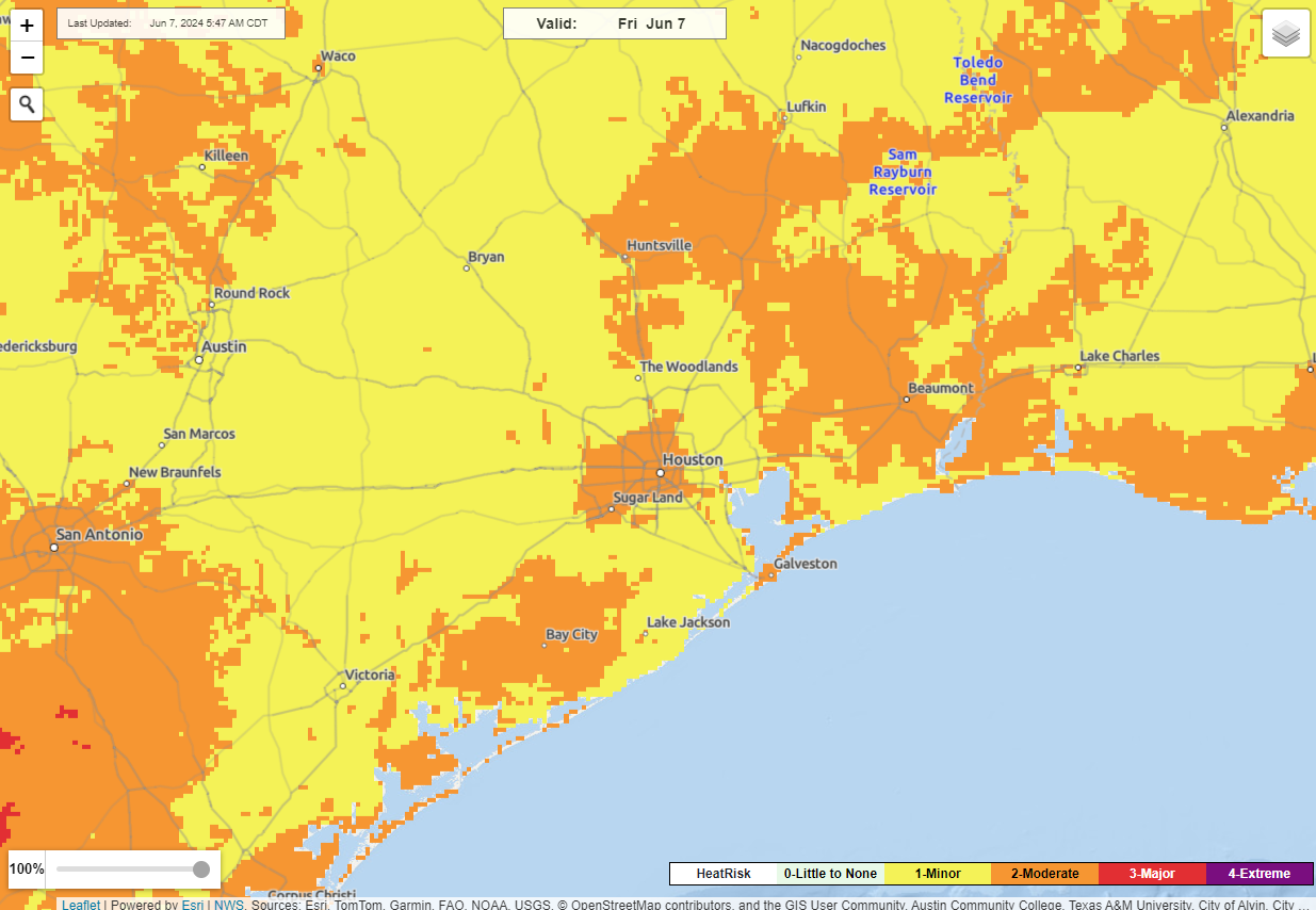
One side note: Because of so much sunshine, ozone levels will be high today, and there are air quality alerts for ozone posted. So if you struggle with that, be aware that today will be further unpleasant.
Weekend
The humidity will slowly inch back up this weekend. Look for more of our standard 70s dewpoints with daytime highs in the mid-90s. Rain chances look minimal to near zero on Saturday with ample sunshine expected. Sunday stands a slightly better chance of a brief, passing shower, more in the “it can’t be entirely ruled out” range of things. Morning lows should hold in the mid-70s, with slightly steamier morning conditions.
Monday
The forecast gets very difficult here. From a rainfall perspective, we aren’t expecting anything crazy, just a few showers or storms for now. We’ll keep watch. The tricky part comes with determining how much this cold front can punch through Houston. The GFS model really wants to send the humidity back south to Cancun, while most other model data shows perhaps a modest drop in humidity, maybe similar to what we saw yesterday and today.
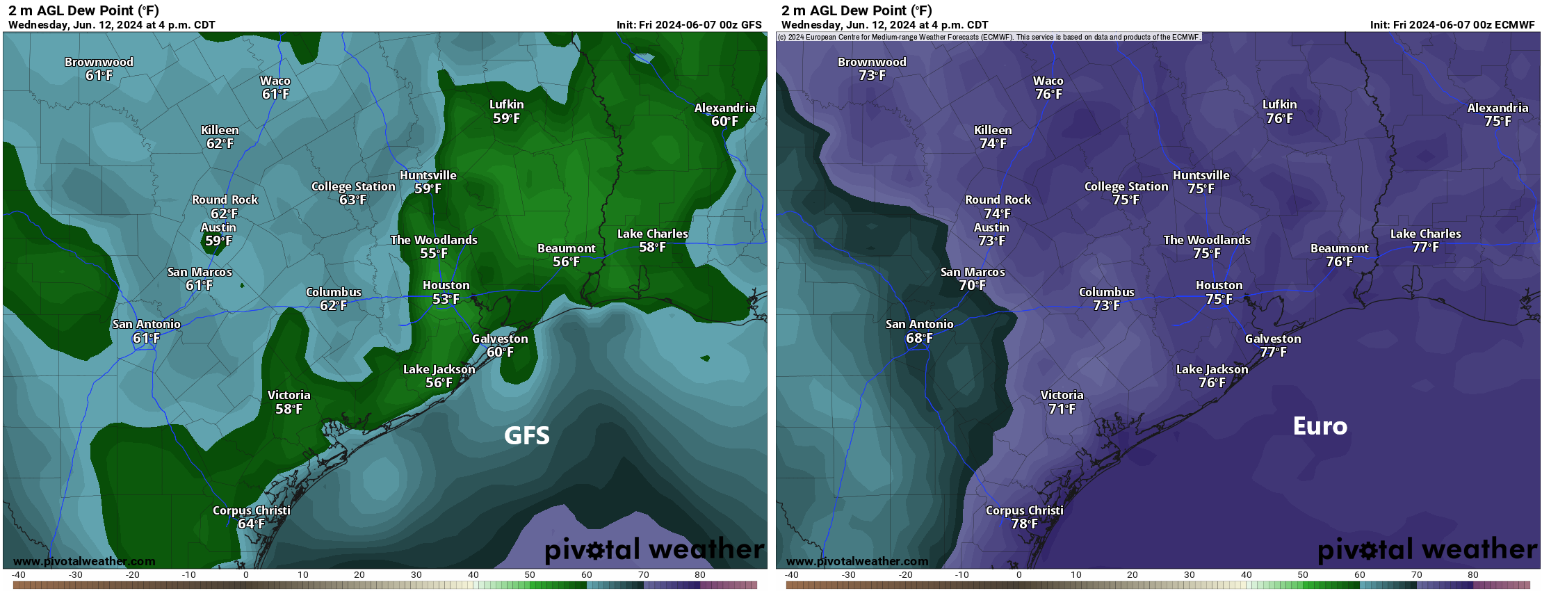
I would lean toward the latter, but there is a world in which the former could indeed come to fruition. History and climatology favors the Euro and other models in this instance. But never say never. Perhaps we’ll come back with good news later this weekend or Monday. One can hope.
Rest of next week
After Monday, the week looks to be somewhere between average and slightly unsettled. We could see a few thunderstorms as a trough settles in over us and we end up placed on the downward side of building ridge to our west and southwest. Temperatures look very benign with generally low-90s and 70s for lows, fairly average for mid-June. We should see temps reach back to the mid-90s by late week or the weekend.
Tropics
Look for a post over at The Eyewall in just a bit that will discuss the potential of a system in the Gulf in about 10 to 14 days. I am not concerned about this from a “big storm” or Houston impacts standpoint. It’s still early in the season and model support is lacking. However, there may be something that tries to get going later next week or after Father’s Day. I’ll have that for you a little later this morning.


I’m a wistful watcher. There, I admit it.
As yesterday goes to show, we can handle the heat. It is the humidity that makes it unbearable. So, any and all reduction in humidity is welcome.
Love use of “wistfully.”