In brief: In today’s update we discuss the ‘why’ behind today’s strong winds, and how cold it will get tonight. We also take a look at our sunny conditions into Saturday, when there is another chance of rain with a secondary front.
A gusty day
Houston will experience a very windy day today, with gusts this afternoon up to 40 mph or higher. This is the first time we have seen a really strong influx of colder and drier air this season, and you may be wondering why? The answer has to do with pressure systems, and particularly the circulation of air around a strong low pressure system bounded by a high pressure system.
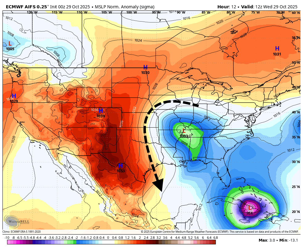
In this case the low associated with Tuesday evening’s front has continued moving eastward. We are now effectively on the “back side” of this low, with strong high pressure building behind it. Today, therefore, we are seeing strong wrap around winds behind the low, with a tight pressure gradient (note the high over west Texas). This has created a superhighway for north-northwesterly winds that will peak this afternoon before finally ebbing late tonight. That sound you hear outside is fall blowing in.
Wednesday
Besides the wind, we are going to see much cooler temperatures today. In fact our highs in the mid- to upper-60s today will be cooler than about half of our nights so far this month. Gusty winds will build this morning and peak during the afternoon hours, with gusts up to 40 or possibly 45 mph possible.
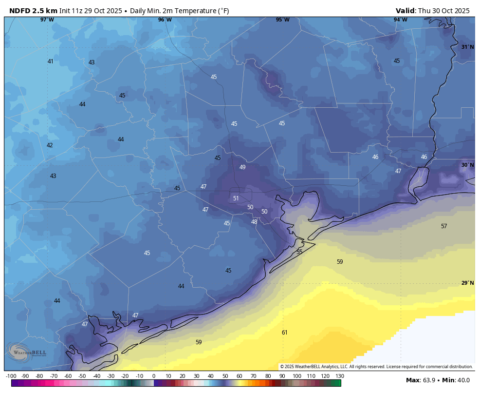
With the setting sun this evening, lows tonight will quickly cool to around 50 degrees in the most urban parts of Houston, with outlying areas dropping into the 40s. It will be our coldest night in more than six months. Winds should begin to slacken this evening, and fall back toward more normal levels by Thursday morning.
Thursday
This will be a sunny and fine day, with lighter northerly winds and highs around 70 degrees. Thursday night’s lows may be a degree or so cooler than Wednesday night with ideal radiational cooling.
Friday
Halloween weather will be anything but spooky, with highs in the mid-70s and pure sunshine. Evening temperatures will be the 60s, with light winds. Overnight lows will drop into the 50s.
Saturday
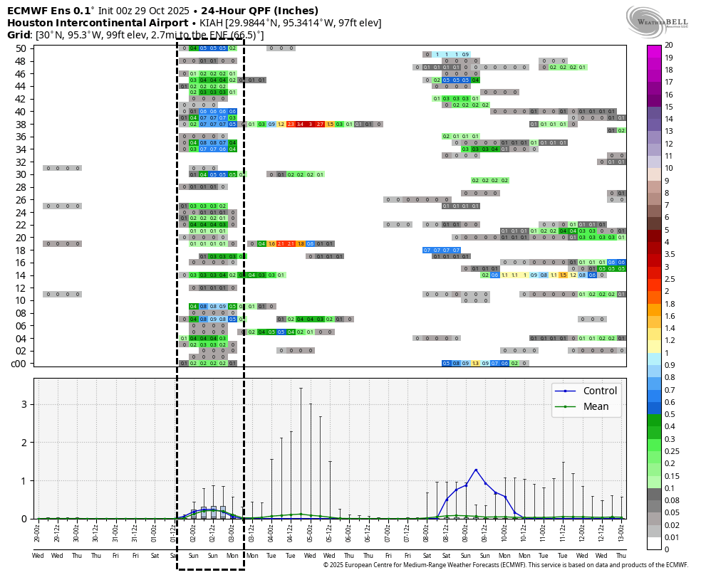
The onshore flow resumes on Friday or Friday night, and so we’ll start to see the return of some moisture. The question is how much, because a weaker front is going to advance toward the area, and if there is enough moisture it is likely to produce some showers (and possibly a few thunderstorms). Given the uncertainty, there are corresponding questions about Saturday’s weather. For now I expect highs in the 70s, with mostly clear skies through the early afternoon. However I would say there is probably a 50 percent chance of showers later in the afternoon, evening, or overnight hours, and at this point I can’t rule out a few thunderstorms. We’ll keep an eye on things. Lows on Saturday night drop into the 50s.
Sunday, Monday, and Tuesday
These look like a trio of pleasant days in the wake of that secondary front, with highs in the 70s and lows in the 50s, with moderate levels of humidity. Sunshine should reign supreme.
Later next week
Temperatures may recover some later next week, with highs around 80 and lows in the vicinity of 60 degrees. We shall see.
