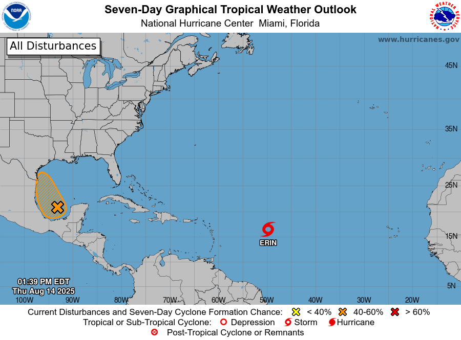
In brief: The National Hurricane Center has raised the odds of a tropical depression or storm forming in the Southern Gulf during the next day or two. This post seeks to quell any fears this may cause Texas residents. In the greater Houston area we can expect elevated rain chances on Friday and Saturday, but nothing extreme.
Invest 98L status
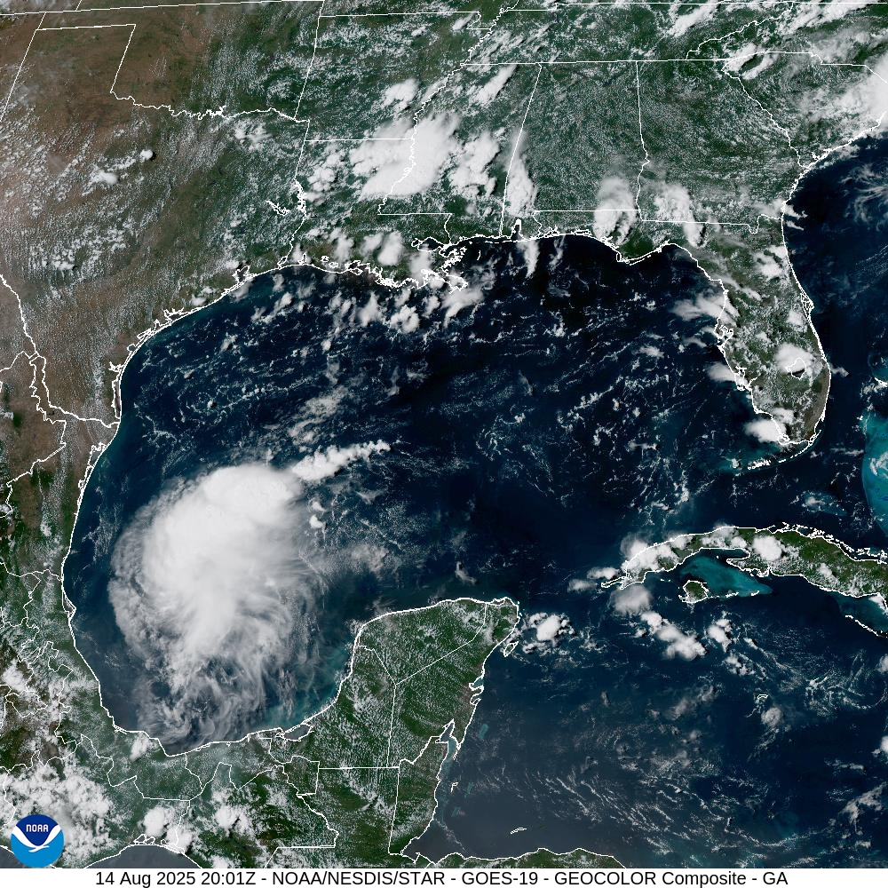
Early this afternoon the National Hurricane Center increased the likelihood that a tropical system in the extreme southern Gulf, Invest 98L, will form into a tropical depression or storm during the next two days. The odds this morning were 20 percent, and as of 1 pm CT they are now 40 percent. Accordingly the color of the “tropical blob” on the hurricane center’s site has gone from yellow to orange. This has prompted a number of questions from readers about this system, and a measure of concern.
Our most important message is that residents of the greater Houston metro area really should not be concerned.
We will get a better idea about the nature of this system later today when a Hurricane Hunter aircraft flies into it to retrieve data about wind speeds, air pressure, and more. In any case, as of early afternoon on Thursday, the system does not have a closed circulation. However the satellite appearance is improving (in the sense that it is becoming better organized) and there are increasing amounts of thunderstorms. So it is moving in the right direction toward becoming a depression.
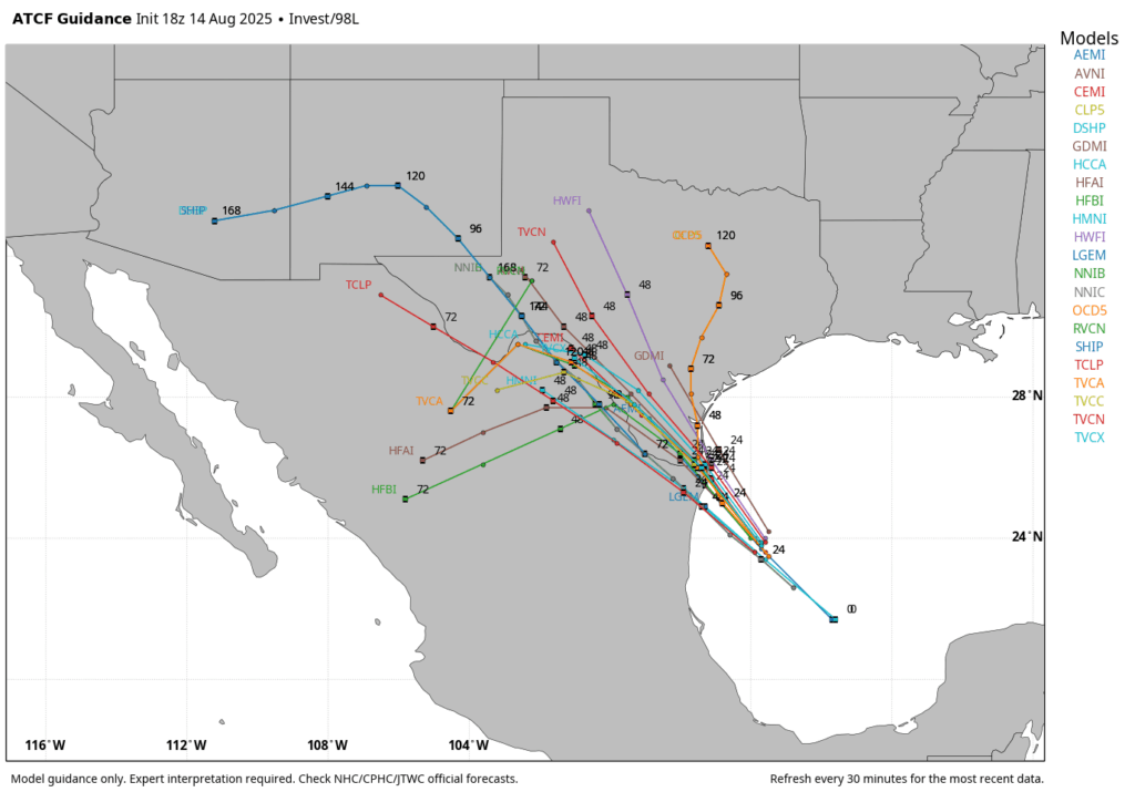
It is therefore plausible that this could become a tropical depression or a low-end tropical storm during the next 24 hours. However, by Friday afternoon or evening this should have moved inland, likely somewhere between Brownsville and Corpus Christi. Given this short window of opportunity, we think there is a pretty hard limit on how strong the storm can get.
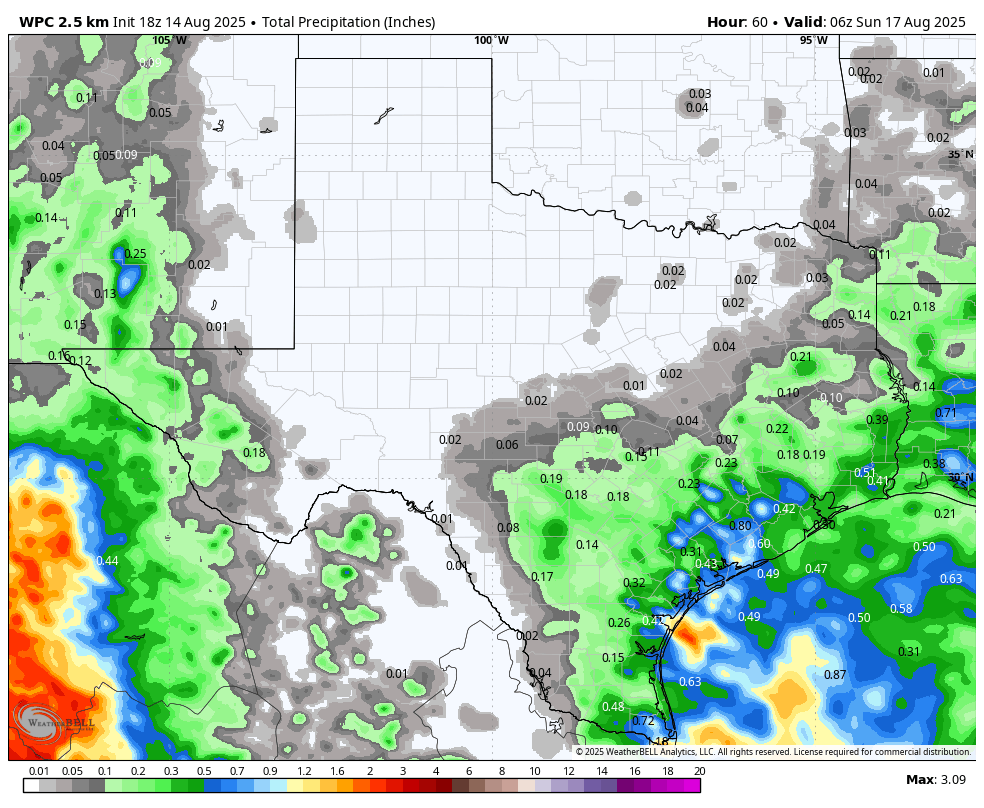
The primary impacts from Invest 98L will therefore be rainfall. And although we can never be too sure about tropical systems, in August, moving into Texas, this one appears to be largely beneficial in terms of the precipitation it will produce. For the greater Houston region this means an elevated chance of showers, some of it potentially heavy, on Friday into Saturday. Coastal regions face the highest risk, with some areas perhaps seeing a bullseye of 1 to 3 inches of rain. Still, I expect most people will receive less than 1 inch, with the majority of that probably less than 0.5 inch.
More tomorrow.
