We’re almost to fall, folks. Almost. We just have to get through today and Thursday morning before a cool front arrives.
Today
Fog, especially in rural areas, may be a problem until about 9 a.m. The National Weather Service has issued a dense fog advisory through then for most of the metro areas, so be sure and take care when driving. Otherwise, we’re in for one more summer-like day. The difference between today and Monday and Tuesday, however, is that with high pressure moving east we’re going to see more clouds (especially along the coast) and possibly some scattered showers later today. I still expect to see highs around 90 degrees.
Thursday
The big day. As moisture pools ahead of the front we should see some fairly widespread, although likely brief, showers during the middle of the day. The front itself should move into northern parts of the region by around noon, and likely will be off the coast by or before sunset. Any rain should end with the front’s passage, and breezy conditions will follow in its wake, and drier, cooler air will move in Thursday night and Friday.

Friday through Sunday
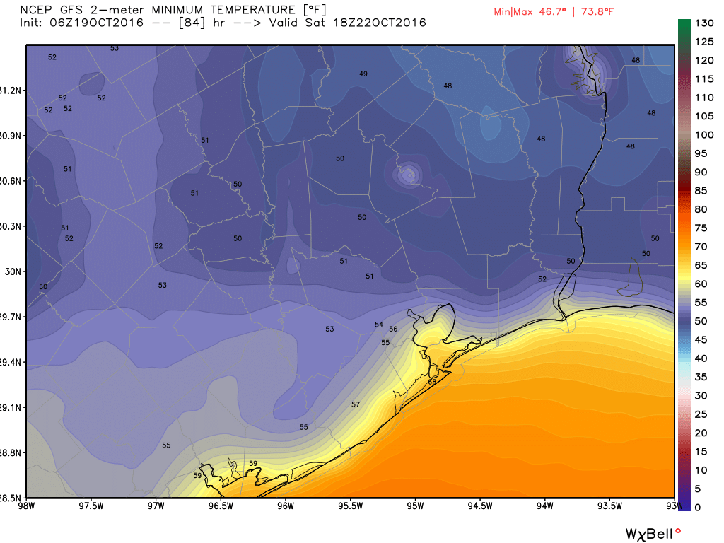
Ahh, the promised land. Highs this weekend should be in the upper 70s and low 80s, and overnight lows in the 50s (the immediate coast may remain in the 60s). Still looks like Saturday morning will be the coolest of the week. Enjoy the sunshine and dry air. We deserve it.
Next week
Higher pressures should build back over the area next week, but temperatures should still remain in the mid-80s, with overnight lows around 70 degrees. It won’t be cold, but it won’t be excessively hot for October, either. The next front will probably come through Houston right before Halloween, or so.
Posted Wednesday at 6:45am CT by Eric
Yesterday you asked, “Can I get an Amen?”
Here it is, “A-a-a-men, A-a-a- men, “A-a-men, Amen, Amen.” (You know the tune)
Gentlemen – For the 3rd consecutive day, a walk on the roof of my parking garage revealed a view of beautiful puffy white flat-bottomed clouds as far as the eye could see in every direction. What is the meteorological explanation?
Where, approximately was this? And what time?
Mid-town. Monday and Wednesday , early afternoon 1:00 or 2:00. Tuesday, late morning, 11:30-ish
Was it a “The Simpsons” sky?
is there a massive storm coming Thursday in the Pacific NW (Oregon and Washington state coasts) Will that weather give us our cool front ?