In brief: Houston should have one more round of fairly widespread thunderstorms today, especially closer to the coast before things start to ease up closer to what’s typical for June. The relatively mild weather of this week will revert back to typical early summer fare heading into next week.
Today
After yesterday’s widespread rains, we get one more crack at the free car wash today. Things are starting off quiet this morning. That should change as the morning progresses. We’ll have a couple showers pop up along the coast over the next few hours. That will evolve into more numerous downpours and thunderstorms after 10 or 11 AM. This will be especially true along the coast and just inland, so Highway 59/I-69 is kind of our demarcation line today. South and east of there, higher rain risk, north and west lower rain risk.
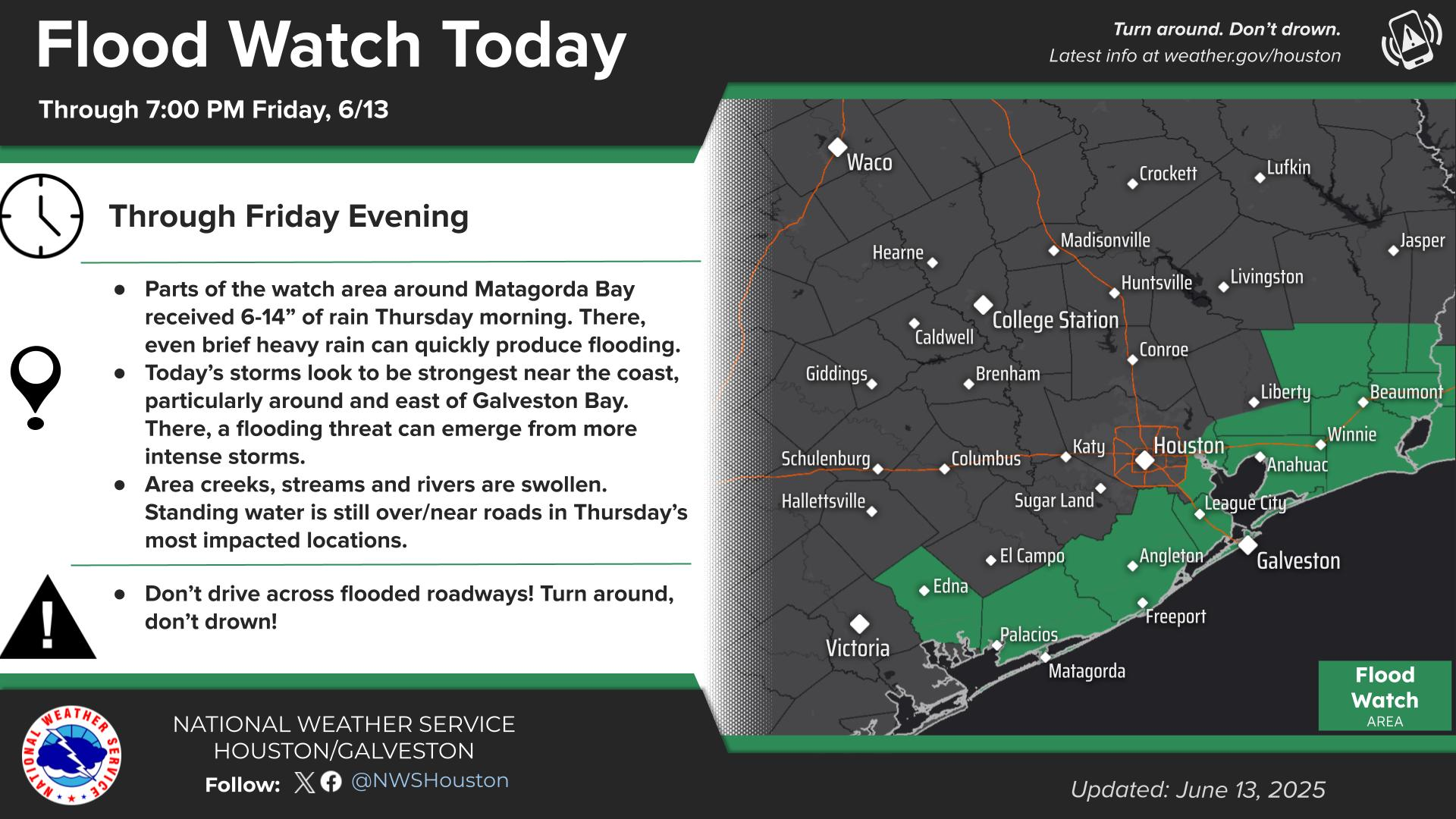
A flood watch is in effect for coastal counties between Matagorda Bay and Louisiana today. These areas will be more susceptible to the heaviest rains. We will continue the Stage 1 flood alert as well for the rest of today. The Matagorda area was hardest hit yesterday, but today I would watch closer to Galveston and on the island for some healthy street flooding risks. These storms will be capable of dumping 2 to 4 inches in an hour.
So, storms become widespread at the coast after 10 or 11 AM and some additional more scattered activity spreads inland to the northwest from there. Rains should dissipate after sunset.
Saturday & Sunday
On Saturday, the trough that sits over the Arklatex today will move into the Mississippi Valley to our east. That should reduce the overall support for widespread thunderstorms like we’ve had since midweek.
What does this mean? Well, we should revert to more typical summertime weather. I would expect to see some showers or a couple thunderstorms develop each day from late morning through afternoon along the sea breeze as it slowly migrates inland from the Gulf. Many of us will see nothing at all, but a few will receive the often-welcome cooling downpour on Saturday or Sunday. Coverage may be a smidge higher on Sunday than Saturday. But anyone planning to partake in outdoor activities will probably only have to briefly dodge a shower, if anything at all.
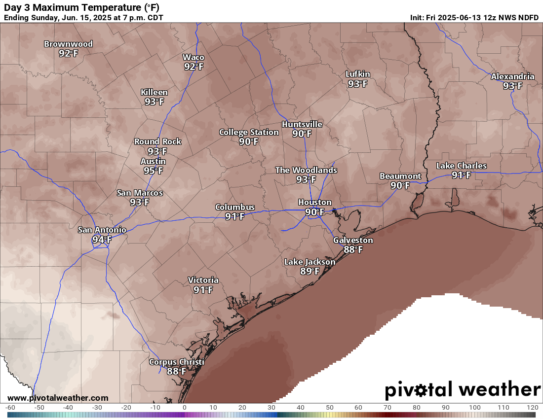
It will warm back up though. We should reach the low-90s with a couple mid-90s here or there. Morning lows will be in the upper-70s.
Next week
High pressure over the Southwest will flatten out while a new area of high pressure builds west across the Gulf Coast toward Texas. We’ll probably keep Monday much like Sunday or Saturday, but Tuesday and Wednesday could see slightly increased rain chances before we probably shut off the sprinklers for a couple days later next week. Highs will generally remain in the lower-90s, close to normal for mid-June.

Thank you for the continuous updates. What kept the bulk of the heavier rain locked outside of the metro yesterday?
The outflow boundary that the storms fired up off of remained south of Houston I believe.
Oh yeh ….that clears it up doesn’t it
Its a valid explanation, unless you wanted a tiktok version to help you out, lol
The mosquitoes are rubbing their insecty hands together with all this rain.
While I normally complain that our mosquitos need navigational and landing lights, they’ve been tiny and hyper aggressive lately is my experience. My Calves are ate up. On the bright side, lawn and peppers are loving this rain!
Looks like they forecasted wrong again. The rain has concentrated between Bay City, Rosenberg and downtown. Very very little precipitation along the coast if any.
insightful observations. I’m glad you commented to tell us this.
The radar shows a lot of rain along the coast later today so maybe you could at least wait until the day is over to call foul.
No sunset colors tonight (Woodlands) – just that creepy yellow-green bile color. Yellow skies as far as could be seen.