If you check a radar this morning you can see showers offshore in the Gulf of Mexico. These are associated with a low pressure system in the Gulf. If this were a few months later in the year we would be tracking this closely, but in April? Not so much of a concern. However, a few of these showers may migrate onshore into coastal counties today and Wednesday. We’re also tracking the as-yet uncertain possibility of storms on Saturday in association with a passing cold front.
Tuesday
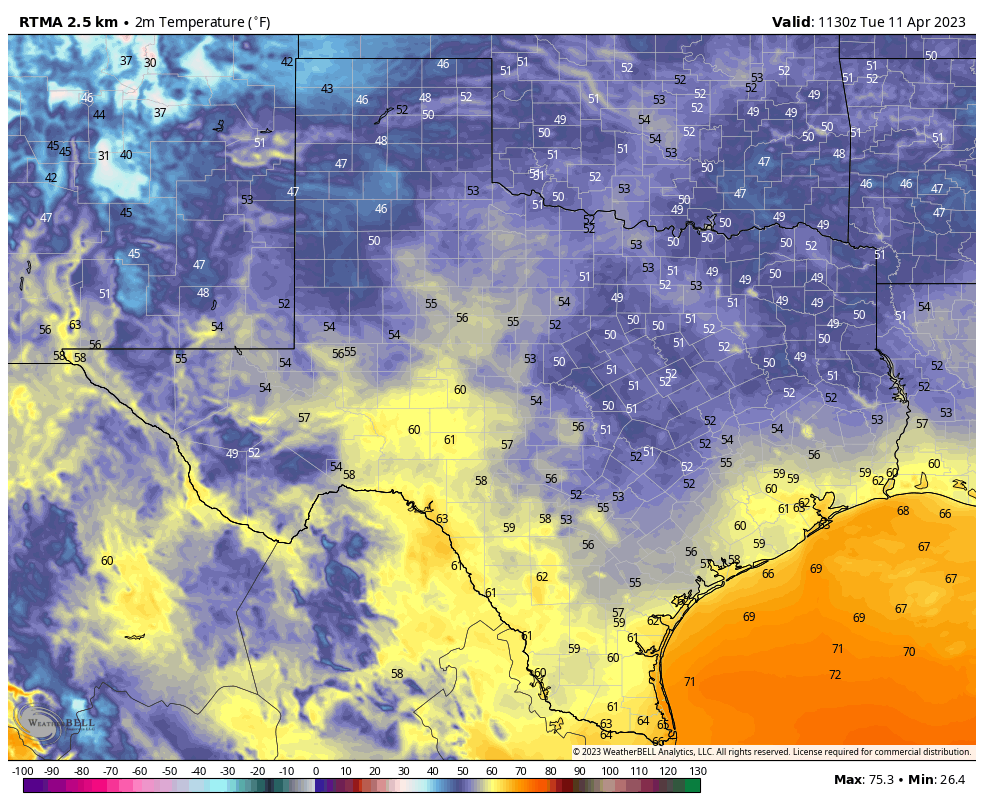
Mostly the Gulf low will send us a drier northerly flow, as our region lies on its western edge. For today, that means a mostly cloudy morning with some clearing skies later this afternoon. Highs will reach about 75 degrees, with light northerly winds. With dewpoints in the 50s, humidity levels will be reasonably low for mid-April. As mentioned above, areas near the coast may see a passing shower due to the Gulf low. Overnight low temperatures will drop into the upper 50s.
Wednesday
This day should be rather similar to Tuesday, with highs in the mid-70s, and another chance at a passing shower for coastal areas. Lows on Wednesday night will again drop into the upper 50s.
Thursday and Friday
As the low pulls away, we’ll start to see a more southerly flow. If you’ve lived in Houston for any time period at all, you’ll well know that means warmer and more humid air. Highs will reach about 80 degrees on Thursday, and into the low- to mid-80s on Friday under partly to mostly sunny skies. By Friday night lows will only drop to around 70 degrees.
Saturday
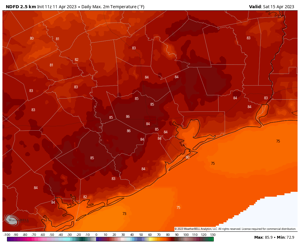
The weekend will start out warm, with partly sunny skies and highs climbing into the mid- to upper-80s for much of the area. Far inland parts of the region may not get that warm, depending on the timing of a cold front. But wait, there’s uncertainty beyond the timing. While the atmosphere looks to be rather unstable, an important factor for storms, there may not be enough shear to really get strong thunderstorms going. We probably won’t know what is going to happen for another day or two, until we get into the realm of higher resolution models. Until then, you need to at least account for the possibility of showers, thunderstorms, and possibly severe weather on Saturday afternoon and evening in Houston. It is by no means a slam dunk, but it is certainly a possibility.
Sunday
The second half of the weekend looks drier, cooler and calmer, with highs in the vicinity of 80 degrees and mostly sunny skies. Overnight lows should drop into the mid-50s, or thereabouts. So, pretty darn nice.
Next week
The cooler air will stick around for a couple of days before we start to warm up next week. There are hints in the models about more rain in the Tuesday and Wednesday time frame next week. But at this point, who knows? Not this forecaster.


This particular pattern is actually pleasant. It doesn’t have the drama of a hurricane, freeze, or heat furnace and this is a good thing.
I like my weather like I like my coffee: bland and barely noticed. Oh, wait. That’s not quite right.
Please comment when this week’s drought report is released.
Drought reports are released each Thursday. https://droughtmonitor.unl.edu/
I really need this to change!! We are having a wedding Saturday evening and the ceremony is outdoors!😬
Unlike the SciGuy I have no reputation for forecast accuracy to maintain and therefore none of the pressure that goes with his job. Must be difficult. Many of us would like a lot of rain and welcome every opportunity the rain gods provide. But if any comfort to you at all, what I see on the 4 day look ahead model run displays is a light side swipe by the passing front. A little green that comes and goes around 6P Saturday. Maybe you put up some open-side tents just in case, but given the track record of the past few years here….it looks like just another fizzle.
When I saw the words “rain gods”, I stopped reading the rest of your comment