In brief: Get ready for a wild ride in the temperature department. Houston will threaten our all-time November high temperature tomorrow before a cold front knocks 20 degrees off things for Sunday, followed by morning lows in the 30s and 40s. Don’t get too comfortable because 80s should return later next week.
Today & Saturday
The main story the next two days will be temperatures. Hot temperatures. Typical early November daytime highs are in the mid-70s. We’ll easily jump 10 to 15 degrees above that today and Saturday. Can we do our first official 90 degree November day on record? If I were in Vegas, I would take the under, but not by much. My guess is we hit 86 to 88 today and 87 to 89 tomorrow at IAH.
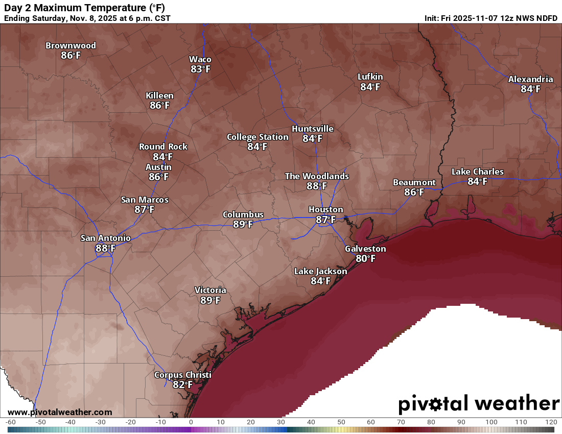
Upper air temperatures do support highs as close to 90 as we’ll ever see in November, so the chance is definitely there. Either way, it will be close to a record for the date (89 both days). Dewpoints crept back into the mid-60s on Thursday. Look for more of that today and tomorrow, with a chance for dews to get into the 70s (very humid) tomorrow night ahead of the front.
Sunday
The cold front itself should hit the Houston area between about 2 to 6 AM on Sunday, give or take. It will come with perhaps a handful of light showers, especially south and east of the city. But for the most part the only way you’ll know is by the increase in wind. Wind gusts of 25 to 30 mph, with a few 35 mph gusts as well are likely Sunday and Sunday night. This won’t be quite as windy as the front that hit us right before Halloween but you will notice it out there.
As far as temperatures go, Sunday will be interesting. We may see temps drop for a few hours on Sunday morning after sunrise before stabilizing and warming back to near 70 degrees Sunday afternoon. Either way, it will be roughly 15 to 20 degrees cooler on Sunday than it will be Saturday, so break out the pumpkin spice latte. Have some weight to stabilize your Texans tailgate canopies in the breezy conditions and perhaps a light jacket before the game against the Jags. It’ll be sunny otherwise.
Monday and Tuesday
More sun Monday and Tuesday. It appears that the coldest morning will be Tuesday, with the best combination of clear skies and light winds.
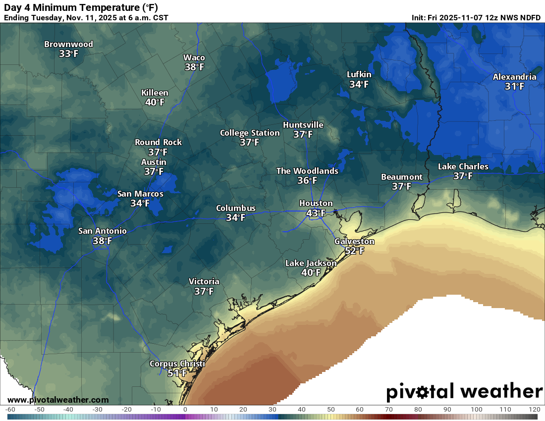
We should see numerous 40s everywhere on Monday and then 40s with many upper-30s peppered in on Tuesday morning. Tuesday’s record low of 32 degrees seems comfortably safe for Houston, but a few spots could push the freezing mark well outside of the Metro area. Highs on Monday may not even get much past 60 degrees in spots. Time to get up the Christmas lights.
Beyond Tuesday
If you thought this was it, that this was winter arriving for the season, Charlie Brown would like a word.

You are probably going to be surprised to know that high temperatures may push back into the low to mid-80s by late next week. If they don’t hate you already, I assure you that your sinuses will hate you by next weekend.
