In brief: We continue to be in an environment where showers and thunderstorms are possible, and may be numerous during the daytime. This pattern will hold through today and possibly Thursday before slightly drier weather. Later, some time next week, temperatures appear likely to soar into the mid- or upper-90s.
Wednesday
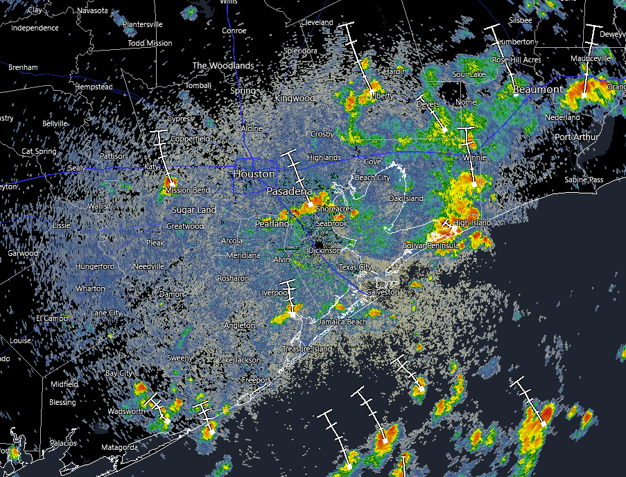
Showers and thunderstorms on Tuesday were definitely hit or miss: Some areas near Tomball and Sugar Land received in excess of 1 inch, while most of the rest of the region picked up significantly less. Then, last night, more than 1 inch fell in locations near League City. This pattern is likely to continue today, with hit or miss showers and thunderstorms across the region. Storms should be more common near the coast this morning before spreading inland later today.

Overall rain chances are probably on the order of 60 percent with everything from gully washers to light rain to simply ominous skies in your neighborhood. Flooding shouldn’t be too much of an issue, but we cannot rule out some ponding on streets. Highs today will reach the upper 80s for most locations, but areas far inland will see a little more sunshine, and may push into the lower 90s. Winds will generally be light. Lows tonight will drop into the 70s, with decreasing rain chances.
Thursday
Expect a similar day to Wednesday, albeit with perhaps slightly less coverage of showers and thunderstorms. Nevertheless the potential for moderate to strong, if briefly lived, storms will be there. Temperatures and humidity will be similar to Wednesday.
Friday and Saturday
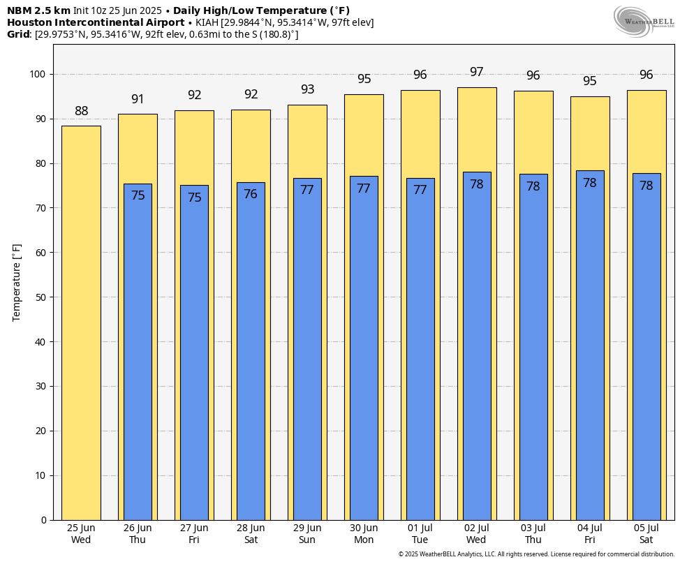
A slightly drier air mass should drop rain chances back to around one-in-three for each of these days, with decreasing intensity. As a result skies should be partly to mostly sunny, with highs in the lower 90s. For the most part, I think outdoor activities will be fine.
Sunday and Monday
These days should bring slightly better rain chances, perhaps 30 to 50 percent, but overall accumulations look modest. Expect highs in the lower 90s.

The rest of next week
A modest ridge of high pressure may build over much of Texas later next week, and by Wednesday or so we should be solidly into the mid-90s, and possibly hotter toward the end of next week. So expect July to feel very July like. Whether this ridge sticks around or breaks down to allow some rain chances to return, well, we’ll just have to see. It’s not August—yet.

I somehow slept through 2.6″ of rain last night. Then, as I backed the car out of the garage, the sky opened up and another deluge began. So I’m probably at 3″ by now.
I hate it when I sleep through a good storm. I love to watch heavy thunderstorms on my back porch.
By mid-August, the ground will probably be scorched with brown grass and 3 inch wide cracks everywhere. You will never be able to tell we had all this rain in June. I could be wrong, though, hopefully.
Always with the negative waves.
Or it could be a hurricane. Cheer up, it could always be worse; or it could be even better.
3 days with 50-70% chances of thunderstorms in a row. 3 days without a drop of rain in Jersey Village. And every time it does rain, most of it stays a mile or two away in every direction. Things are not good for going into July.
We had a surprise just before 7AM this morning in Katy. A thunderclap about knocked us out of bed! Our dog who doesn’t have storm anxiety, started barking like crazy.
Nice 👍