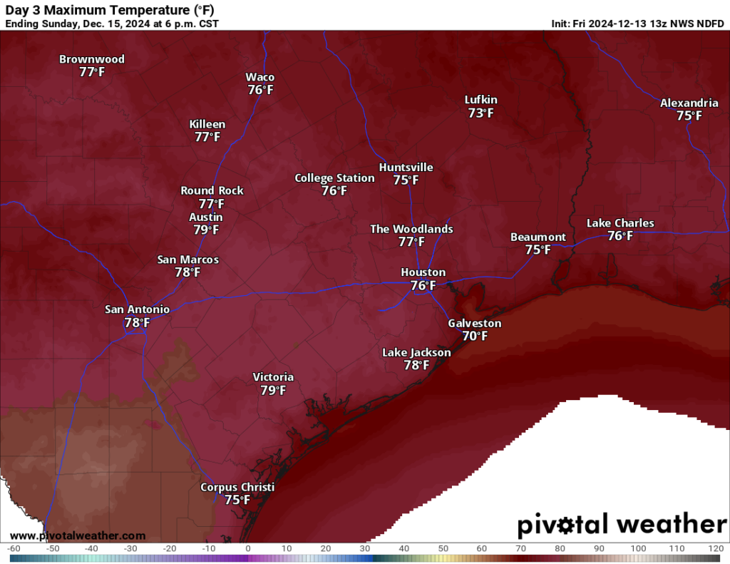
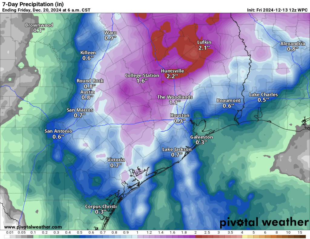
In brief: Rain chances return to Houston today, and they look to hang with us off and on through next week. While rain accumulations look mostly minor, there could be a few spots that see a couple inches of rainfall. A warming trend kicks off, with a lot of 70s and even an outside chance at 80 degrees in a few spots. Cooler weather arrives again later next week.
Today
Radar shows very, very light precipitation across the area this morning, with the exception of a few steadier showers down in Matagorda County. As the day goes on, look for more and more of this activity. Most people probably won’t see heavy rain, but a couple downpours will be around. Temperatures and humidity will do the slow climb today with cloud cover. Look for low 70s south and mid-60s north today. It’ll also be a touch breezy at times today.
Saturday
Drizzle and showers will continue tonight and into tomorrow. As we build up more warmth, humidity, and available moisture tomorrow, we could see some thunderstorms as well. It appears that’s most likely north and west of the city, closer to the front. But don’t be surprised to hear some thunder on Saturday anywhere. Temperatures will be tricky. Ahead of the front, we should see widespread 70s for highs and even a puncher’s chance at 80 degrees down toward Victoria or Bay City. But as the front nudges into parts of the area, even if it stalls out, places like College Station or Huntsville could slip back into the 60s tomorrow afternoon. Dress for spring south and maybe two seasons north.

Sunday
The cold front backs up to the north later this weekend, and this should allow for low clouds and/or patchy fog to make for a dreary-at-times Sunday. There will be drizzle and some passing showers around, but Sunday may have the best chance at some more dry periods. We’ll see highs in the 70s everywhere, with at least a few 80s possible south of I-10.
Monday through Wednesday
Like a pendulum, the front swings back toward us on Monday. This should bring back a chance of showers and thunderstorms to the area. The front may again stall, this time closer to Houston, which may actually give the metro area a better chance of showers or storms Monday than we see tomorrow. Whatever the case, the front will again retreat Tuesday before a stronger front hits the area on Wednesday.

Total rainfall has been mostly a bummer lately, and model forecasts heading into this event are also somewhat tantalizing, with the Euro for example showing north of 3 inches of rain in northwest Harris County between now and next week. So, with that in mind, I would say to expect a quarter to half inch in most spots. There will be “lollipops” of 1 to 3 inches, but if recent history is a guide they will be an exception, not the rule.
Temperatures will be in the 70s to near 80 again on Monday, though as the front approaches, we could see temporary cooler air filter in north and west of Houston. Tuesday may be a hair cooler as the air mass tries to recover some. Let’s call it low-70s for highs for now. Then on Wednesday, we’ll see a slight bump up in humidity and morning lows before the front hits.
Late next week
Thursday should see temps back into the 40s for lows and struggle into the upper-50s for highs. It’ll stay cool into the weekend with temps in the 30s and 40s for lows and 50s and 60s for highs. A warming trend may occur into Christmas, but to what degree and whether it comes with rain or chances for another front is still to be determined.

“Consider this a “high end” rainfall forecast for the area. Many places will remain in the quarter to half-inch range, but a few spots will see upwards of an inch or two if they get soaked by heavier downpours.”
Here we go again folks, model failure coming up
What is your precise prediction, oh sage of sunshowers?
Lollll!
Nowcasting. It’s more accurate 😉
Nowcasting – bing-go!!
Been in the surrounding Houston area for quite a long time (Magnolia now).
We simply wake up, trudge around until we’re somewhat cognizant, then step outside to “check the weather”, then plan the day accordingly.
Perhaps a fine spring day for Christmas. My plants are confused and so am I. Alas that is the Houston experience. It’s a roll of the dice each time. Enjoy what you have and remember what you had, happy holidays to all.
Yeah, I was fixing some Christmas lights on the house the other day and I have a rose budding lol
There forcasting 0.70 inches for my area so that means that I may get a trace
I’m glad to see more comments re the DRY. Even Matt says “rainfall has been mostly a bummer lately”…..and no comments about rain spoiling outdoor party plans…. I don’t know if this be climate change or a weather cycle but it bears watching and deeper ideas on the mechanism. We’re not set up well for the next 7 month hot…wells can run dry, the flora turns to TX prairie. Maybe that’s native but who doesn’t love a profusion of ginger and palms.
Any idea on the drones in the northeast ??