In brief: We expect some showers and thunderstorms on Saturday in Houston, a couple of which could be on the stronger side. Outside of that, we have nice weather to close the weekend, and another warming trend in store next week.
Got Valentine’s (or anti-Valentine’s) Day plans on Saturday? Be sure to include an umbrella as part of your fancy attire. We’ve got the details on some storms this weekend.
Today
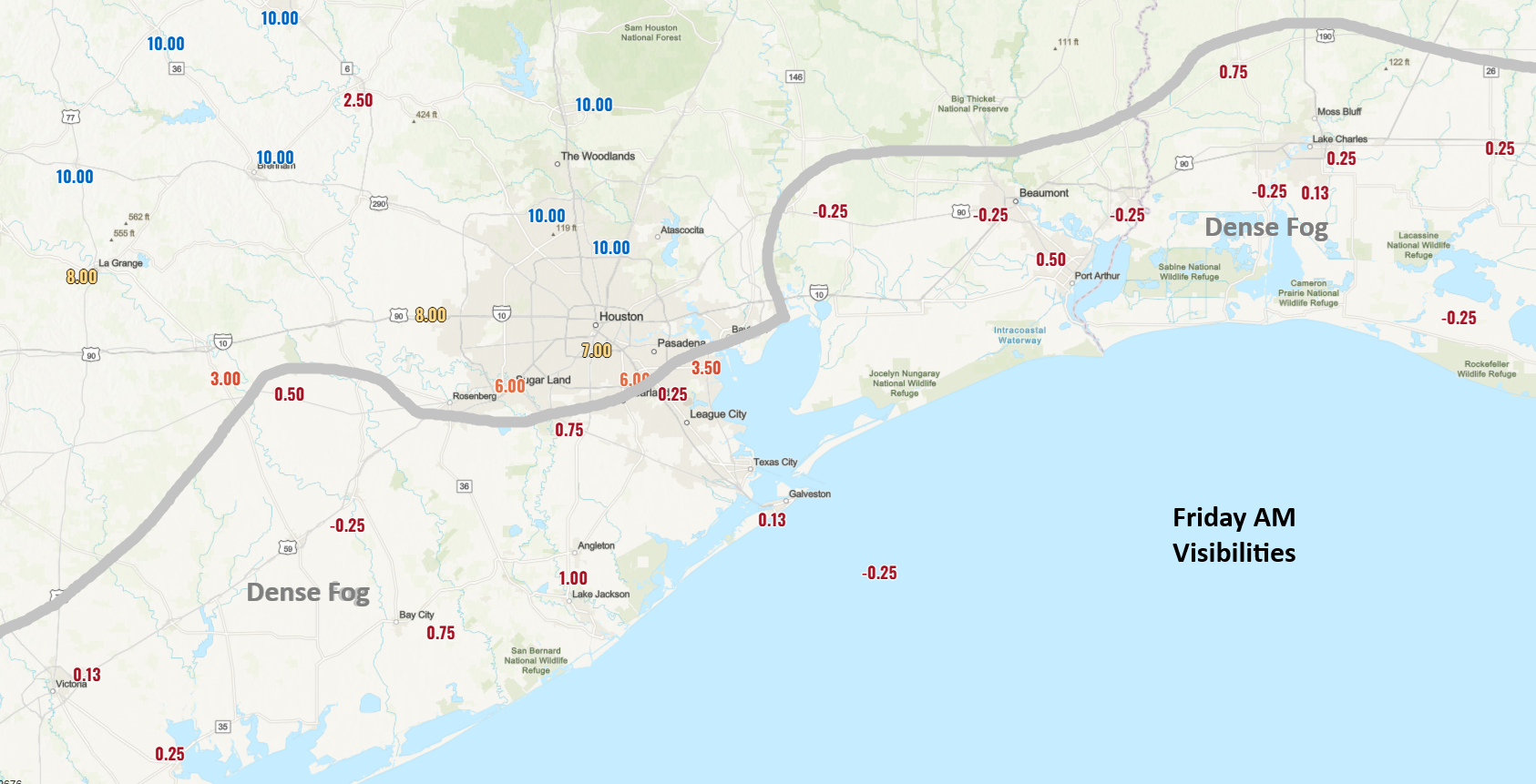
Keep your eyes open for fog this morning. It’s a prevalent pest across the southeast half of the area, and it’s locally dense in spots. It will slowly lift through morning, but fog may cling to Galveston Island or around the bay for much of Friday. Otherwise, it’ll be warm and humid today with highs in the 70s to near 80 inland and cooler at the coast.
Saturday
Through midday Saturday, all looks well. A few sprinkles or showers, as well as some continued fog is a possibility but otherwise it’ll be fine. Round one of showers or a few thunderstorms may arrive around mid to late afternoon. None of these are expected to be significant. It’s the second round that arrives in the evening, probably between 6 and 10 PM or so that may have some noisy, stronger storms.
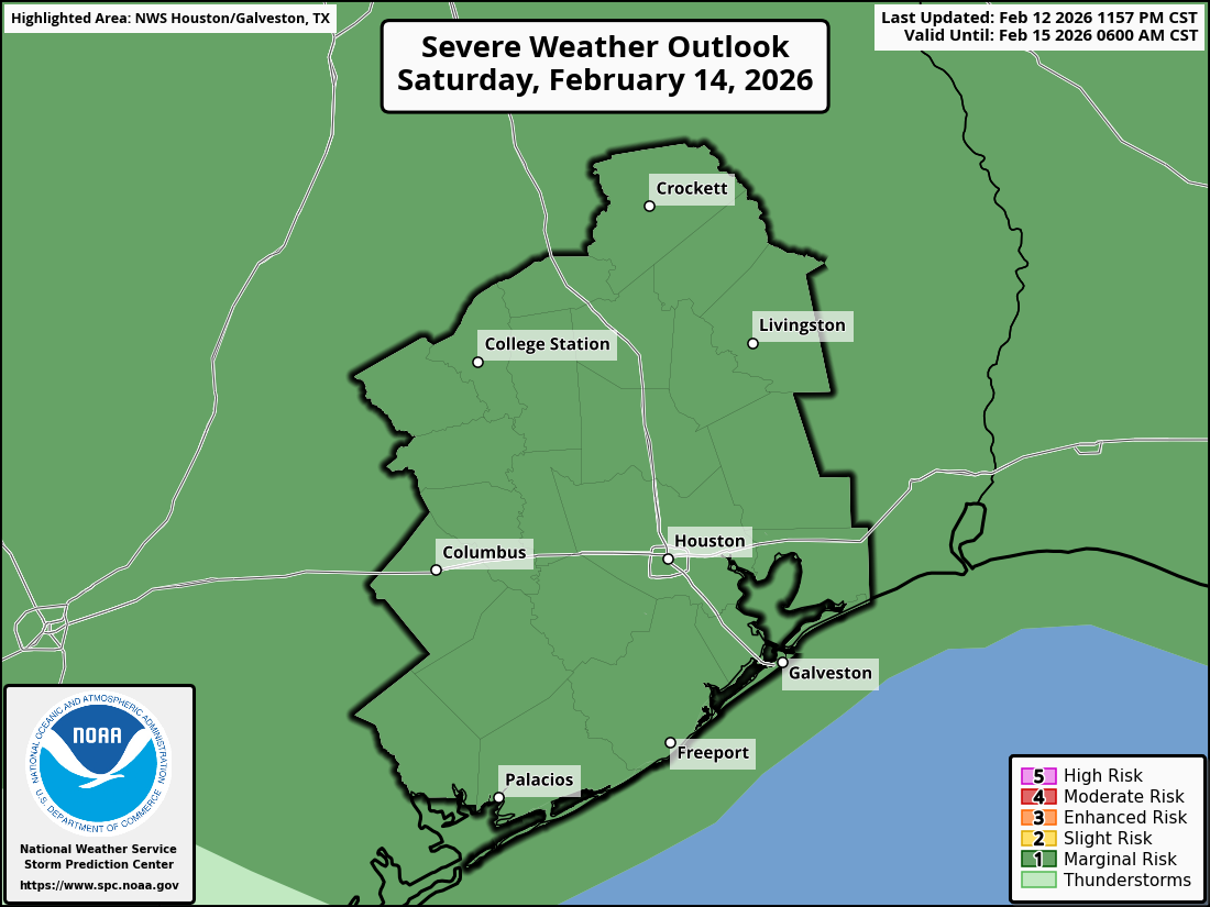
The entire region is carpeted in a marginal risk, level 1/5, for severe weather tomorrow, which generally means lower-end coverage of severe storms. Many locations will hear thunder, but only one or two may see a severe storm with gusty winds. Storms should exit the coast around or before midnight, ending any severe threat, The chance of a severe storm may be highest north of I-10 tomorrow.
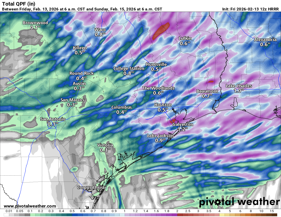
In addition, some locally heavy rain is likely tomorrow, with a few spots perhaps seeing 2 inches of rain, while others see a quarter inch. Basically, have an umbrella, and if you hear thunder, retreat to a safe indoor location.
Otherwise, look for clouds, some sun, and some fog with highs in the 70s.
Sunday & Washington’s Birthday
We should clear out and have a picture-perfect Sunday and Presidents’ Day Monday. Sunday looks glorious with sunshine and highs in the low-70s, although a bit on the breezy side at times with north winds gusting to 20 to 25 mph or so. Monday morning will start in the 40s and 50s, warming into the 70s again with pleasant humidity and sunshine.
Rest of next week
To be honest, next week looks a bit like this week, with temps warming up again into the 80s probably, along with slowly building humidity. We will probably see our next front sometime near next weekend or just beyond. Timing is suspect right now. That next front could have a tinge more punch of cooler air behind it, but nothing like a freeze or anything.
