As expected with warmer daytime temperatures some isolated, but fairly strong thunderstorms have popped up over the Houston area. The National Weather Service has issued a street flooding advisory for one area just to the southeast of downtown Houston. Fortunately, so far these storms have not moved over areas hard particularly hit by rains Sunday night and Monday morning.
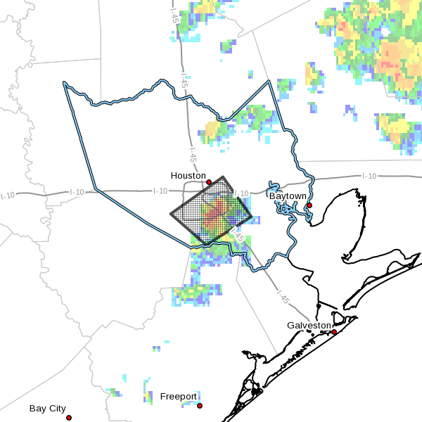
We will probably continue to see these slow-moving pop-up thunderstorms for the rest of the afternoon and evening across parts of the Houston metro area, although I do not expect any organized activity. Nevertheless, if you’re underneath one they have the quick potential to drop an inch or two of rain pretty quickly. I’d expect the threat of these showers to end later this evening.
The next concern is the possibility of a more organized line of storms moving into the metro area sometime Wednesday morning or around noon. As I mentioned earlier today, there’s still a fair amount of uncertainty with this system, but it’s worth monitoring. I’ll post more tonight about the likelihood of this threat when (hopefully) the odds of it occurring become more clear.
Posted at 2:35pm CT Tuesday
I’m in the box right now at work, right next to the ugly red/orange looking thingy that’s just inside 610, but it’s just drizzling here.