In brief: Today should be dry and hot in Houston, but the isolated to scattered shower chances will (sort of) return this weekend. Temps will remain pretty hot with low to mid-90s being the standard for a while longer.
Look, if we’re really being honest, I don’t have much to add to what Eric’s forecast yesterday summed up in gifs. The only thing that kind of changed was the rain! Several spots picked up a quarter to even a half-inch or slightly more of rain yesterday from passing showers.
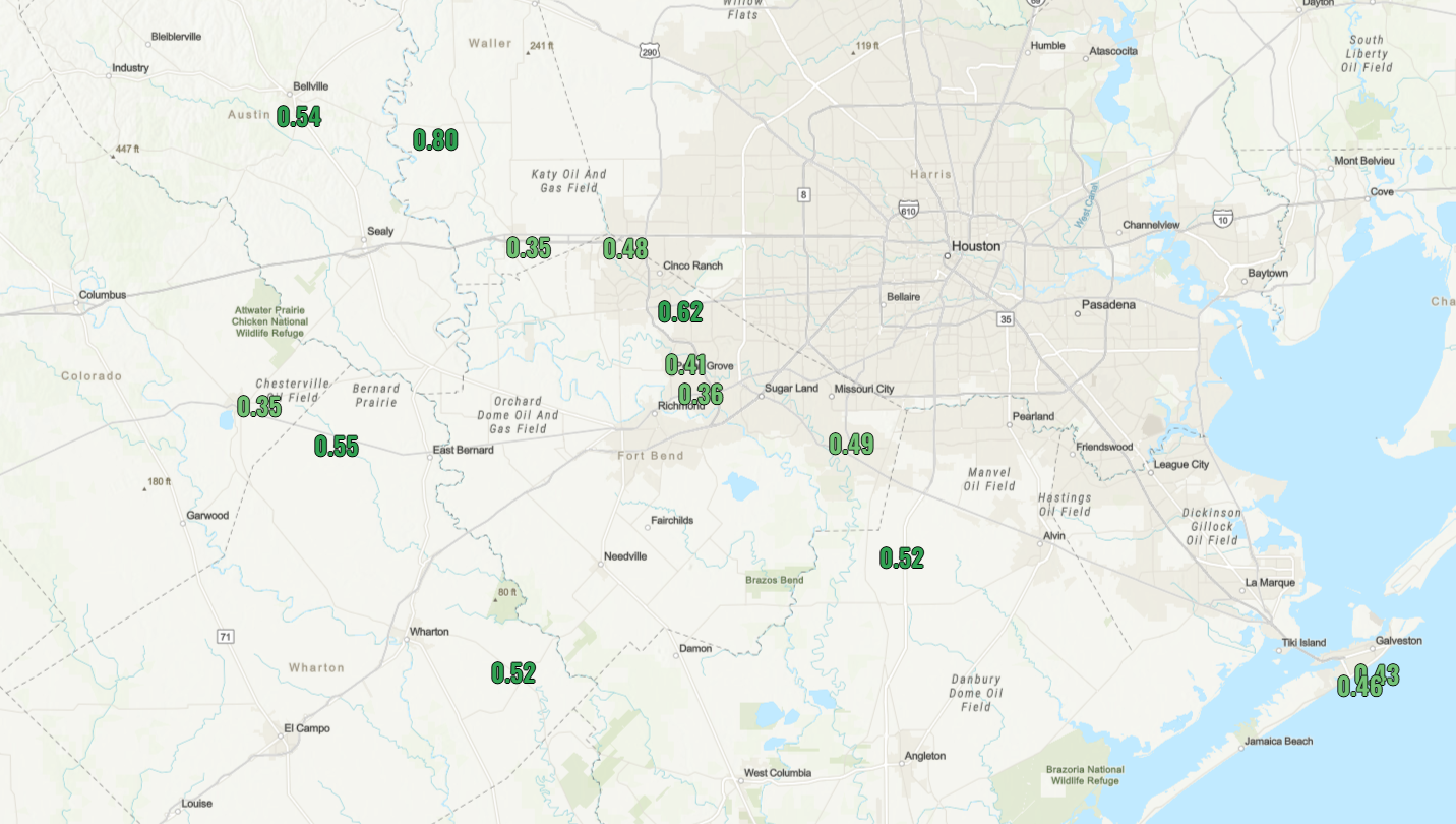
Unauthorized showers, but not bad at all.
Today through Monday
In terms of rain chances, today looks minimal to near zero. Tomorrow looks quite isolated. Sunday and Monday should see at least a smattering of afternoon showers in typical late summer fashion here in Houston. Most of us will probably see little to no rain, but like Thursday, a few locations could pick up a quarter to half-inch from a heavier downpour.
Temperatures? Well, we are truly in “Second Summer” now. It’ll be hot, today especially. I wouldn’t be shocked to see upper-90s in a few locations this afternoon. Temps will then back down into the low to mid-90s Saturday through Monday. Morning lows won’t be as nice as earlier this week, with mid to upper 70s.
Rest of next week
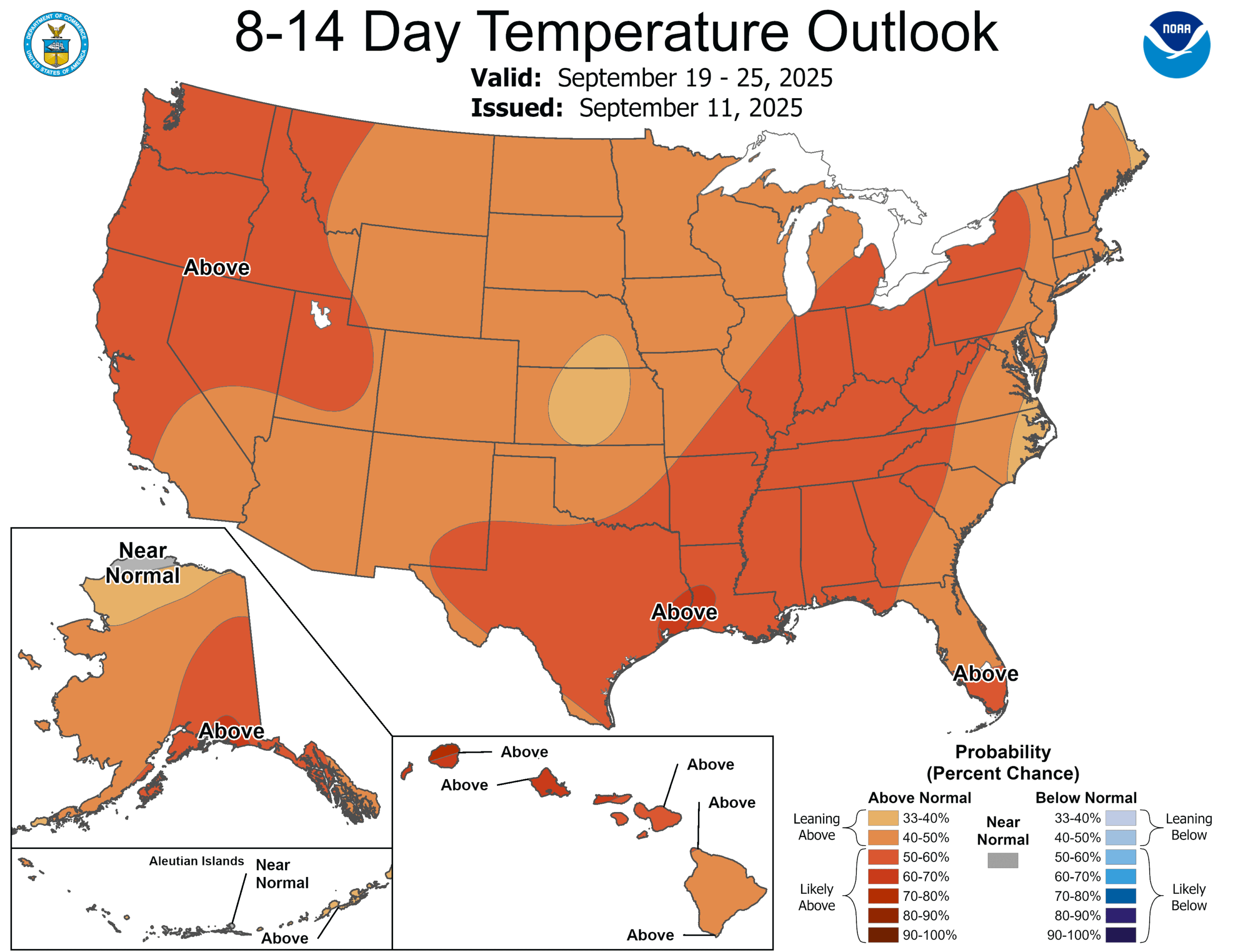
It may get hotter yet next week, with temperatures starting through Tuesday or Wednesday in the low to mid-90s. We could do mid to even isolated upper-90s by late week or next weekend, possibly. It looks like this week was, indeed, fake fall. The 8-to-14-day outlook from NOAA’s Climate Prediction Center shows the highest odds of above normal temperatures in the Lower 48 right over Southeast Texas.
Every now and then, we can count on a decent end to September temperature-wise. I’m not sure this is the year. But, hey, at least we had this week and a mostly tolerable summer!
