In brief: I hope everyone is enjoying the weekend. Just a quick post this morning to update our thinking on the potential for storms later today, and what this all means for our weather on Easter Sunday.
Saturday and Saturday night
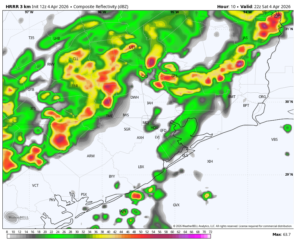
The Houston area radar should remain largely quiet this morning, but off to our northwest I expect an area of showers and thunderstorms to begin developing in the Brazos Valley. We may see a few scattered showers and thunderstorms in the Houston metro area this afternoon, but I suspect that this larger mass (or possibly line) of storms will not start moving into our region until 4 to 6 pm. The bulk of the storms will then move through between that time and around midnight, or shortly before.
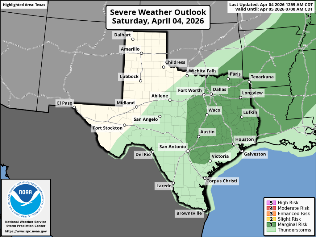
What to expect? There is definitely the potential for some briefly strong thunderstorms, although the overall threat level for damaging winds and hail is not particularly high. I’m not ruling anything out, but I don’t anticipate that most of us will see those conditions. Heavy rain is also possible, but again I expect this to be fairly sporadic rather than widespread. However, if you are out and about this evening in a spot that does get hit, know that we could see some briefly backed up streets.
In terms of accumulations I expect widely varying totals. Some parts of Houston may get 2 inches, and other parts 2 tenths of an inch of rain between now and midnight. The signal for heavy rain is slightly stronger for areas north of I-10, but really anywhere is at risk. I’m hopeful that most of our area gets some much needed rain, but know that parts of Houston and surrounding counties will probably be disappointed.
Easter Sunday
The front will slog its way down to the coast during the overnight hours, and low temperatures should be in the upper 50s for most locations by sunrise on Sunday. Skies will be mostly cloudy and remain so throughout the holiday. If you see a speck of sunshine, count yourselves lucky. (So yes to bunny; no to sunny.) With some lingering moisture higher in the atmosphere, I expect that coastal areas (i.e. south of Interstate 10) could see some additional rain on Sunday. For the most part these rains should be light. Highs on Sunday will likely reach the mid-60s, or perhaps a touch higher. With lows on Sunday night dropping into the upper 50s, Monday night looks to be our coldest night of the week.
I hope everyone has an egg-cellent holiday and we’ll be back on Monday morning with our usual in-depth update.