In brief: The first of several cold fronts will arrive in Houston today, bringing with it a decent chance of rain and possibly a few storms. We’ll warm back up on Saturday before another, stronger front knocks most of Houston into the 30s by Monday of next week.
Wednesday
After an abnormally warm start to the month, Houston will see the first substantial frontal passage of February later today. We can expect a (probably broken) line of showers and thunderstorms to move through the area this morning before noon, from west to east, before drier air moves in from the northwest this afternoon. I don’t expect anything too wild and crazy from the rain showers, but it’s Houston so be prepared for the possibility of some thunderstorms and briefly heavy rainfall. Highs today will crest at about 70 degrees this morning before dropping into the 60s this afternoon, and the 50s this evening.
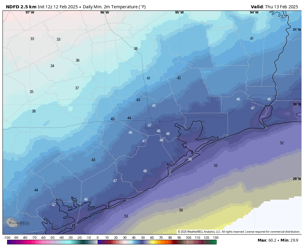
Thursday
Lows on Thursday morning will be in the low 40s, and with a chilly northerly flow expect high temperatures to only climb into the mid-50s. We will see mostly sunny skies, however. Lows on Thursday night will drop into the 40s as winds turn more easterly.
Friday
Skies will be partly sunny on Friday, with highs likely climbing into the mid-60s. As atmospheric moisture levels rise we could see a few scattered showers develop later in the day. Friday night looks to be mild, with lows only dropping into the upper 50s or lower 60s.
Saturday
Humidity levels will spike on Saturday, with high temperatures likely pushing toward 80 degrees as we see a surge of warmer air ahead of the next cool front. Although the timing is still a bit uncertain, this front likely moves through on Saturday afternoon or evening, and it should bring a chance of showers and thunderstorms with it. We’ll see about the dynamics for storms, but right now they don’t appear to be overly favorable in the Houston metro area. Lows on Saturday night are likely to plunge in the wake of the front, dropping to about 40 degrees.
Sunday
Expect clear, sunny, and cold conditions with high temperatures of around 50 degrees. Lows on Sunday night will drop into the 30s for much of Houston, and we cannot rule out a light freeze for some inland areas.
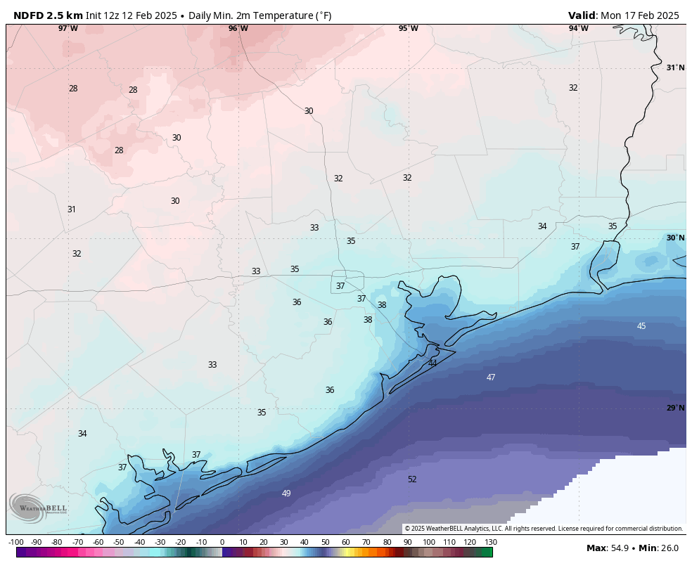
Next week
We’ll be chilly on Monday and Monday night before a warmup next week, followed by what appears to be another fairly strong cold front on Tuesday or Wednesday. This will, once again, bring the chance of a light freeze to Houston by Thursday morning or so. Winter is not over yet.

Ok guys, who’s also going to go with Darwin here on the potted plants this time?
I made the call to leave several outside on the carport last month. I covered them and trained two heat lamps on them and lost a few but the bulk survived, so that might be worth a shot for the ones you can’t bring in again but don’t want to freeze.
Lol we usually never start our vegetable garden until like mid March because there is always that chance for a late season cold snap.
probably throwing them all back in the garage for me.
Very refreshing this morning in the rain-cooled air, and nice driving in without a fog-prolonged darkness.
Quoting: “Highs today will crest at about 70 degrees this morning before dropping into the 60s this afternoon, and the 50s this evening”.
It’s currently 54 degrees up Magnolia way, and raining. I see it’s 50 degrees up in Montgomery, so the temp around here will be dropping soon.