In brief: Houston’s best chance of rain for awhile comes this weekend, particularly on Saturday. But for our driest areas north and west of the city, there’s likely to be little or no relief. We’ll have better luck with a cool front that arrives on Tuesday to usher in some wonderfully drier air for most of next week.
Thursday
If you’ve been paying attention to the weather this week, then you have a good sense of what to expect today: plenty of sunshine and high temperatures in the low 90s. Winds will be light, from the north and east, at perhaps 5 to 10 mph. With dewpoints in the 60s, the air will still feel somewhat humid, but it won’t be super sticky as is customary during summertime in Houston. Lows tonight will, generally, drop into the low- to mid-70s.
Friday
We’ll start to see a few clouds on Friday, and humidity levels will rise a bit. High temperatures will range from around 90 degrees to the low 90s. Winds will be a little more pronounced, from the east at perhaps 10 to 15 mph, with higher gusts. Lows fall into the lower 70s. For inland areas rain chances are near zero, but for coastal areas there is a chance of showers during the afternoon and evening hours.
Saturday
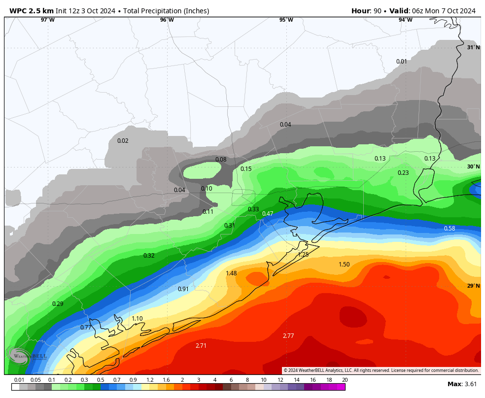
An upper-level low pressure system will bring a healthy chance of rain to coastal areas on Saturday—emphasis on coastal. If you live north of Interstate 10, you’re probably out of luck. Even areas like Pearland and Clear Lake might be on the edge of seeing meaningful rainfall. But for areas right along the coast, including Galveston, there is the potential for 1 or more inches of rainfall on Saturday. Away from the coast, highs will be in the vicinity of 90 degrees, with a mix of sunshine and clouds. Overnight lows will likely drop into the mid-70s.
Sunday
We’ll see fewer clouds on Sunday, and as a result lower rain chances, even for coastal areas. But we still may see a few showers. High temperatures will probably slot into the low 90s for most of the region. Lows on Sunday night will drop into the mid-70s.
Next week
Monday will bring more of the same sunny, and hot weather, with highs in the low 90s. However by Tuesday morning, give or take, we should see drier air starting to move into the Houston area as part of the tail end of a fairly robust cold front in the Midwestern United States. It’s still too early to say precisely what our temperatures will be, but I expect most of us will see something in the neighborhood of highs in the upper 80s and lows in the lower 60s. With the drier air, humidity will be noticeably lower. Hopefully, at least moderately drier air will persist into the weekend.
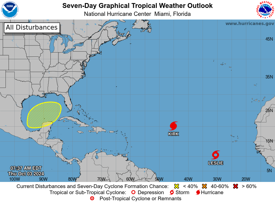
Tropics
For Texas, there’s nothing to see here. For a deeper view, including a rampaging Kirk and newly formed Leslie, check out The Eyewall.

Congrats to Eric! I saw a review of his new book “Reentry” about SpaceX and the development of the Falcon9 rocket in last week’s Economist!
How can you not have flood insurance. If you’re near lakes, rivers, watershed you need it. Anyplace water can flow down to you, if it can fill up somewhere else. Imagine the Houston urban core if the Barker, Addicks levees broke during Harvey. More participants mean lower rates. The rain frequency is low here but when it does rain it tends to come in buckets. If it’s too expensive for you, insurers are trying to tell you something.
That’s amazingly shortsighted. Way to grind salt into people’s wounds.
IF flood insurance is available, it IS frequently too expensive, esp when piled on top of everything else. Insurance companies are there for profit, not for people.
Be sure to live above the 100 year flood plain. It helps.
That being said, basic homeowners’ insurance (if you can get it) and the recent round of property tax increases is likely going to start driving people out of Harris County, at least those who can afford to move. I’ll probably be in that number.
Insurance for anything is a necessary evil. Insurance companies are businesses not charities and as horribly greedy as they are, there really is no alternative but to pay up. Although, from unfortunate experience, it is clear that a large number of motorists in Houston do not bother with insurance – for which there appears to be no repercussions on them.
Barker and Addicks are dams, not levees and the corps of idiots released flood water to safeguard houses upstream of the bayou which had been built on the flood plain behind the dams which resulted in the flooding of many neighborhoods downstream. Law suits against the corps for doing this are ongoing.
Is it ever going to be fall again?
We need the rain, been at long stretch since measurable rain here in Hwy 6/Westpark area.
I had over 3″ last week.
My irrigation system is coming on every four days now. With the low humidity, plants/shrubs are drying out faster.
Agreed, I water my lawn for a half hour and it’s barely noticeably different. Just trying to save it so I don’t need to re-sod at the end of the season.