In brief: The greater Houston region faces one more very warm day before drier and moderately cooler air arrives tonight and on Tuesday. And then, the forecast remains one of persistence with sunny, warm days, cooler nights, and for Houston, pleasantly dry air for as far as the eye can see.
No rain
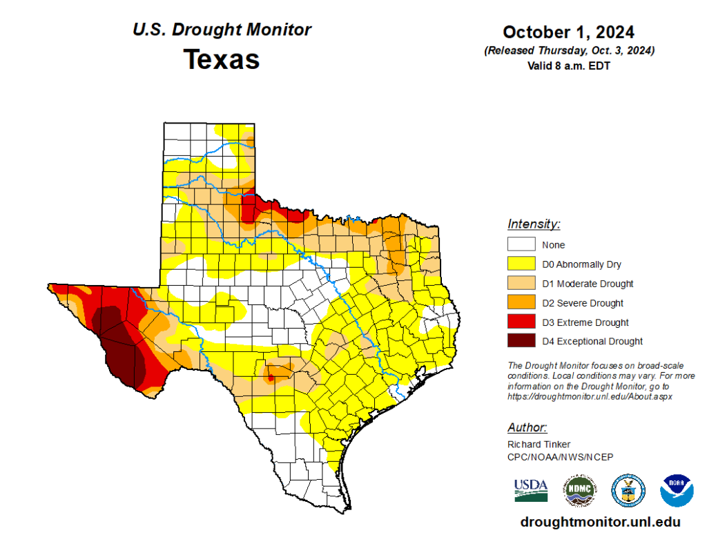
Our average high temperature so far this month has run above 93 degrees, which may be normal for late August, but is decidedly not for early October. This late summer pattern definitely needs to break. Fortunately, we’ll see some cooler and drier air to help with that in the coming days, but what we’re not going to see much of is rainfall.
As expected, showers this past weekend remained mostly offshore. Our next chance of rain, meager though it may be, does not come for another 10 days or so. Even clouds will be scarce this week, and into the weekend, as somewhat drier air prevails for awhile. In other words, expect sunny days and mostly clear nights for the foreseeable future.

Monday
We’re going to see one more day of temperatures in the low 90s across the metro area today, ahead of the arrival of a front that pushes in from the northeast. This will be what is sometimes called a “backdoor” front as the main thrust of the colder and drier air goes to our east, but a finger or whirl of cooler and drier air is spun out, and southward into Houston. Already, dewpoints will be in the 60s today, so while the air will feel warm, it also won’t feel Houston humid. Winds today will be fairly light, from the northeast. Low temperatures tonight will drop down to around 70 degrees.
Tuesday
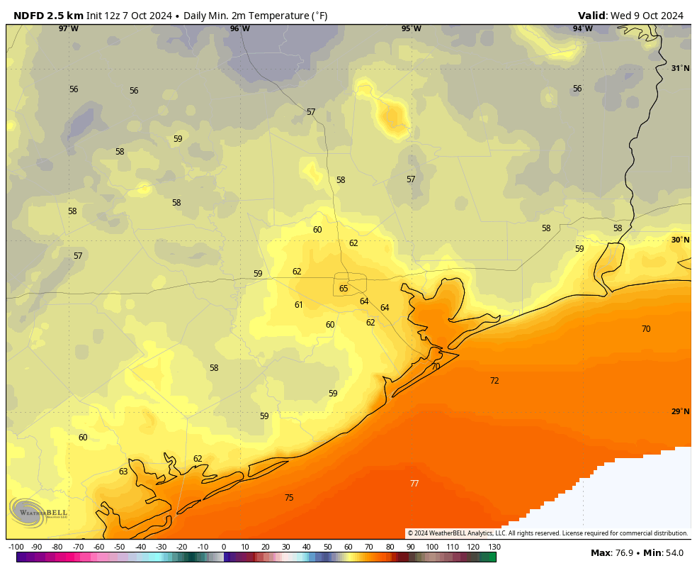
Even drier air will arrive on Tuesday morning, pushing dewpoints down further. As you probably now, drier air heats up more efficiently than humid air, so because this is not a strong push of colder air from the north we’ll still see warm days this week. Especially with the sunshine. As a result, Tuesday will see highs in the upper 80s, with overnight lows dropping into the lower 60s for much of the city away from the coast. Areas further inland will see the upper 50s on Wednesday morning.

Wednesday through Friday
More of the same. We’ll see sunny and warm days, in the upper 80s. Nights will be pleasant, in the low- to mid-60s in Houston, with cooler conditions outside of the city. With lower dewpoints the air won’t feel particularly humid. For early October, this is pretty nice weather.
Saturday and Sunday
The outlook for the weekend really doesn’t change much: sunny skies with highs in the upper 80s to possibly 90 degrees, with cool-ish nights in the mid-60s. If you have outdoor plans for this coming weekend, proceed with confidence in the weather.
Next week
Sunny skies with highs around 90 degrees will probably continue into the middle of next week, when perhaps a bit stronger front arrives. The details on this one are fuzzy, naturally, but it has the potential to drive nighttime temperatures in the 50s and, if we’re lucky, bring some rain chances with it. We shall see.

Tropics
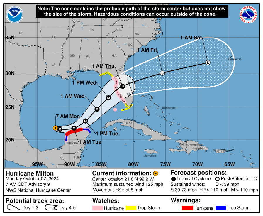
There remain zero concerns to Texas. We are now firmly in the offseason for hurricane activity. However Milton became a major hurricane this morning in the southern Gulf of Mexico, and it poses a very significant threat to Florida on Wednesday and Thursday of this week. The Tampa Bay region of the state has not been directly hit by a major hurricane in more than a century, but that could well change this week. We have continuing coverage on The Eyewall.

Wonder when we will get 50s weather, but for now some rain would be nice, sad that’s almost completely out of the question this week.
Unless a sharp trough of low pressure dips into Texas later this month, we may experience another October like 2010 when most of us didn’t see a drop of rain all month. Even though we are not fully in La Nina yet, we are already experiencing a typical La Nina pattern. These upper high pressure ridges tend to arch right over Texas preventing the jet stream from being able to dive into the state during La Nina falls/winters. That is why I firmly believe we are going to be staying warm and dry for the foreseeable future. We will have cold spells and rainy days but the trend will definitely be above average temperatures and sparse rainfall for the next 6 months especially if La Nina is able to fully develop and set in. I hope I’m wrong.
Better to stay dry for a bit longer than risk having a Milton on our doorstep. Your garden hose will not cause widespread flooding across the area.
Plus, lower humidity is an actual change of pace for us so let’s enjoy it while it is here.
Exactly
Again, and I don’t know why the instantaneous jump to one extreme or the other, there’s a large middle ground between being parched and a cat 4 hurricane. No one wants either, but it is not arguable that the region could use some rain. This need not come in the form of a hurricane, major or otherwise.
Apparently alot of people in this region are convinced that there is nothing in between drought and a cat 5 hurricane. Like every single summer we’ve ever had we were either in a d4 drought or getting slammed by a major hurricane. People have forgotten that it can rain during the summer without it being from a hurricane.
He said ‘dry’, not ‘drought’. Can’t you read? Do you need a primer?
You’re the one jumping to extremes.
You are not very nice.
Tim Ls been at this for days. I guess people are tired of it.
Staying dry for a bit longer means going into drought.
It’s like saying well I would rather starve to death than eat to much. Makes no sense there are more than just those 2 options. 🙄
Nah this weather is great.
The lower humidity, and especially the nice overnight lows definitely help to blunt the high water bills. My house has only caught 0.12″ of rain in the past 25 days unfortunately… hoping to use this dry weather to build a patio.
Exactly
I’ll second that! (or third that?)
Lol
I’ll take the dry instead of a hurricane. Poor Florida.
BUT it’s sure hard to feel seasonal when it’s 90 out. 🙁
I am very surprised to learn that Tampa has not seen a hurricane in over 100 years.
I’ll take and enjoy the drier air with temps under 70 for my long morning walks… It looks like I may have the rest of October to have a chance or two at pool time with friends before the warmer weather totally leaves us..For various reasons, I had a short beach/pool season this summer..
Odd that the HOU water monitor is at 44” and IAH is at 51”. Quick comparison shows more rain north of the urban core during the spring this year. HOU will cross below the annual trend line on Wednesday and will officially move into “below normal”. Sad, and I think not a good sign for 2025. I’ll stop watering when we spend hours <65F as the grasses go dormant and the perennial fades away. Well wishes to Fla folks.
Milton will offer us a chance to see how fast people in Florida get their power back on compared to us here in Houston. I am willing to bet that most people in the Tampa Bay area will have their power back within a matter of days, not weeks, even with a Cat 4/5 storm. And then Centerpoint can see just how terrible their response was.
annnnnnd it’s a CAT 5. Here we go yet again. They seem to hit overnight more often than not lately.
We woke up late today, 7:15, and out the door at 7:30 for the morning walk (Magnolia). It was actually bearable (so walked further), because of the lower dewpoint – tomorrow morning will no doubt be a bit better.
It’s sad FL folks have to deal with another hurricane, while still recovering from Helene.
This low humidity weather is lovely!