Houston experienced spectacular weather on Wednesday, and this pattern will continue until a cold front shakes things up a bit this weekend. Still, the overall plan is for nearly continuous sunshine through the early part of next week.
Thursday
Lows are generally in the low 40s this morning, but with mostly sunny skies this afternoon highs will reach 70 degrees, or just a tad warmer, for most locations. Winds will be light, from the west, at perhaps 5 mph. A few clouds may form tonight, with lows likely dropping into the low-to-mid 40s—a few degrees warmer than Wednesday night.
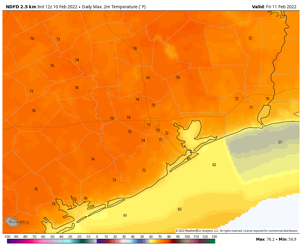
Friday
As temperatures on Friday morning fall to near dewpoints, a few areas of light fog are possible. But then we should quickly see mostly sunny skies, and this will allow high temperatures to reach 70 to 75 degrees. Winds will again be fairly light. Overnight lows may only drop to around 50 degrees in Houston.
Saturday
Unfortunately, after the entire work week saw sunny and sedate weather, we’ve got a front to deal with on Saturday, likely before noon. Effectively this means that areas inland of Highway 59/Interstate 69 may only warm into the 50s before the front’s arrival, and coastal areas the low 60s. Some light rain is possible with the front, especially nearer the coast where more moisture is available. Still, any showers will probably be briefly lived. Winds should gust to 20 to 25 mph on Saturday afternoon, in the front’s wake. As drier air moves in Saturday afternoon, skies should clear out during the late afternoon or evening hours. Overnight lows probably will drop into the upper 30s in Houston, with a light freeze possible for areas far north and west of the city.
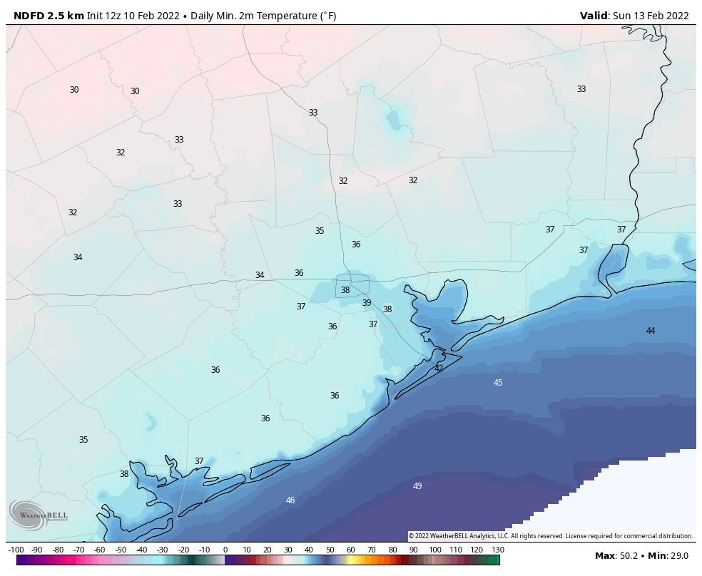
Sunday
This should be a fine winter day, with relatively light winds, sunshine, and highs in the upper 50s to 60 degrees. Sunday night should be a degree or two warmer than Saturday night.
Next week
We’ll see a warming trend, with temperatures rebounding to 70 degrees by Tuesday. Then we’ll see a pattern change as clouds begin to build and rain chances return. This will happen as the atmosphere sees a series of disturbances rotated through, and moisture levels start to increase. We’re not looking at anything crazy, I don’t think, with probably 0.25 to 0.75 inch of rain for most. I’d pencil in our next front for Thursday, which will perhaps knock lows back into the low 40s, give or take.
I’m looking forward to a bit more hard winter weather, I’m still traumatized by that December from Hell.
Only 38 days until spring
You say that like it’s a good thing!
I’m enjoying this weather while the getting is good. It will be soon enough before the 9 months of summer is back.