Summary: As expected, much of the storm action has remained north of Interstate 10 today, and that’s where the focus will likely stay through the evening. However, after a lull through the late evening hours, a strong storm system will move in from the southwest, affecting primarily coastal regions. We are maintaining a Stage 1 flood alert through Wednesday night.
Tuesday evening
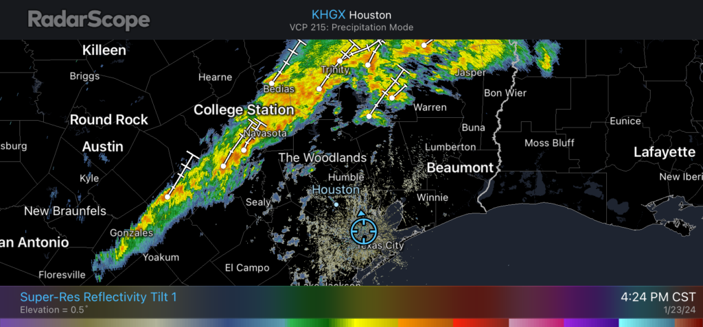
A line of storms is draped across the northwest periphery of the Houston region, affecting areas such as Brenham, College Station, and Huntsville. This system should persist through the evening hours, mostly remaining to the north of Interstate 10, and likely weakening over time. An additional 1 to 3 inches of rainfall are possible for these areas between now and midnight.
Early on Wednesday
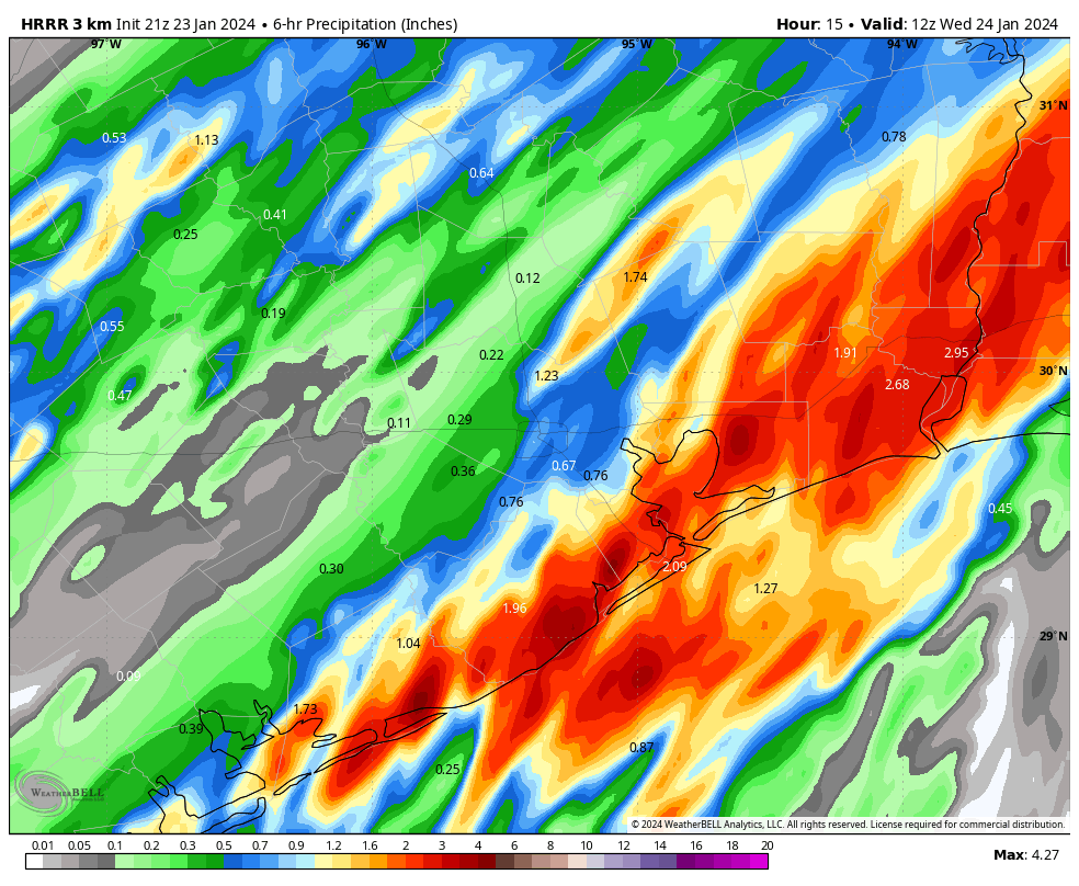
For a few hours around midnight, our area may see a bit of a lull, but then another storm system will be moving in from the southwest. This one is likely to develop near Matagorda Bay around midnight, and steadily progress to the northeast during the pre-dawn hours, bringing strong storms to Galveston and other coastal areas, and the potential for strong storms along and south of Interstate 10 in the Houston metro area. Some of these storms will likely be intense, with some high rainfall rates.
The only good news I can offer is that the system looks fairly progressive, so it should push off to the east by around sunrise on Wednesday. Therefore I don’t expect (too much) mayhem for Wednesday morning’s commute. In terms of accumulations, we could see 1 to 3 inches in the coastal counties by Wednesday morning, with the possibility of some higher bullseyes.
Later Wednesday and Thursday
Things may settle down a bit on Wednesday in the Houston metro area, but we’re likely to continue to see at least some disorganized showers and possibly thunderstorms. Coastal counties may see another round of storms late on Wednesday evening or early on Thursday, but I don’t have great confidence in that forecast just yet.
A weak front arrives on Thursday morning, and this should push all of the rain showers to our east sometime during the morning hours. Phew—I can’t imagine too many people will complain about seeing the backside of rain showers for a little while.
We’ll be back with a comprehensive update early on Wednesday morning.


Should we put our plants back outside or is it likely to freeze again?
Theres no upcoming freezing temps for the rest of this week.
In that morning update (or maybe in a few days after this has passed) can you offer some insights into what is creating this pattern of storm development over several days? Is it one disturbance, or are we getting different waves from different areas?
What does Powered by Reliant mean? Seems like a cult phrase or something. Guess I’m out of the loop?
Reliant Energy is their sponsor and they’re an energy company that provides power to homes and businesses. So “powered by Reliant” is a catchy way of saying “sponsored by Reliant” while also alluding to what Reliant is.
The SCW App is “freezing up”. Unable to open your Jan 24 post via the app. Had to open it directly from the website. Rebooted my phone, but got the same result.
Yes, we are aware of the issue. See my comment below today’s SCW post.