In brief: In today’s post we discuss the very, very warm temperatures across the Houston region this morning and put them into context. We also look ahead to the potential for some storms with a front on Wednesday, with cooler and drier air to follow.
Crazy high low temperatures
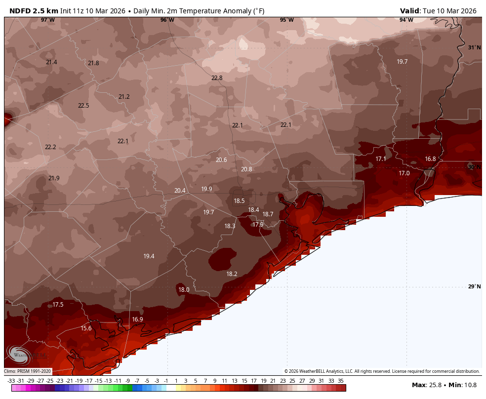
Temperatures this morning are really, really warm for this time of year. Lows in much of Houston range from 70 to 75 degrees. (We won’t know the official minimum temperature for another hour or two, but as of 6:25 am CT the low at Bush Intercontinental Airport is 73 degrees). The record high minimum temperature for this date is 71 degrees, set in 2009. The normal high temperature for today is 73 degrees, so we’re already there before sunrise.
Is anyone ready for a cool front?
Tuesday

Today will be another mostly cloudy and warm day, with highs in the low- to mid-80s across the region. It will also be breezy, with southerly gusts up to 25 mph, or perhaps a bit higher. With dewpoints of around 70 degrees it will definitely feel rather humid outside today.
Houston rodeo
Aside from the humidity and at-times gusty winds, there are no real weather concerns for the Houston Livestock Show and Rodeo this evening. Temperatures before the show will be in the mid- to upper-70s, and won’t be much lower than that afterward. Overnight minimums will again be near, or possibly set records in Houston, only dropping into the lower 70s.
Wednesday
This is a bit of a tricky day to forecast. My best guess is that we see the potential for scattered showers, and perhaps a few thunderstorms on Wednesday morning. None of these is likely to be too serious, and I expect daytime highs to approach about 80 degrees. Shortly after noon a more organized line of storms is likely to approach the area from the west, and this should move through the city during the afternoon hours before exiting by early evening.
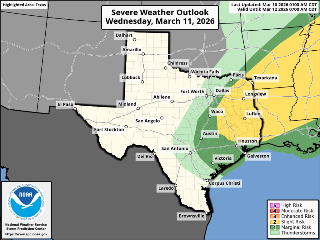
There are a lot of moving pieces here, but if they all align we could see some severe weather, particularly for areas north and east of downtown Houston, along the I-69 and I-10 corridors. This most likely would take the form of hail and damaging winds. Storm chances are lesser (but non-zero) for central and southern Houston. Anyway, we’ll endeavor to have more precise information for you in tomorrow morning’s update.
Thursday
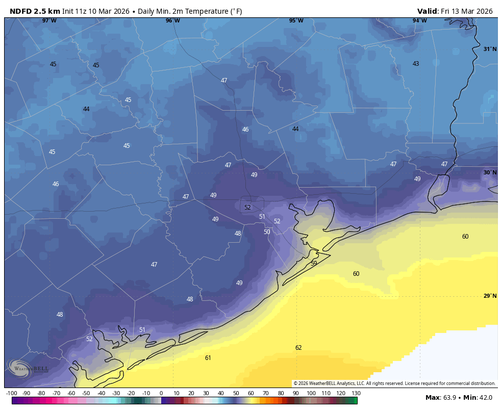
Drier air will follow the front through, with lows on Wednesday night falling into the 50s. Thursday will be a sunny and breezy day, with highs likely in the vicinity of 65 to 70 degrees and much lower humidity. Lows on Thursday night will drop to around 50 degrees in Houston, with colder conditions for outlying areas.
Friday, Saturday, and Sunday
The weekend should bring lots of sunshine into the region along with a returning southerly flow. Highs will gradually warm each day, from 75 degrees on Friday to 85 degrees by Sunday. Even so dewpoints don’t look too crazy, so it probably won’t feel as sticky outside as it is now. There is no chance of inclement weather this weekend, so make your plans accordingly.
Next week
Another front follows next week, likely on Monday. This one might have a little more oomph and we might see a few nights in the 40s. We’ll see!