In brief: Scattered to numerous storms will impact the Houston area once more today. Severe risks, while low are not zero. We’ll remain unsettled heading into the late week and weekend but hopefully at a less intense pace than we’ve started the week with. Hotter weather lurks on the horizon.
[UPDATE: We’re pulling the trigger on Stage 1 Flood Alert. See the details at the bottom of the post.]
Today
After things calmed down yesterday, they stayed calm, thankfully. We will not have that luxury today. Storms (non-severe) are already moving across Matagorda County and Wharton County this morning.
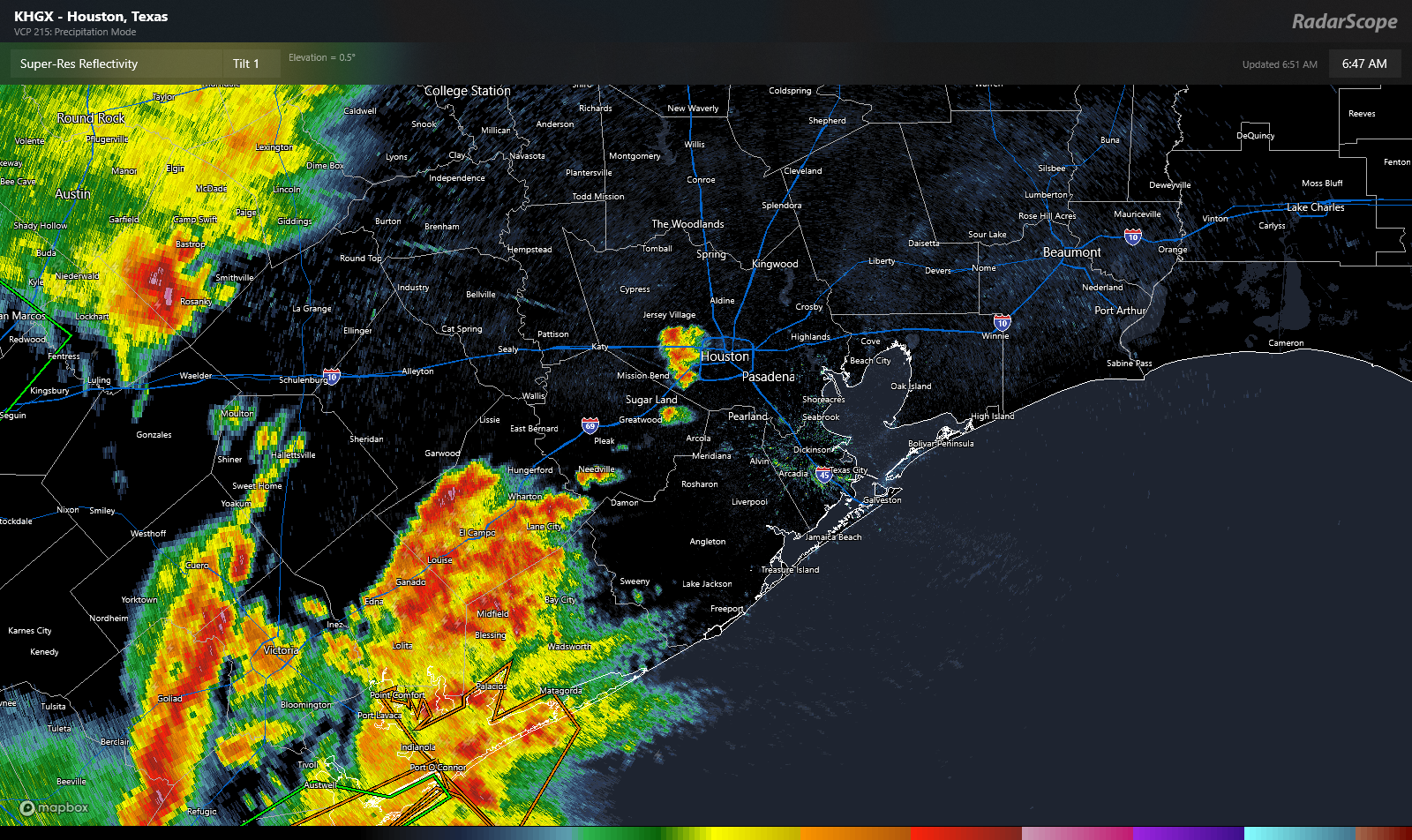
There are also a couple isolated storms just west of Downtown. Over the next few hours, the activity near Matagorda Bay will slide across Brazoria and Galveston Counties. Some of those storms could be strong to severe with gusty winds. Lightning and heavy rain are a given with these storms as well. Elsewhere, scattered storms will pop across the rest of the area today. While we don’t expect significant severe weather, we cannot rule out isolated severe storms. Gusty winds are the main concern today.
It’s possible we see an additional cluster of storms develop with daytime heating out near College Station and the Brazos Valley. Those could swing through in the evening hours. Again, the primary concern would be isolated gusty wind as that happens.
Also keep an eye out for heavy rainfall. These storms are putting down close to 2 inch per hour rainfall rates. This could cause some street flooding to crop up in spots. Nothing too, too serious but just be mindful in typically flood-prone spots. Temperatures will be held back in the 80s today.
Thursday through Sunday
We may venture back to a somewhat less widespread coverage of storm chances here, with more sea breeze driven daily thunderstorms. Those tend to be less intense but can produce locally heavy rainfall. So all days should see the potential for a little street flooding in isolated spots. Many places would end up without much rain. One or two storms could be strong.
That said, we will want to keep tabs on what happens out in western Texas. We’ll be in a northwest flow aloft, as winds 20,000 feet up move from northwest to southeast across Texas. If any sort of complexes of storms can develop out west, they could end up nearby eventually. Models don’t do a great job predicting those features more than 18-36 hours out, so there’s certainly a tinge of uncertainty in the forecast. So with all that in mind, we don’t currently expect widespread storms but we’ll be babysitting the situation through the week.
Temperatures look to top out in the upper-80s on days with rain and low-90s on days without. Morning lows should generally be in the 70s.
Next week
A return to drier, hotter weather seems likely next week. High pressure may try to anchor over the Southeast or Gulf, which would keep Southeast Texas at least at the periphery of hot weather, with temperatures likely starting the week in the low 90s and moving upward from there.
Mid-90s will probably return at some point. Stay tuned.
Update: Storms this morning are producing localized torrential downpours with rates of 2-4 inches per hour that will cause heavy ponding and some street flooding in spots. As as result, we’re pulling the trigger on a Stage 1 alert on our Flood Scale.


Is southeast texas really above normal when above normal is normal here?
Yes, temperatures will continue to stay above the previous 30-year average for most of the year and beyond amid the warming planet.
You might consider getting a round bed, that way you can’t always get up on the wrong side of it.
lmao I’m stealing this line
In other words it’s getting hotter here. Temperatures are facts. 🙂
We know some people don’t like facts or fact-checkers.
What confuses me about meteorologists is the shift from the word “average” to “normal” over the past 20-30 years. A day in the low 90s in May in Houston is “normal”, but not “average”. We average right around 90 degrees right now for a high, and anywhere from about 87-93 is within one standard deviation. Any of those particular days are “normal”. Where we string together a whole bunch of them is when it becomes abnormal.
Just a little pet peeve of mine. If you average 4 degrees above average over the month (like this one has), that is not “normal” as it is outside of what you would expect statistically.
Normal is not used in this sense by meteorologists. For instance, if the mean temperature of say, May 27 is lower than that of May 24 over the last 30 years, the “normal” temperature is smoothed out to reflect the fact that temperatures are rising each day until mid-summer. This reflects the difference between mathematical average and the fact that in general temperatures rise until August. Normal in this sense doesn’t mean somewhere around the average
Ah, so basically Smoothing which is “normalizing” the data. Thanks!
A nice small rogue thunderstorm popped up around I-10 and Beltway 8 a little after 6a and has dropped over an inch of much needed rain.
Yep, that thunder woke me right up!
The model does not look like the description in the article, at least for NW Houston.
Yet another model bust. Most of the metro is about to be rocked by the advancing mass of storms. Already getting heavy rain in Bellaire.
Well, watching WunderMap radar, with Severe Layer turned On (4 options). Two large cones are shown, one below I-10 and one up above 290 (Brenham area), both just on the edge of west HOU area.
When I tap each cone, it is reported, “HAZARD…Wind gusts up to 50 mph and half inch hail.”. The storms are moving along quickly. New cones also show up, while others drop off.
Hope we don’t lose power for four hours (and Internet for six hours) again.
Well, the rains are gone for us in Magnolia, as it seems for other areas.
Nothing extreme, rain-wise … but a very nice side effect is it’s 70°F out now!! 👍
rain and pea-sized hail in Clear Lake
Free plant water vs near-future mosquito hell : it’s like trying to balance an equation in high-school chemsitry
Nice spring thunder shower in Copperfield! About 1″ so far…
Coming down in buckets in Santa Fe. Street flooded. Lightning flying around.
I suggest putting the time of the update before or after the update.