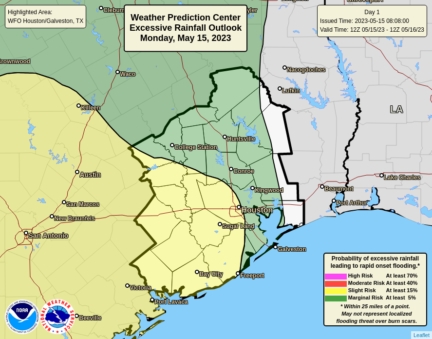
Good morning. After a wet weekend that left several area rivers and bayous near or over tops of their banks, and saturated area soils, our region will begin to transition to a somewhat drier pattern overall. However, a healthy chance of storms will remain today for areas along and west of Interstate 45 before our skies turn sunnier on Tuesday and then remain that way for most of the remainder of the week.
Monday
The problem for today is that our atmosphere remains fairly moist, and we’re not quite done with atmospheric disturbances. This should allow showers and thunderstorms to fire up southwest of Houston early this afternoon, and then lift northward into western and central parts of the city, before exiting to the north by around sunset. Most areas west of Interstate 45 will likely see around 0.5 inch of rain, which is totally manageable. But some areas could pick up 1 to 3 inches beneath stronger thunderstorms, and this may briefly back-up streets. For this reason, I’m going to keep a Stage 1 flood alert going for the western half of the Houston region, basically areas west of I-45.

Skies will otherwise be mostly cloudy, and for most areas this should limit high temperatures in the mid-80s. Winds, outside of thunderstorms, will generally be light at about 5 mph out of the east. Low temperatures tonight will drop to around 70 degrees in Houston as rain chances recede to near zero.
Tuesday
A weak cool front arrives on Monday night, and this will shift our winds to come from the west or northwest. Unfortunately, it will also provide a bit of instability that will help produce one more round of showers and thunderstorms on Tuesday. While I don’t expect these to be as widespread as the rain on Monday, I think there’s still a solid 30 to 50 percent chance of showers on Tuesday afternoon. Expect partly sunny skies with highs in the mid-80s. Lows on Tuesday night will drop to around 70 degrees.
Wednesday
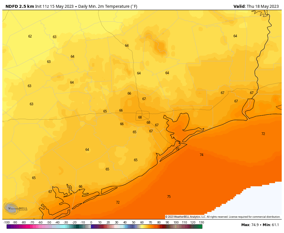
Rain chances drop back to around 20 percent, with mostly sunny skies during the afternoon hours. Look for highs in the mid- to upper 80s during the afternoon and, for some inland areas, lows dropping into the mid- to upper 60s on Wednesday night. That is some May cold front action for you, Houston!

Thursday and Friday
These should be a pair of mostly sunny days with highs in the upper 80s to 90 degrees. Lows will drop into the low 70s.
Saturday and Sunday
The weekend forecast is—dare I say it on a Monday morning, up in the air? There looks to be a second front coming this weekend, and while it’s too early to say for sure, I think there’s a decent chance it pushes all the way through Houston and off the coast on Saturday. This could bring some scattered showers with it. For now let’s ballpark partly sunny skies and highs in the upper 80s. If the front makes it, I wouldn’t rule out some lows in the mid-60s for most of the metro area early next week. We’ll see.


Lows in the 60s isn’t much in the grand scheme of things but it will feel like paradise compared to lows in the sticky mid to upper 70s.