Good morning. We’ll have the possibility of strong storms on Tuesday before beautiful fall weather for the rest of the week.
TODAY
We’ll see warm temperatures — near 80 degrees — and muggy air today as moisture returns off the Gulf of Mexico. There will also be a chance of scattered showers and thunderstorms but I don’t expect too much of the area to see rain. We’ll have to wait for Tuesday for that.
TUESDAY
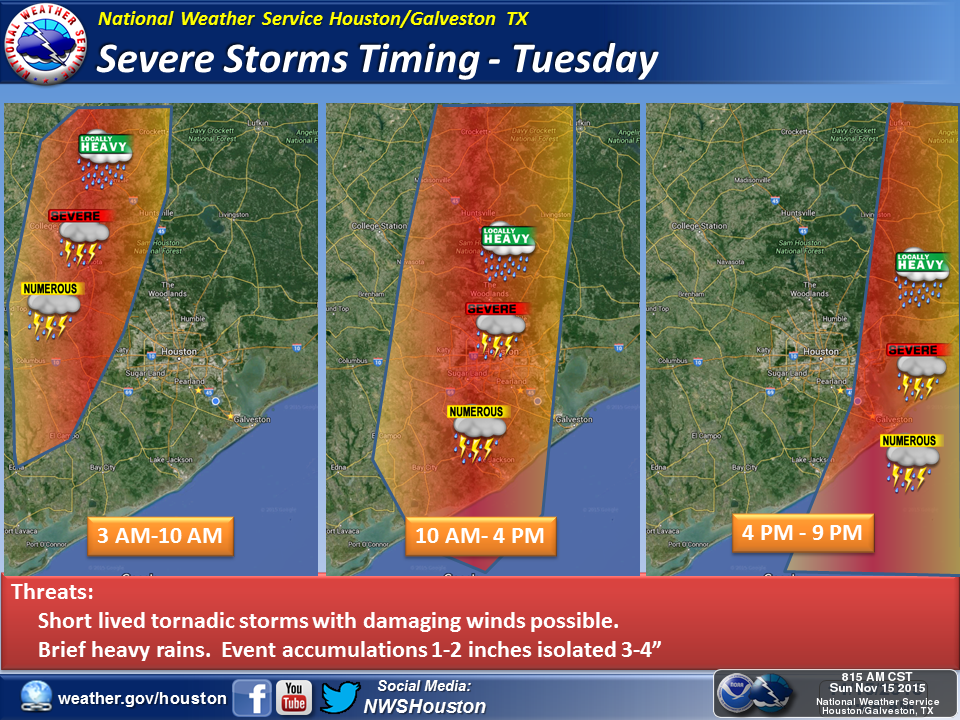
Beginning tonight and especially on Tuesday the region will a good chance of thunderstorms as a strong cool front approaches from the west and then moves quickly through the area. The following map from the National Weather Service shows their best estimates of timing for these storms.

Fortunately it now appears these storms won’t be quite so intense as they could have been. Because they’ll move through fairly quickly — I’d expect them to be gone from the metro area by early- to mid-afternoon — they’re probably only going to drop a couple of inches of rain for most areas.
In addition, while some weak tornadoes are possible, conditions most likely won’t favor development of strong tornadoes. The map below “Convective Available Potential Energy” or CAPE, and that value really needs to be in the 2,000-2,500 range to see major tornadoes. Regardless, the best chance of tornadoes will likely come during the early morning hours on Tuesday.

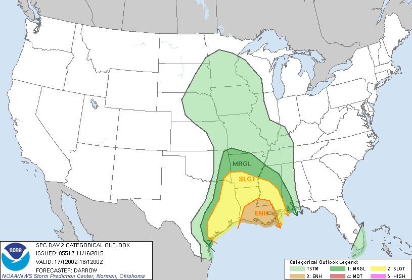
For a few hours on Tuesday during the middle of the day conditions still could get pretty nasty around town, but it appears the strongest storms will develop to the east of Houston later on Tuesday night, over New Orleans. Here’s the outlook for this scenario from NOAA’s Storm Prediction Center:

After the front moves through rain chances will end quickly on Tuesday afternoon or evening.
REST OF THE WEEK
The rest of the week, frankly, looks gorgeous. Highs will be in the low 70s, generally, with lows in the low 50s. This dry, sunny pattern should last through Sunday.
For anyone looking at this today, please note that the map with the timing has been updated (the link to the updated map is just above the map on this page).