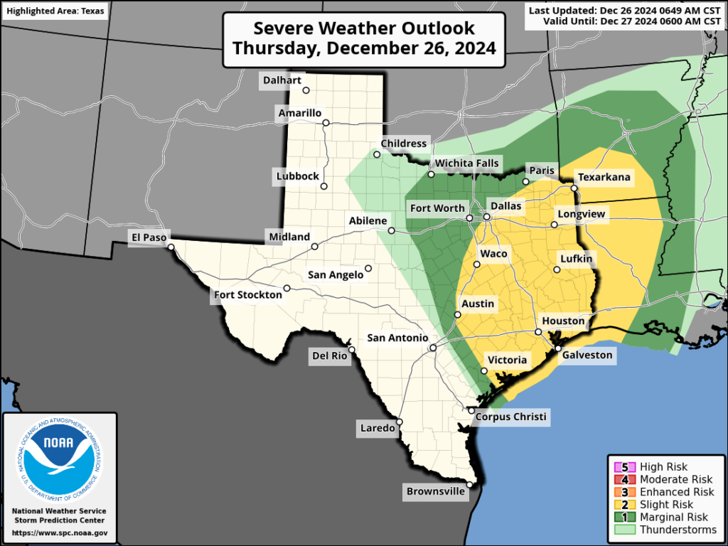
In brief: The atmospheric setup today is favorable for severe weather, including hail, damaging winds, and possibly tornadoes. The main threat will come from late this morning until early this evening. After the storms, Houston’s weather turns much calmer for the weekend.
Thursday
After a relatively mild Christmas Day, the atmosphere above Houston is recharged for another round of storms today. Rising moisture levels will spark some scattered showers this morning before an atmospheric disturbance advances into the area. Accordingly, we should start to see some thunderstorms later this morning, and likely becoming more widespread by around noon or so. We will then see the threat of severe weather until about sunset this evening, or shortly thereafter.

What does that mean? Well in addition to heavy rainfall, there may be enough rotation in the atmosphere to support a few tornadoes, enough updraft to support hail, and downdrafts to promote high surface winds. On top of this, although much of the area probably will see about 1 inch of rain, higher accumulations are definitely possible and this may lead to some localized street flooding. The bottom line is that, from late this morning through the early evening hours, you should be prepared for the possibility of disruptive weather.
Skies, otherwise, will be mostly cloudy. Expect highs in the mid-70s. Some moderately drier air will move in with a weak front tonight, allowing for lows to drop into the upper 50s in Houston.
Friday
Friday should be mostly sunny and pleasant, with high temperatures in the low- to mid-70s. Winds will generally be light. As the short-lived front washes out, lows on Friday night will be a bit warmer, in the lower 60s.
Saturday
This will be a warmer, slightly more humid day, with high temperatures in the upper 70s. A front will move through Houston on Saturday evening (exact timing to be determined) and this may bring with it a broken line of showers sometime during the day. I’m not particularly bullish on the potential for showers, but we’ll see. Anyway, Saturday night should be cooler, in the 50s.
Sunday
This should be a lovely day, with highs in the lower 70s, sunshine, and drier air. Lows on Sunday night will drop into the 50s.

Next week
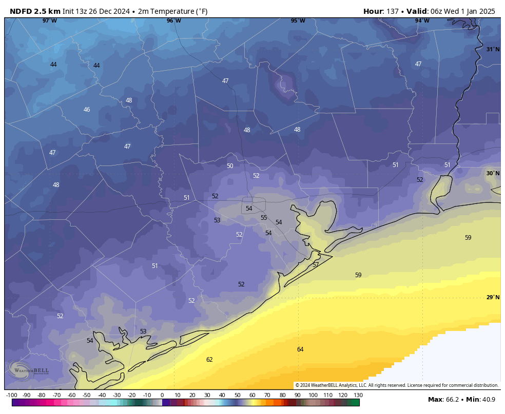
We should see lots of sunshine next week. We’ll be a bit warmer on Monday, but a front looks set to arrive late on Monday night, or New Year’s Eve, to begin the process of bringing temperatures down to more typical levels for this time of year. My early guess at temperatures for the night of New Year’s Eve calls for temperatures in the 50s, with probably mostly clear skies, and breezy conditions. So while it very likely won’t rain during New Year’s celebrations, it could be chilly. Lows should fall into the 40s for most of next week, in the new year.

sighing
Ok
Same
Getting the truck under shelter. Folks let the community know where you see hail.
Thanks for your reliable word.
Any thoughts yet for deep freezes like we have had the last few years? They create lots of issues with plants and pipes.
I don’t think we are going to see any harsh freezes this winter. We still may see a light freeze or two, but that’s about it. The Arctic Oscillation has been stuck in an overwhelmingly positive phase through most of the fall and winter so far. And it doesn’t appear like that’s going to change anytime soon. That could turn on a dime, though later this winter. But I wouldn’t be surprised if we continue to see mild conditions persist through the remainder of the winter.
Hope you are correct! I was born in Houston and am used to our weather, but these deep freezes are definitely not for me!
How about a late crushing freeze on April 1st just to wipe out all the plants and blooming of spring?
Uh no??
Boy I hope you’re right, Joseph
Since the 1960s, Houston winters usually had a night or two of a light freezes and that is about it for temperatures under 40° Fahrenheit for the rest of Winter in Houston.
I’m not sure where you got that data from, but that couldn’t be further from the truth. The 1970s and 80s were littered with harsh freezes in Houston, with almost every winter seeing at least one or more nights in the low 20s and teens. The winters of the 1990s and 2000s were more mild, but we still saw more than just a night or two of light freezes through most of those winters. We also saw an uptick of hard freezes in the 2010s and especially the 2020s so far.
Making plans for tonight in case we lose power today …
So we have no idea about the specific timing and threats from a more localized standpoint? A broad statement about the entire Houston area from late morning to early evening really isn’t that actionable
Look out your window,
Yes it’s not hard. Pull up your favorite radar app and look for the green and yellow cells heading your way. Any with red in the middle…get inside. Those are nasty.
Yes, it is so annoying when my coworkers only look at the hourly rain percentage chances to determine when it will rain. They get so confused when the timing is off. I constantly have to show them this seemingly unheard-of technology known as the radar.
always awful here
Looks like it’s almost through west and downtown Houston and so far only one tornado box down in Wharton. Keep your fingers crossed.
I’m getting these emails late at night which doesn’t help us. Miss having them in the morning on the day of the news. It’s been like this most of 2024-can it be better in 2025?