In brief: I hope you enjoyed the spell of slightly drier air overnight, because we’re already seeing dewpoints start to rise this morning. The front that pushed through on Tuesday will return this evening as a warm front. Another front arrives Friday night, bringing a decent chance of showers heading into the weekend.
Houston rainfall
We’ve made much of the emerging drought across the greater Houston region in recent weeks, with parts of the area reaching ‘severe’ drought levels after a very dry September and October, along with lots of sunshine and abnormally hot days to speed evaporation. So the prospect of rain to end October and start November was a refreshing one, even if it did lead to some minor flooding inconveniences on Houston roadways.
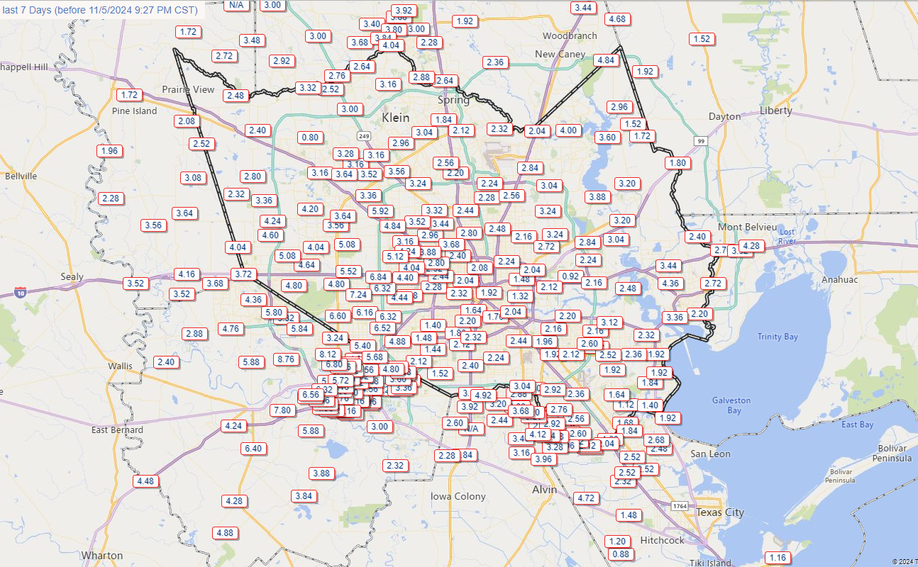
So how did we do? As the rain gauge map from the Harris County Flood Warning System shows, the vast majority of our region picked up between 1.5 and 4 inches of rainfall over the last week, with some locations in southwest Houston even seeing 6 to 8 inches. This was exactly the kind of rainfall the Houston area needed to pick up before the onset of winter to really help out our soils and foliage. We’ll get official information about the drought status on Thursday, but we’ve definitely improved our situation, especially with less rain needed during shorter days with a lower Sun angle.

Wednesday
We’re holding on to some dry air this morning, but dewpoints will begin to rise pretty quickly today. By this afternoon or evening, pretty much everyone is going to feel Houston humid once again. Skies will be sunny today, with a light northerly wind, and high temperatures in the upper 70s to 80 degrees. With the more humid air in place, low temperatures on Wednesday night will only fall to around 70 degrees in Houston.
Thursday and Friday
Rain chances return to the forecast on Wednesday night, and we’ll see something on the order of a 1-in-3 chance of light to moderate showers on both Thursday and Friday. Both days will be mostly cloudy, with humid air, and highs around 80 degrees or a touch warmer. So we’re going back to a pretty warm and humid pattern. Some modest change may arrive on Friday night, in the form of a weak front.

Saturday and Sunday
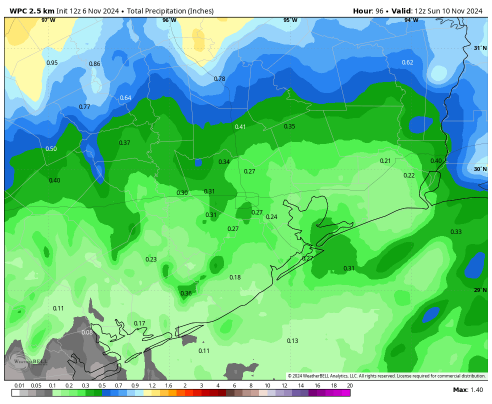
Our region’s weather for the weekend depends on the impacts of said front, which is likely to limp into the area on its last legs Friday night or Saturday. I expect this front to bring at least some scattered showers with it on Friday night into Saturday morning, and possibly some thunderstorms. Rain chances appear best before sunrise on Saturday, but showers could linger into the daytime hours. Highs on Saturday are likely to reach about 80 degrees, with slightly drier air, and lows Saturday night dropping into the 60s. Sunday again will be in the vicinity of 80 degrees, with a slight chance of showers. Lows on Sunday night will likely drop into the 60s, although it’s difficult to predict how far into the 60s.
Next week
Veterans Day should have fair weather, with sunny skies and highs around 80 degrees. There’s a slight chance of some daytime showers. Tuesday and Wednesday also look warm and fairly humid before the probable arrival of a stronger front on Wednesday or Thursday. The details are still uneven, but the signal for colder and drier air is becoming more convincing.

Tropics
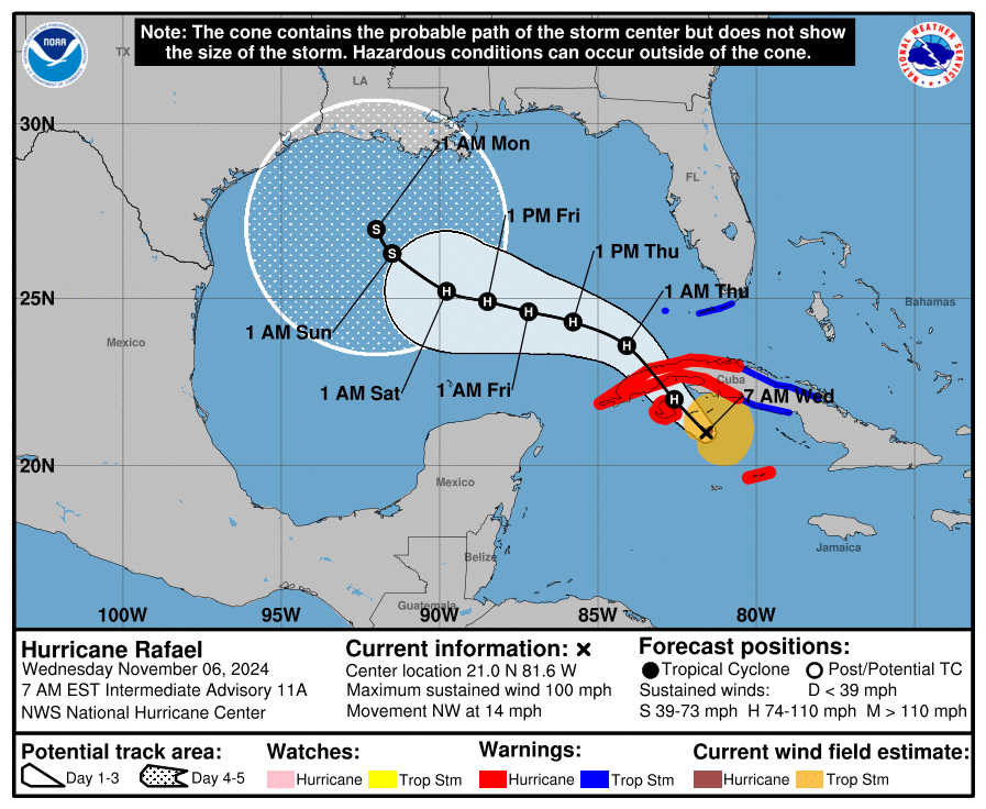
You may have noticed that Hurricane Rafael formed on Tuesday, and should move into the Gulf of Mexico today where it will continue trucking northwest toward the central Gulf. If this were August or September, we’d definitely be on high alert for some tropical activity. But my friends, this is November. And although this has been an extremely warm year for sea surface temperatures, the Gulf is nonetheless going to be pretty hostile to Rafael in terms of dry air and shear as we get toward the weekend.
Put more succinctly, we can expect Rafael to move northwest into the central Gulf of Mexico by Sunday. However, as it does so, it’s probably going to get chopped up by those hostile conditions I mentioned above. My sense is that Rafael eventually succumbs to these conditions and peters out in the Gulf before reaching land, but the bottom line for Texas is that we should have minimal concerns about the system at this time. We’ll of course alert you if that changes.

2.5″- 6.5″ since the rains started last week across my farms and pastures in Fort Bend and Wharton counties. Very happy.
3” here in Montgomery County!!!
Wish these fronts would throw an anchor or two out in the Gulf and just hang around till, I don’t know, May or so!
I wish they would actually bring in some really dry air.
I second that!
I don’t even want to hear the words warm or humid anymore. It’s gonna be mid November and we are still getting swamp a___ ! This has to stop yall.
I just want a fall ;_;
Any idea what Raphael will do to Cancun? Going for the weekend!
Calm down, Ted.
Rainfall over the stated timeframe (~5 days) in CLC/Northfork (just SE of Ellington) was less than one inch. Lawn still gasping for a significant drink……..
Always disgusting weather in Houston. If you want nice weather you need a plane ticket.
Big shift in track forecast for Raphael from Hurricane Center — looking for rain impacts to LA, TX coasts with this change ?
John H: Probably no impacts at all unless there is some higher surf along the coast. The latest update shifts Rafael even further away from the Gulf Coast.
No. The only real impact will be slightly higher tides at the coast.
If this helps anyone feel a tiny bit better about the late season heat, we have not broken any record highs yet this November. Here is a lit of the previous record highs in Houston for the first 6 days of November:
1st. 89 2010
2nd. 89 1978
3rd. 88 2016
4th. 89 1988
5th. 88 2017
6th. 89. 2017
I still hate it! Haha! But it is nice to know this isn’t record breaking.