In brief: Heavy rain has led to a number of flood watches, warnings, and advisories near Houston today. Rain is expected to slowly wind down after sunset.
Apologies for the later than hoped for post. Eric and I have both been engaged in other obligations today.
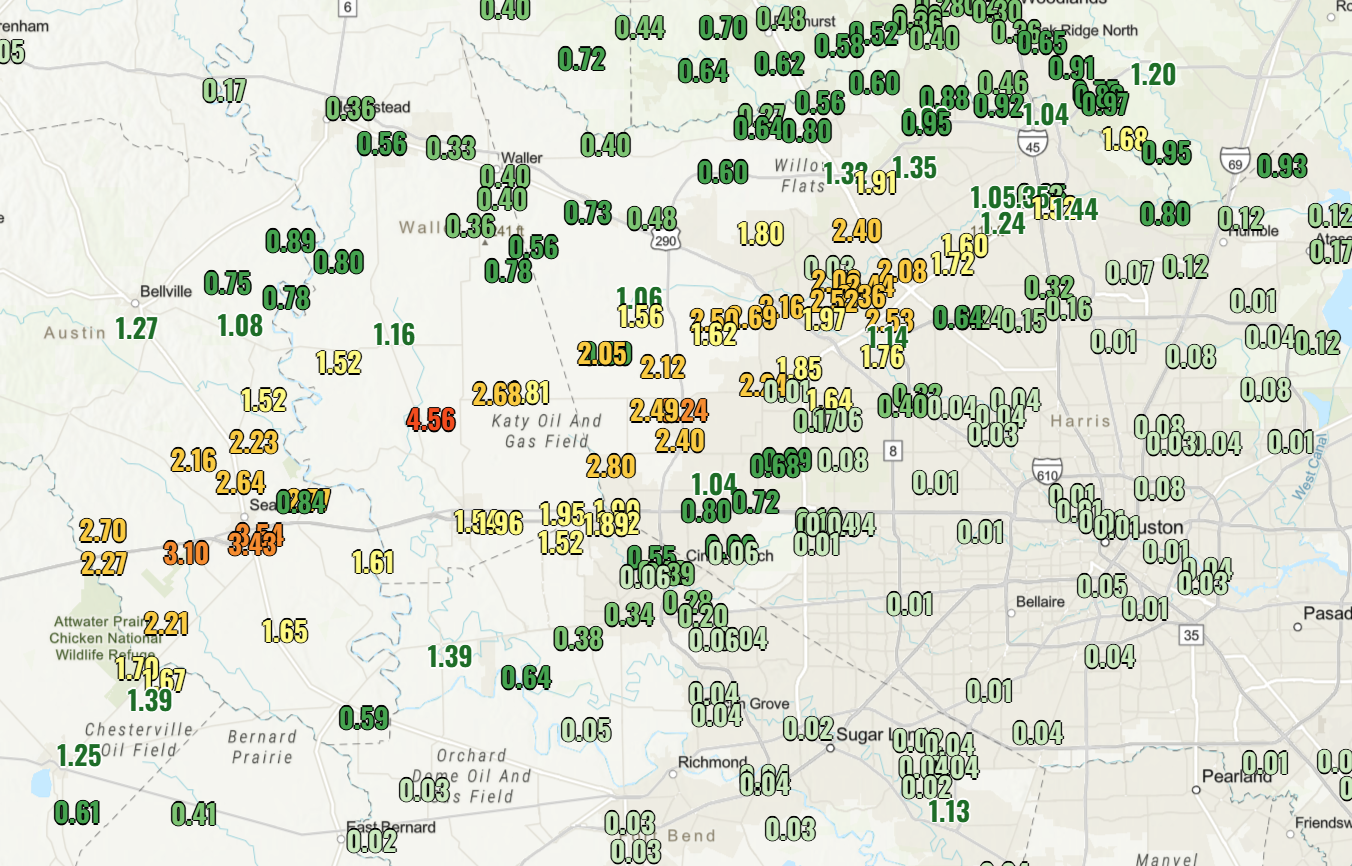
So far today, some areas west of Houston have seen nearly 5 inches of rain, with a Harris County Flood Control gauge north of Pattison registering over 4.5 inches so far. If you’re traveling north or west of Downtown, just be advised there may be street flooding in spots.
A look at radar this evening shows torrential rain north of Kingwood, tracking north of Liberty. A second area of absolutely torrential rainfall is centered from just south of Spring through Jersey Village down to near Memorial City. Additional moderate to heavy rain continues to the west.
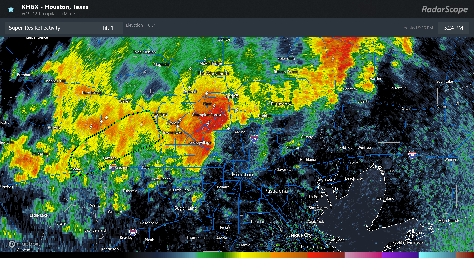
Over the next few hours, this rain is only going to creep east slowly. This almost certainly will not make it to the coast. So, yes, you’re shut out again down there. But across southern Montgomery, central Harris, and areas west of Harris County and northeast into Liberty County, periods of heavy rainfall will continue. The heaviest rain should begin to calm down after 7-8 PM, with showers continuing for a little while longer.
Bottom line: Heavy rain will continue for a little while longer, and street flooding is a good possibility. Additional showers and thunderstorms are possible tomorrow, but they don’t currently look to be as robust as today. Eric will update more on that for you in the morning.