In brief: Showers and a few thunderstorms return to the forecast today in Houston. A stronger line of storms will move through the area tonight, likely with lightning in the middle of the night. So Christmas morning could start with a bang. Most of the holiday should be fine, weather-wise. Expect mild temperatures for the remainder of the year.
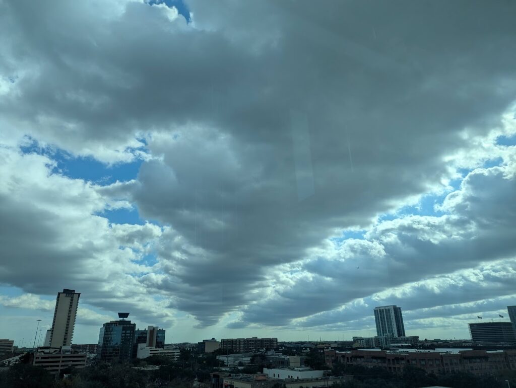
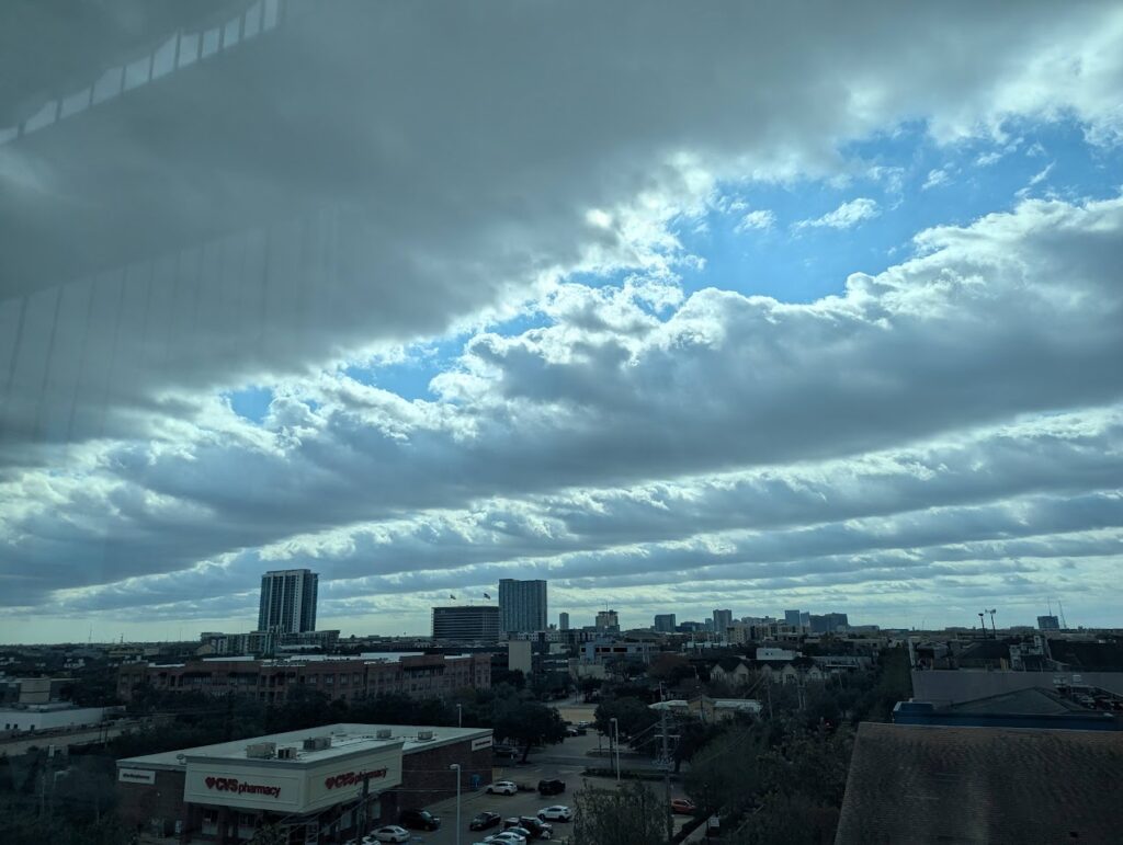
Clouds streets above Houston streets
Tory Gattis sent in the following photos yesterday, which he observed over Midtown in Houston. These are fairly low lying in the sky, so they’re stratocumulus clouds. The straight-line nature of the clouds is colloquially known as cloud streets, and more formally as horizontal convective rolls. The precise reason why they form is actually not particularly well understood, but they sure are pretty to look at. We will see more clouds today, but they are likely to be of a more ominous nature.


Today, tonight, and Christmas
Houston’s weather will turn more dynamic this morning as an upper-level disturbance approaches the area. Scattered showers and thunderstorms will be possible today, with the potential for some slightly more organized activity this evening. High temperatures today will reach the mid-70s, with mostly cloudy skies. Winds will be light, from the southeast. All in all, if you can dodge a few showers and storms, conditions today should not be too disruptive.
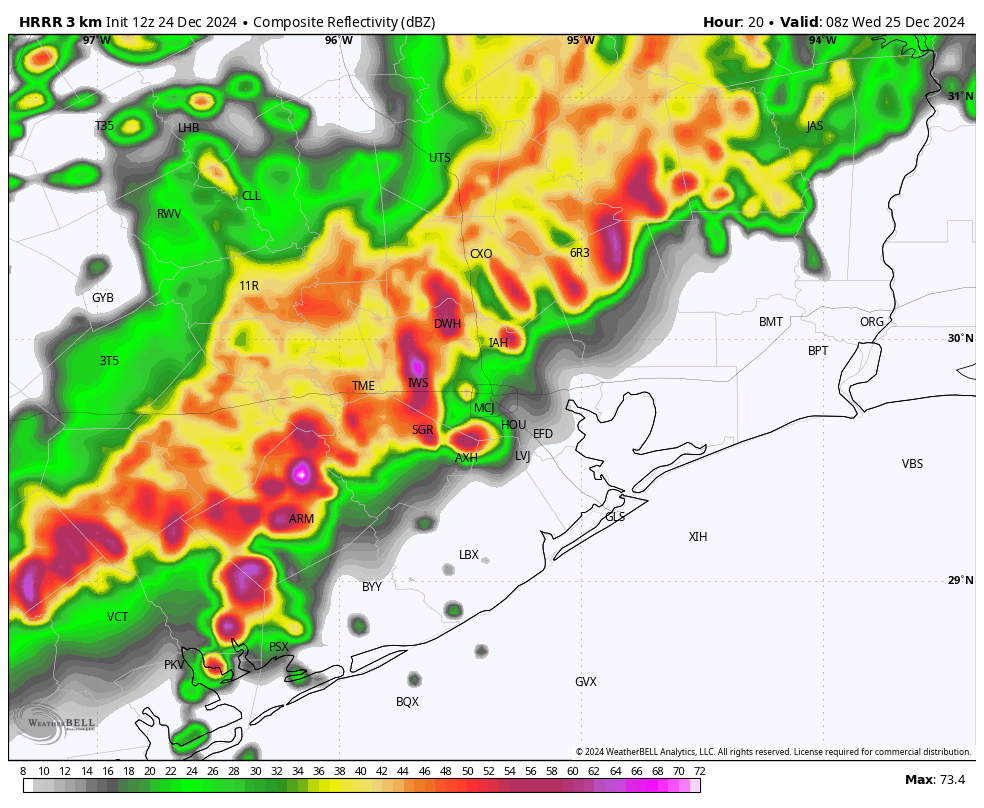
However the story could be different tonight, as an organized line of showers and thunderstorms marches down into Houston from the northwest. I expect this line of storms, likely with a fair bit of lightning, to reach areas north and west of Houston (i.e. Katy and The Woodlands) by just before or around midnight, give or take. It should then push through the Houston metro area between midnight and sunrise on Christmas Day. Some of our latest modeling indicates this may be a rather noisy passage, with briefly heavy rainfall and lots of lightning. If Santa’s coming and going doesn’t wake the dogs, these storms probably will. Damaging winds are possible, as well as a slight chance of hail. Most areas should pick up 1 to 2 inches of rain, with some higher bullseyes.

The good news is that the storms should be off the coast and off to the east of the Houston metro area by fairly early on Christmas Day morning. The storms will drag a weak front into the area, so expect high temperatures in the lower 70s on Christmas, with slightly drier air. Some additional light, scattered showers will be possible with partly to mostly cloudy skies, however I think the rain will be over for most. Lows on Wednesday night will drop into the upper 50s to 60 degrees.
Thursday and Friday
The front won’t last long, and with a soggy atmosphere in place expect warm days in the mid-70s to end the holiday week. Skies will be partly to mostly cloudy, and both of these days and nights will have a decent chance of rainfall. These showers should be less explosive than those expected on Christmas morning, and accumulations far less.
Saturday and Sunday
We should see more sunshine this weekend, although we can’t rule out a few showers on Saturday morning ahead of another weak front. Saturday should be nice, with slightly drier air, and nighttime temperatures falling into the 50s. Sunday should also be sunny, with moderately drier air, and highs in the mid-70s. Rain chances are near zero.
Next week
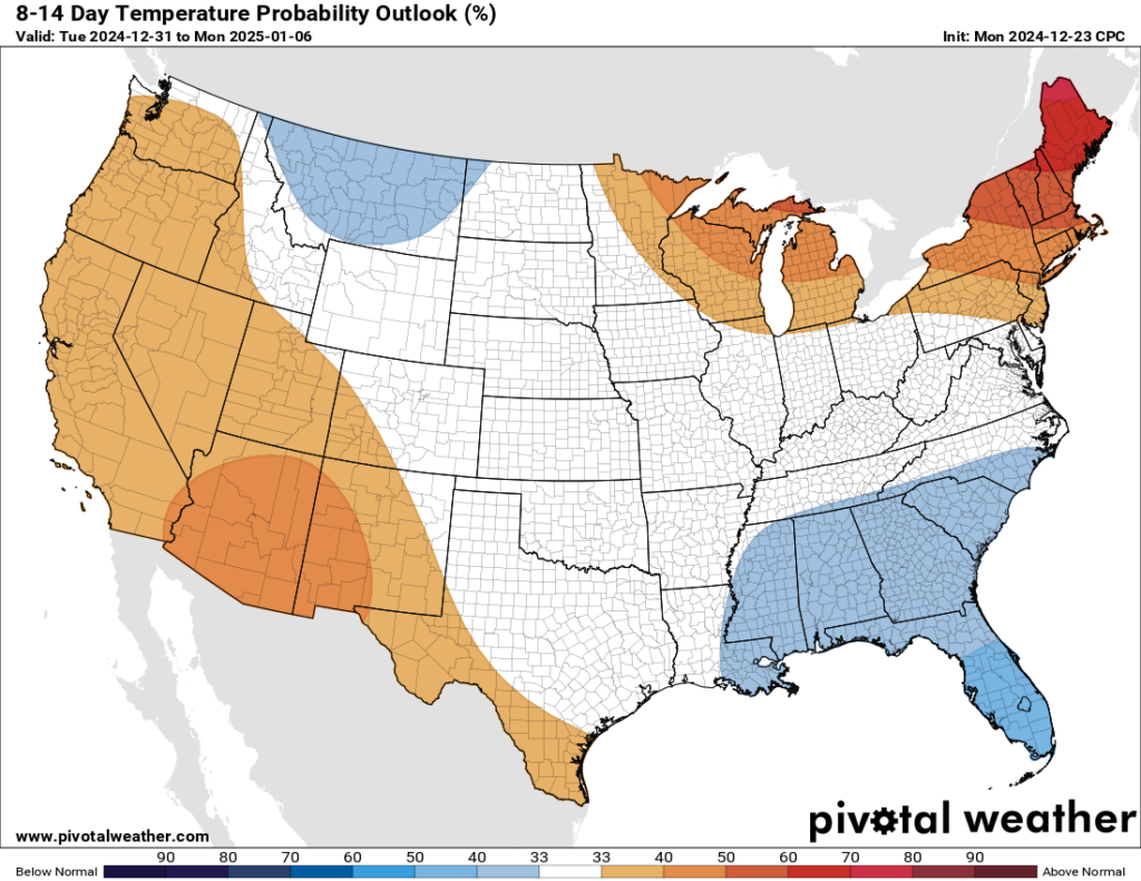
We probably will see the return of a warmer, more southerly flow early next week. We’ll likely also see a slight chance of showers at well. At some point, perhaps on New Year’s Eve, or New Year’s Day, a much stronger front will arrive. This should bring us seasonal weather for 2025, starting the year off on a winter-like note. Details to come.

Merry Christmas to all!
Please do be aware of the potential for storms tonight and early tomorrow. We’ll be keeping an eye on things, and if they look more dramatic than your typical Houston thunderstorms, we will update the site later today. However, if the forecast stays on track we probably will take Christmas Day off from posting. So please have a wonderful day.

Merry Christmas and thank you for all you guys do!
Merry Christmas 🎁🎄
Tonight’s storms is what they mean by “arose such a clatter.” merry Christmas and happy holidays to the whole Space City Weather crew
Gonna be a doozy of a night coming up for folks. Possible power outages with lightning and thunder and possible damaging winds. Some might have a meltdown.
Please no tornados 😞
Please, no hurricanes!
& please no derechos either
Japanese style
Stockings hung by the
Chimney with care. With St. Nick,
THUNDER in the air!
Looks like Santa may have to put the top up on his sleigh tonight. 🎅🏻
Merry Christmas to both you and Matt and your families. Thank you for what you do.
❤️🎅🏻🎄❤️🎅🏻🎄
Other outlets are saying in addition to tonight’s storms that Thursday will have a greater chance of being severe. Is this just hype?
Merry Christmas and thanks for all that you do!
That’s pretty good poetry guys😊I hope you and everyone here has a Very Merry Christmas. God Bless you all.
I gave up hope a long time ago of seeing any meaningful rain where I live.
Yay! I can’t wait to miss out on all the rain again!
I can just imagine the millions of drone sightings tonight. Especially after people have had a few. Not to mention the 911 calls about someone breaking into a neighbor’s home through the chimney.
Good one! lmao
By “average temperatures” for New Years, means highs in the mid 60s with lows in the mid 40s for 2 days and then it will probably be back into the 70s or 80s again for another week or two.
Happy holidays to you and your families, Eric and Matt! Thank you for all you do!
Do the severe storms occurring this afternoon mean the line coming through overnight is going to be worse? Or will this stuff happening now make it less strong later?
The storms later may be less severe because the sun’s heat will be gone. However, if the proper upper atmospheric conditions are just right, you don’t need the heat from the sun for severe weather to pop off.
I’m moving in 7 weeks. Good riddance to this garbage city! Tornado warning in late December. Absolutely ridiculous. Now we have another round of storms (and most definitely power outages) coming tonight on Christmas Eve!? I’m so done with this! I cannot wait to leave. The end is in sight and my family is celebrating. Nobody likes it here.
I missed you, Adam. I’m glad to see your honest posts 💗
Cya in two months for your next departure announcement bud
Had to wait for a date from work which I got a while ago. I’ve been saying February for months now. Nothing has changed. Merry Christmas.
no one posts about hating weather for this long, it’s a troll people
No sane person, lol.
I lived in San Diego for a number of years – the only place with weather BETTER than Houston. All other places = worse.
Anybody NW near Bryan experiencing this storm yet ? Last time we were in “slight risk” here in Houston – we got a derecho. A little storm shy after that.
Rain and lightning. Normal stuff. Didn’t see any wind or hail. Slept one eye open.
The actual radar at 1AM looks just like the post’s simulated for 2 AM. So their forecast looks accurate. But aren’t the real storms far stronger than was forecast?
Timing may be a bit off, but looks, and sounds, like what was described. Severity may vary based upon locations and where the red blobs actually cross over.
In the Lake Houston area, and have had a modest light show, but pretty routine rumble with a few exclamation points.
Can you go into a little detail about how you were able to predict there would be a lot of lightning with tonight’s (this morning’s) storms?