In brief: In today’s post we discuss Houston’s very straightforward forecast, and look ahead to a front this weekend that will bring some (potentially) significantly colder air.

Overall pattern is set
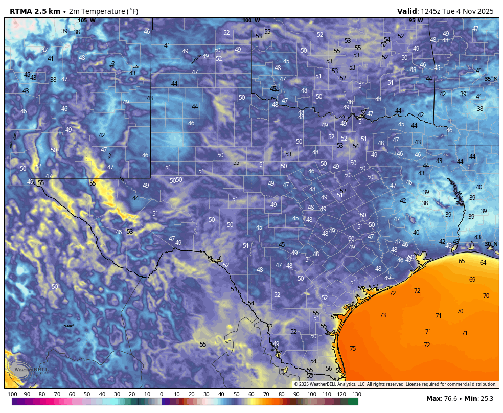
Houston’s forecast is pretty much set for the next week or so. In fact, I would forgive you if you left off checking Space City Weather for a day or two. Really, the only major question I have right now is just how cold temperatures will get early next week, after the arrival of a front next week. The city’s coldest temperature of the fall season, so far, was 47 degrees on Halloween morning. At this time I bet we get colder than that.
Before then we are going to see a gradual warm-up this week, from lows this morning in the vicinity of 50 degrees to lows in the mid-60s this weekend. With high pressure dominating we are going to see mostly sunny to full-on sunny days. We’ll also see gradually more humid air, although nothing oppressive like the region experiences during summer. The front likely arrives on Sunday morning, some time.
Tuesday
Today is going to be an exceptional day, with sunny skies and highs generally in the upper 70s. East winds will shift to come from the south, although remaining fairly light. This is the beginning of the onshore flow, although it will take some time for atmospheric moisture levels to rise. Accordingly humidity will still remain fairly low today. Lows tonight will be warmer, dropping to around 60 degrees in Houston.
Wednesday, Thursday, and Friday
Over this period our daily high temperatures will gradually rise, from about 80 on Wednesday to the mid-80s by Friday (some areas further inland may push into the upper 80s). Really not much more to say. A couple of afternoons may have some wind gusts up to 15 mph. Evenings and mornings won’t be particularly cool, but it will be mild and pleasant to be outside. I’ll be enjoying them.
Saturday and Sunday
The first half of the weekend will bring more warm weather, not unlike Friday. The models have become a little faster with the timing of the front this weekend, and it now looks as though it will come through on Saturday night or Sunday morning. I’ll remain in the “to be determined” camp until there’s some consistency. At this point I think the front will be a dry passage, so I expect a lot of sunshine on Sunday. Look for highs in the upper 70s, probably? I think conditions will be fairly windy, with northerly gusts up to 25 mph, maybe. Lows on Sunday night will probably drop to around 50 degrees in Houston, but I’m writing that in pencil.

Next week
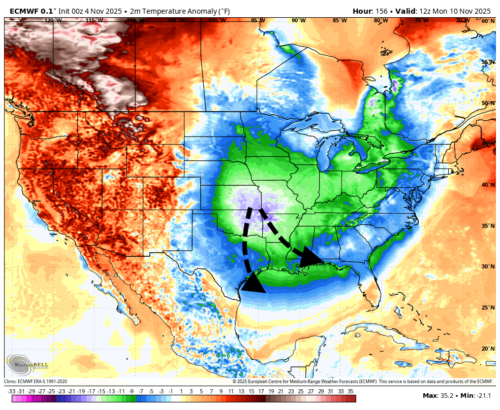
At this point I’m leaning into a “short and sharp” characterization of this front. Matt and I had a little discussion this morning about whether this could be described as an “Arctic” front, as it will be bringing a nose of significantly colder air into the eastern half of the United States. I’m going with a “whiff” of Arctic air, because I do think things could get pretty chilly on Monday night. Houston proper probably holds in the 40s somewhere, but I could see upper 30s for inland areas. It depends on how much of the colder air is pushed due south into Texas, or whether it is shunted off more to the east of us. Anyway, there’s the potential for some rather chilly conditions early next week. I do think temperatures will moderate pretty quicky by Tuesday night or Wednesday, however.
