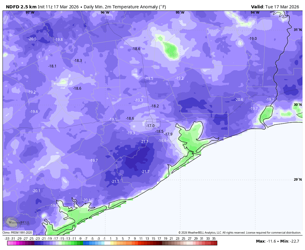
In brief: Temperatures this morning are reaching within a few degrees of record lows for the greater Houston area, with some rural areas experiencing a light freeze. Most of the city has remained just above freezing, however. Today we’ll begin a warming trend that won’t end for some time.
Coldest night competition
The official low temperature at Bush Intercontinental Airport is likely to bottom out at 33 degrees (the record low is 30 degrees, set in 1900), but whatever the official low ends up being temperatures this morning are likely to be Houston’s coldest for many months. Following a warming trend this week the rest of March looks rather warm, and then we’re in to April. So let’s have a competition. When will Houston’s temperature be this cold again? Leave your guess in the comments below and whoever is closest will win either a free Space City Weather t-shirt or a signed copy of Reentry. (Note: The official low did end up being 33 degrees).
Tuesday

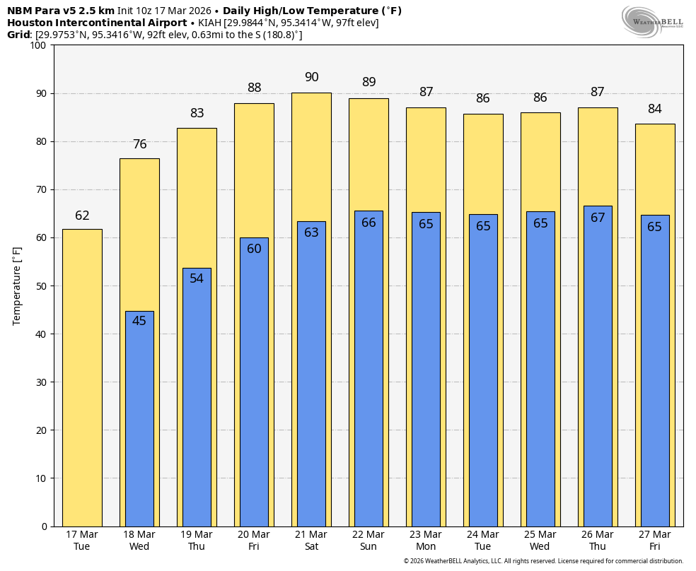
St. Patrick’s Day will feel rather chilly to start, but at least those strong northerly winds have finally died down. Conditions are mostly calm this morning, and even this afternoon winds should only be 5 to 10 mph. But you will note they’re going to start shifting to come from the south, indicating the beginnings of a southerly flow. Anyway, with the help of sunny skies we should see high temperatures climb to around 60 degrees today, or a little warmer.
Houston rodeo forecast
If you’re headed out to the show today you can expect plenty of sunny skies and dry air. Winds will be light this evening, topping out at perhaps 10 mph. Temperatures this evening will be in the mid- to upper 50s, falling to the lower 50s after the show. With clear skies tonight, expect overnight lows to drop into the upper 40s for urban Houston, with slightly cooler conditions for outlying areas, away from the coast.
Wednesday and Thursday
These will be sunny days with a continued warming trend. Expect highs in the mid-70s on Wednesday, followed by around 80 degrees on Thursday. Overnight lows will warm as well, first into the 50s, and then perhaps around 60 degrees. Humidity levels will start to climb, but the air should still feel fairly pleasant throughout this period.
Friday, Saturday, and Sunday
The weekend looks rather warm and sunny as a persistent ridge of high pressure asserts control of our weather. We can expect high temperatures in the mid- to upper-80s, with some areas possibly reaching 90 degrees, along with moderately humid air. Overnight low temperatures will only fall into the mid-60s. The only real hazard I would caution against is the Sun, as it is getting a lot higher in the sky compared to where we were during the winter months. It is now reaches the same height in the sky as in September, so if you’re going to be outside for a prolonged period of time please protect your skin.
Next week
Our very much warmer-than-normal weather should persist at least through the middle of next week, with ongoing highs in the mid-80s and lows probably in the 60s for the most part. There may be some sort of front, along with decent rain chances, by Thursday or Friday of next week but I can make no promises on that account.